 |
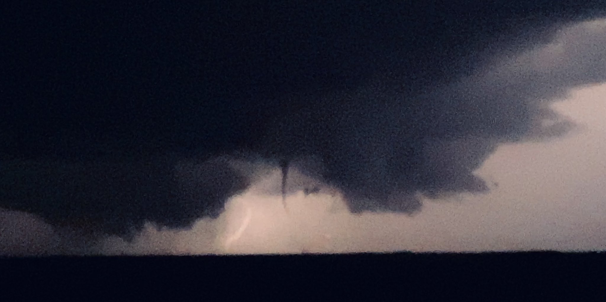
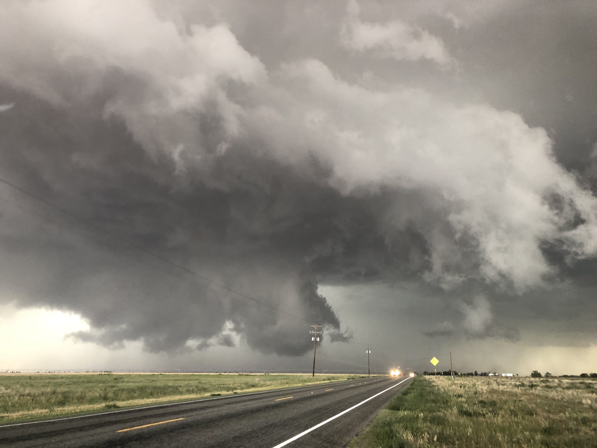
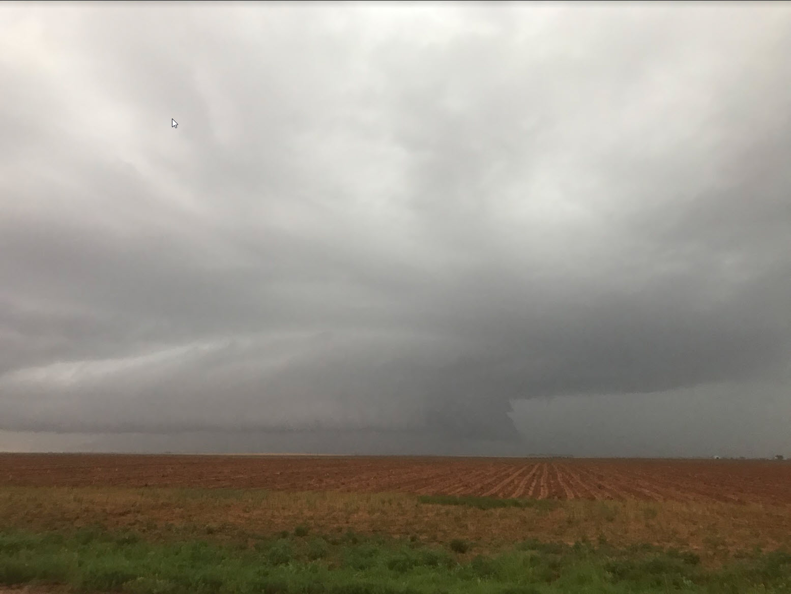
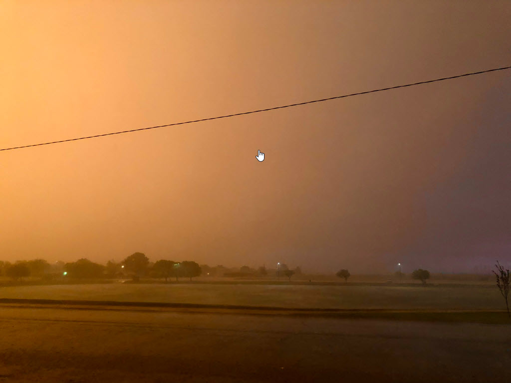
| Tornadic thunderstorm west of Hale Center late Wednesday evening (26 May). The picture was captured at 9:36 pm and is courtesy of Tyler Hudson. |
| |
|
After a relative lull in thunderstorm coverage and intensity for several days, the latter part of May turned active again. The transition back to the unsettled side occurred in earnest on Monday, May 24th.
|
| |
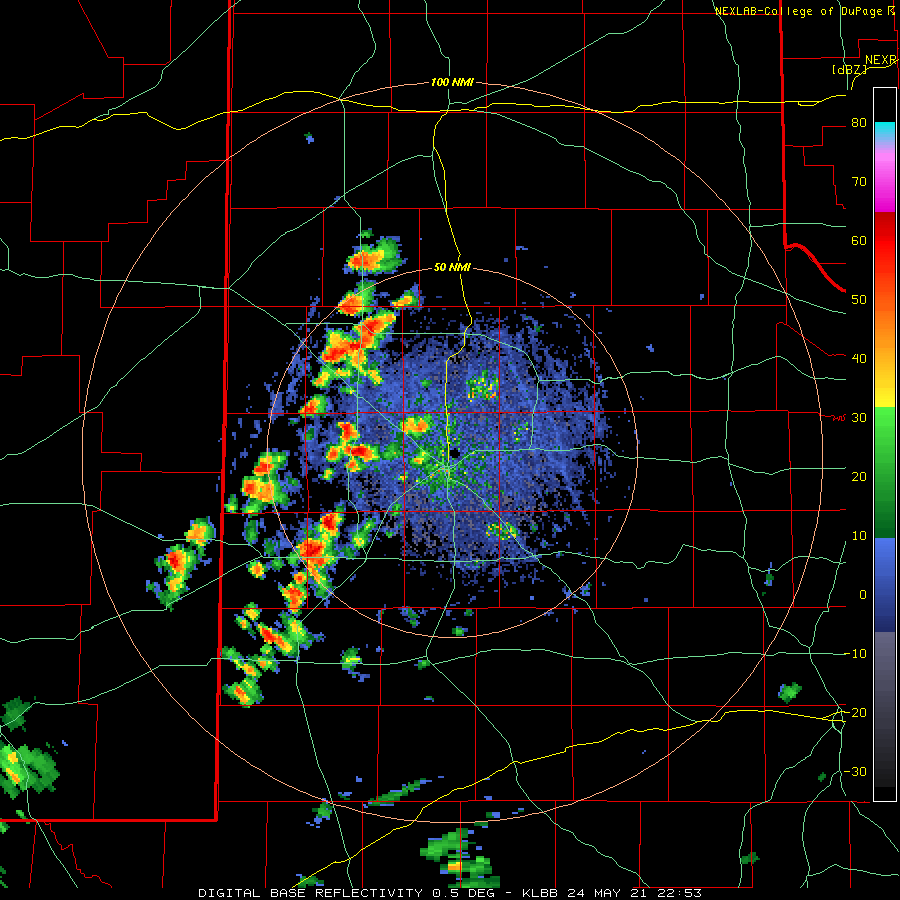 |
| Lubbock WSR-88D base reflectivity loop valid from 5:53 pm May 24th to 12:10 am May 25th. |
| |
| Scattered thunderstorms developed late Monday afternoon in close proximity to a dryline across the western South Plains and southwest Texas Panhandle. A few stronger cores produced large hail and heavy rain, but overall the activity was slow to organize. Eventually, the scattered storms did evolve into a larger complex that moved slowly east and southeastward across the central and eastern South Plains, moving into the Rolling Plains through the evening and overnight hours |
| |
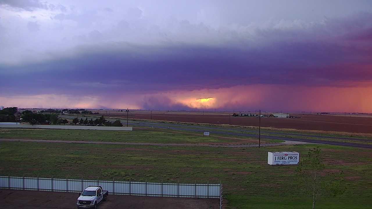 |
| Dusty outflow approaching Wolfforth Monday evening (24 May 2021). The picture is courtesy of KAMC. An additional view of a dusty outflow near Levelland, courtesy of Chris Zorel, can be VIEWED HERE. |
| |
| The main impact during the late evening and overnight hours was the intense rainfall, though isolated instances of hail and strong wind gusts also occurred. In fact, one storm that developed over the southwest Panhandle late Monday evening produced a wind gust to 72 mph as it moved over the Friona West Texas Mesonet (WTM). |
| |
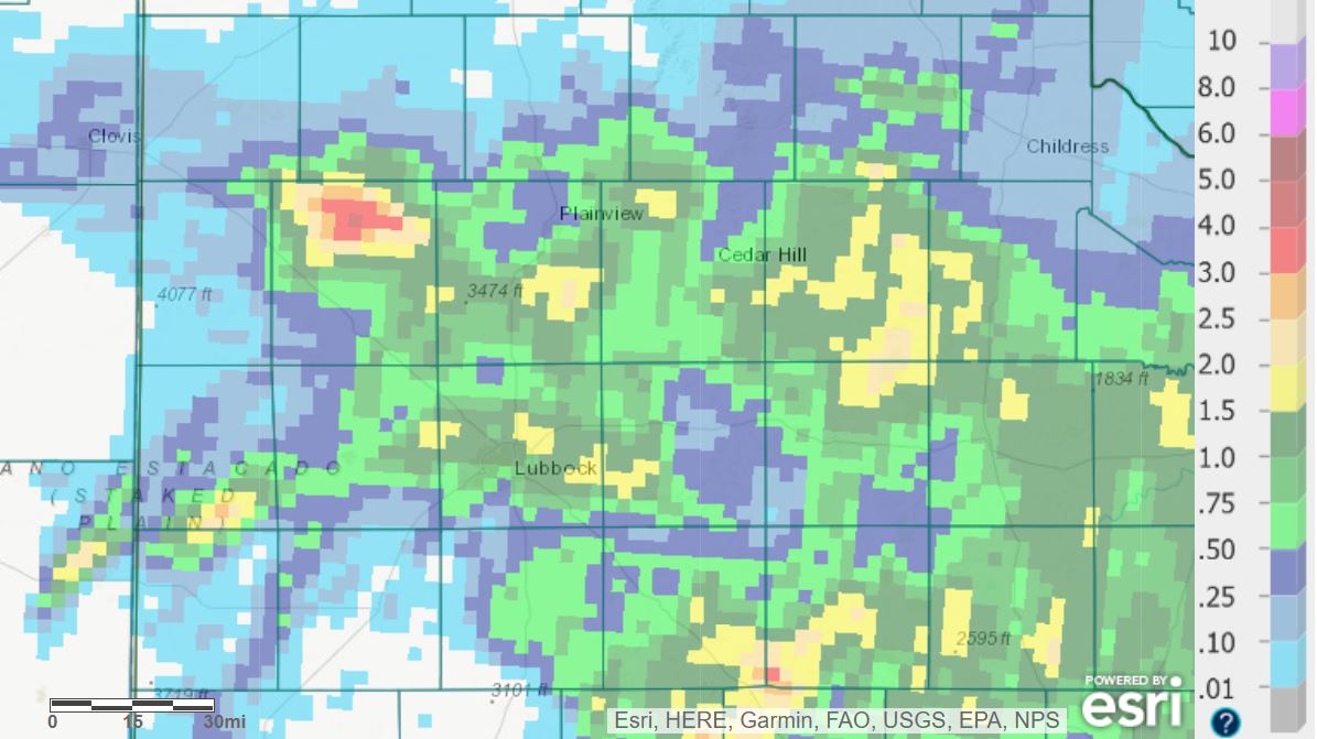 |
| 24-hour radar-estimated and bias-corrected rainfall ending at 7 am on Tuesday (25 May 2021). Rain totals measured by the West Texas Mesonet over this same period can be FOUND HERE. |
| |
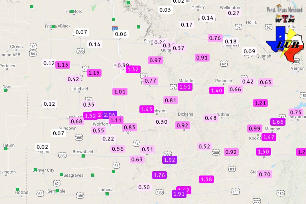
| More widespread was the rainfall, with an inch or more falling over a good chunk of the central and eastern South Plains as well as much of the Rolling Plains. Rain totals in excess of 3 inches fell over northern portions of Lamb County, around the community of Earth, and the Olton Cooperative Observer, on the edge of the heaviest rain, measured 2.70 inches |
| |
 |
| 24-hour rain totals measured by automated gauges in and around Lubbock late Monday into Tuesday morning (24-25 May 2021). |
| |
| Several bands of heavier rain also took focus on the northern part of Lubbock, dropping 2-3 inches of rain during the course of the evening and overnight. The heavy rain caused flash flooding and swelled the Brazos River on the east side of Lubbock. All of this water swept over FM 835 near Buffalo Springs Lake and forced it to be closed. |
| |
|
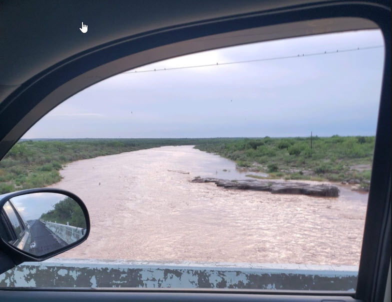
|
| Double Mountain Fork of the Red River flowing, bank to bank, on Tuesday (25 May 2021). |
| |
| The widespread rain shifted to the southeast of the region by early Tuesday morning. The following afternoon brought warm and very humid conditions, though much more limited thunderstorm coverage. Isolated storms did affect the southeast Texas Panhandle, while a very intense t-storm moved northeastward out of the Permian Basin and across the southern Rolling Plains, where it dropped large hail and heavy rain. |
| |
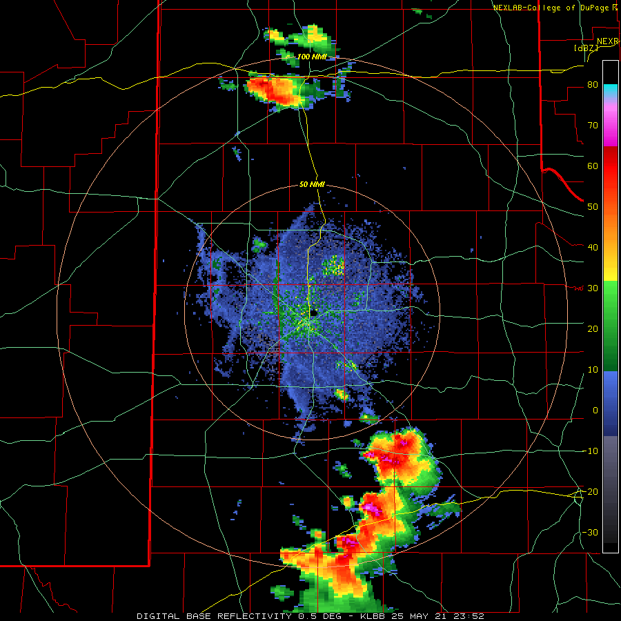 |
| Lubbock WSR-88D base reflectivity loop valid from 6:52 pm to 8:55 pm on Tuesday (25 May 2021). |
| |
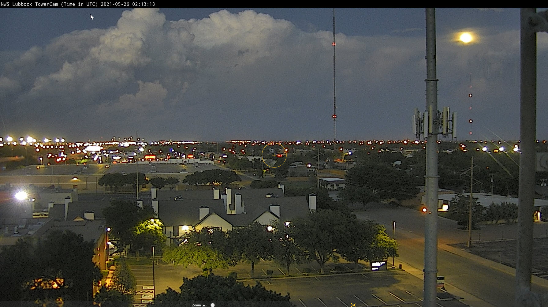
| A few storms developed further west, onto the eastern South Plains, Tuesday evening as an outflow boundary advanced northwestward. The towering clouds, in combination with a full moon, created a beautiful evening picture (see below). |
| |
 |
| Billowing clouds and a rising full moon on Tuesday evening (25 May 2021). |
| |
| The next day, Wednesday (26 May), started out slow, but crescendoed during the mid-late evening hours. Isolated to widely scattered thunderstorms were occasionally marginally severe through the late afternoon and early evening hours across the southwest Texas Panhandle and northwestern South Plains. |
| |
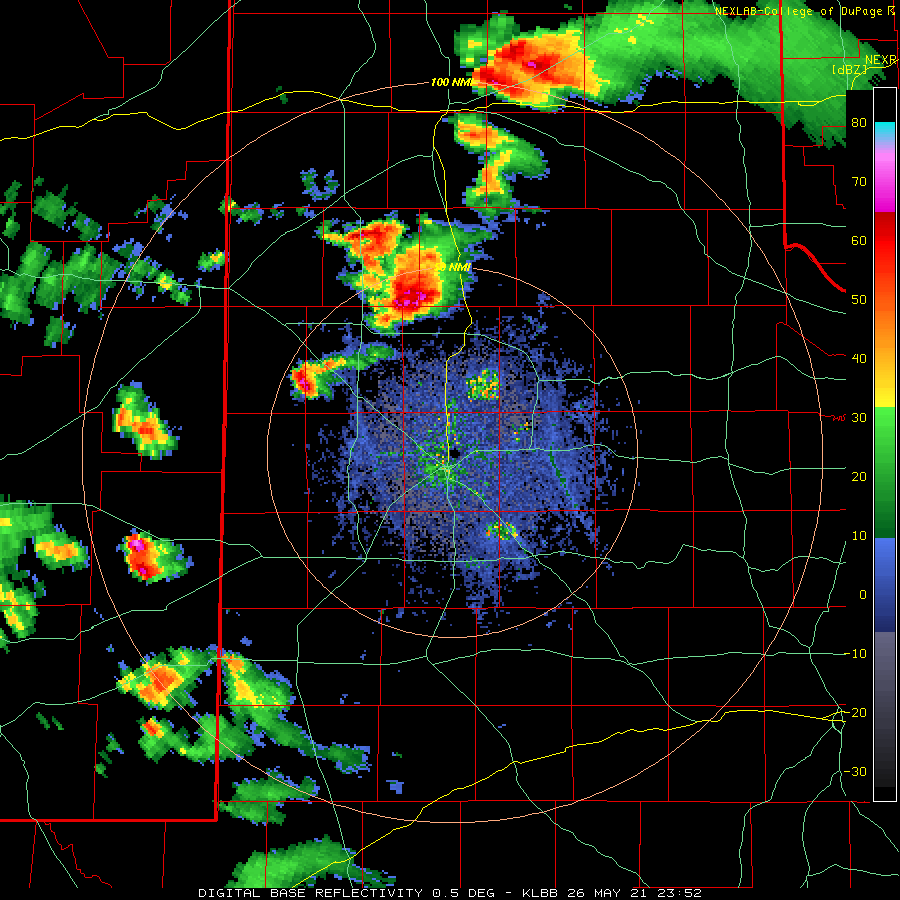
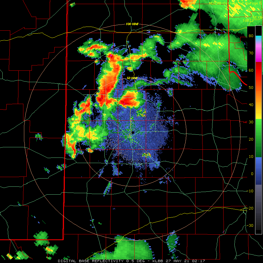 |
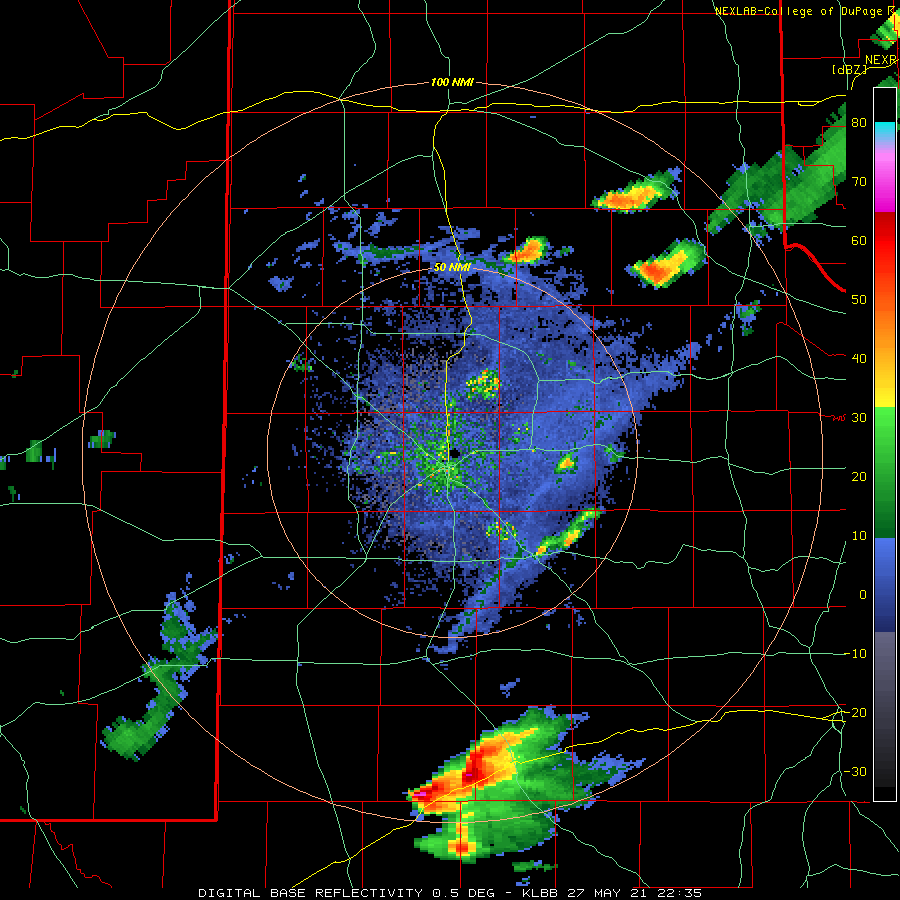
| Lubbock WSR-88D base reflectivity loop valid from 9:17 pm to 10:16 pm on Wednesday (26 May 2021). An additional radar animation, valid from 6:52 pm to 7:24 pm on the 26th, can be VIEWED HERE. |
| |
| The thunderstorms became much better organized during the mid-evening hours, with several supercell (rotating) thunderstorms. The most intense storms took aim on Lamb and western Hale Counties where they generated very large hail, destructive outflow winds and at least one brief tornado. Golf ball size hail was observed 7 miles northwest of Cotton Center at 8:40 pm, and a thin/rope tornado was seen illuminated by lightning about 8 miles west-southwest of Hale Center shortly after 9:30 pm. |
| |
 |
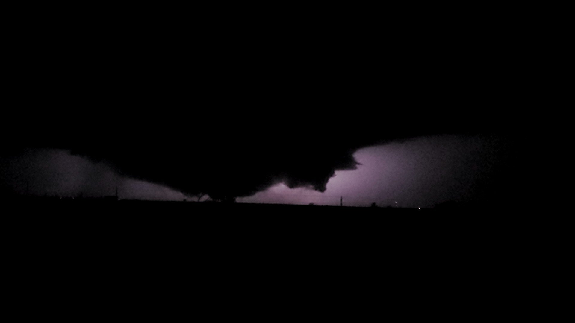 |
| (left) Low-hanging wall cloud northwest of Spade Wednesday evening (26 May). The picture was taken around 8:15 pm and is courtesy of Bob Pack. (right) Ground hugging cloud and possible tornado west of Hale Center at 9:35 pm. The image is courtesy of Adam Young and Matt Ernst. |
| |
| A couple of the thunderstorms then evolved into bowing lines and producing severe, damaging winds. The Amherst WTM measured a peak wind gust of 85 mph, and the Anton WTM sampled 71 mph winds. The intense winds mangled many center-pivots in Hale County and also damaged an outbuilding and flipped a RV. The same locations that experienced the most intense storms of the night also saw very heavy rains. The Olton Cooperative Observer measured 3.71 inches, which is on top of the 2.70 inches that fell two days earlier. |
| |
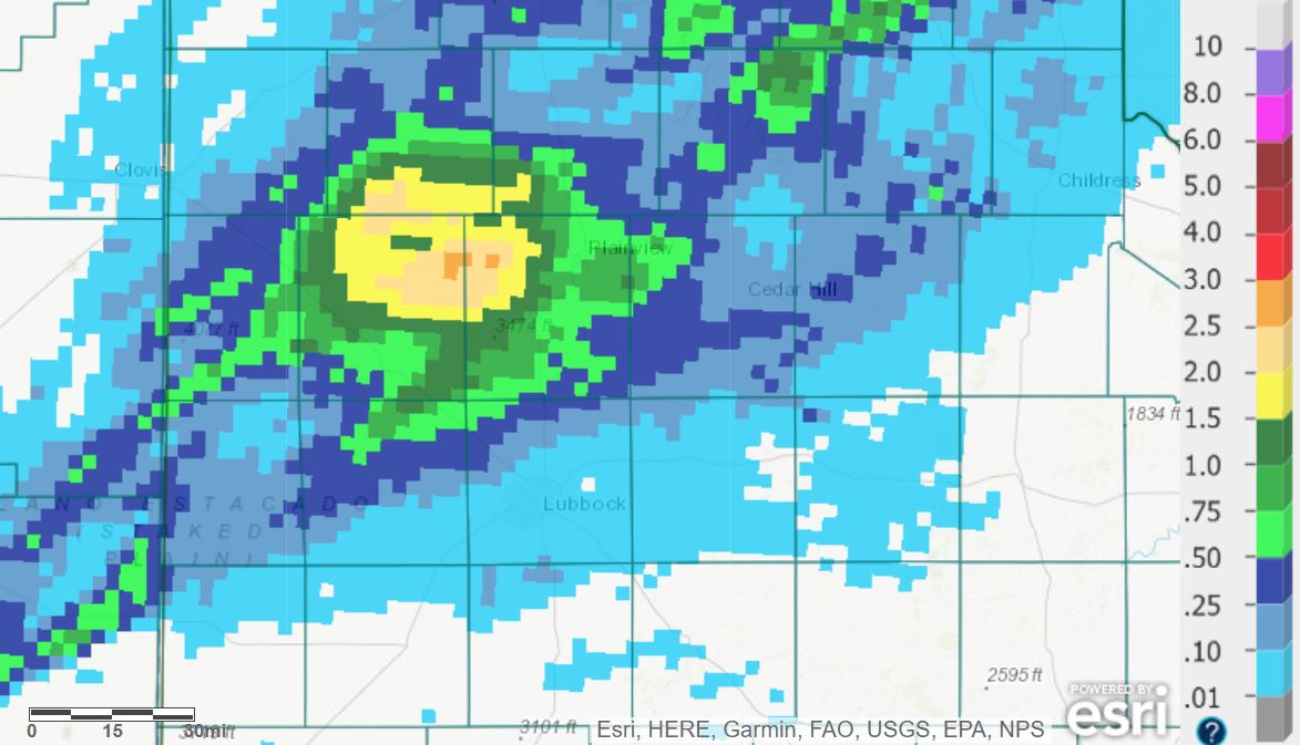 |
| 24-hour radar-estimated and bias-corrected rainfall ending at 7 am on Thursday (27 May 2021). |
| |
|
The next day, Thursday the 27th, was hotter as the dryline mixed eastward to near the edge of the Caprock in the afternoon. Temperatures soared into the lower and middle 90s across the central and western South Plains. The heat fueled isolated thunderstorms, a few which were briefly strong to marginally severe, across the southern Texas Panhandle into the northern Rolling Plains during the late afternoon and evening hours.
|
| |
 |
| Lubbock WSR-88D base reflectivity loop valid from 5:35 pm to 6:46 pm on Thursday (27 May 2021). An additional radar animation, valid from 9:59 pm on the 27th to 11:23 am on the 28th, can be VIEWED HERE. |
| |
| Isolated storms then moved out of eastern New Mexico and affected parts of the southern Texas Panhandle after midnight, and persisted well into the morning hours. The strongest cells occasionally produce hail, measured as large as golf balls with one storm southeast of Floydada. An isolated thunderstorm then developed across the west-central South Plains late Friday morning and tracked steadily eastward all the way into the Rolling Plains, occasionally dropping quarter to half dollar size hail. |
| |
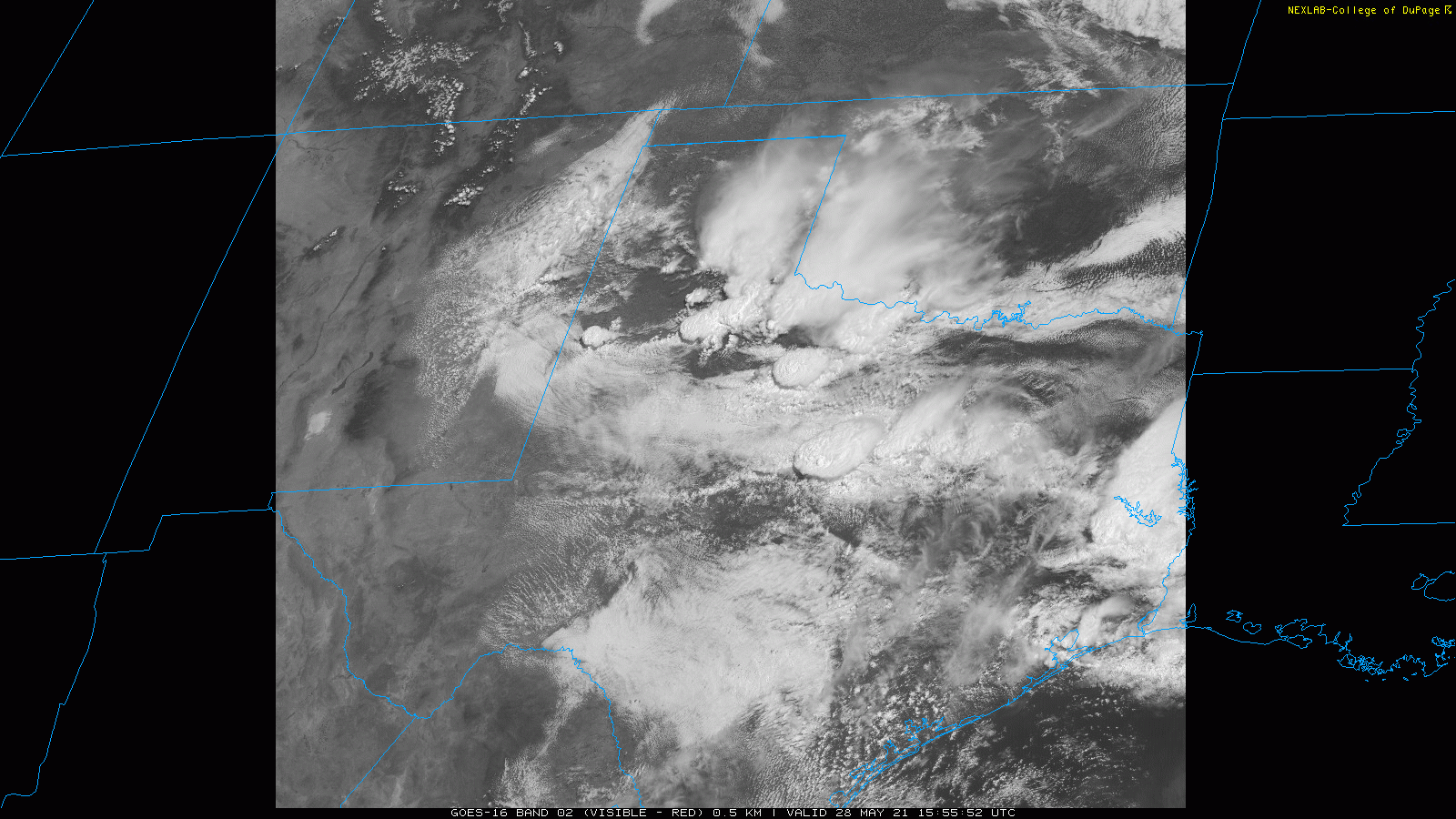 |
| GOES-16 visible satellite imagery valid from 10:55 am to 11:05 am 28 May 2021. |
| |
| Friday concluded with a squall line diving southeastward out of New Mexico and across the western and central South Plains. Locations roughly along and south of Highway 84 saw bountiful lightning and thunder, gusty winds and a brief bout of heavy rain. The Plains and Morton WTM sites measured gusts to 58 mph and 60 mph, respectively. The wind did down a power pole near Whitharral. |
| |
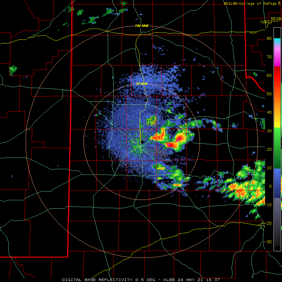
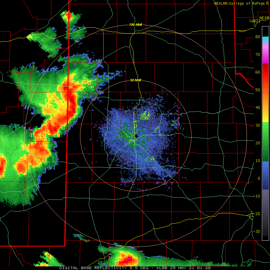 |
| Lubbock WSR-88D base reflectivity loop valid from 8:20 pm on Friday (28 May) to 12:29 am on Saturday (29 May). An additional radar animation, valid from 1:37 pm to 4:26 pm on the 28th can be VIEWED HERE. |
| |
| The holiday weekend started on a quiet note, with plenty of clouds and areas of drizzle but no meaningful rainfall. That changed Sunday evening, as storms that developed across the higher terrain of New Mexico spread into West Texas. One particularly strong storm emerging from eastern New Mexico produced quarter size hail, damaging winds and a funnel cloud west of Morton. |
| |
 |
| Moisture-rich severe storm over western Cochran County Sunday evening (30 May 2021). The picture is courtesy of Bruce Haynie. |
| |
| The severe storms were relatively isolated, however heavy rain affected much of the South Plains and Rolling Plains from Sunday evening into Monday (Memorial Day) morning. Rain totals of 1 to 3 inches were common over this stretch, which filled playa lakes to and above capacity and caused flooding issues in spots. |
| |
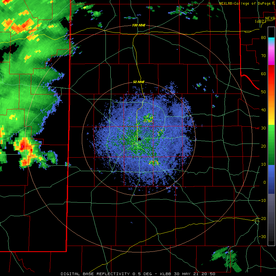 |
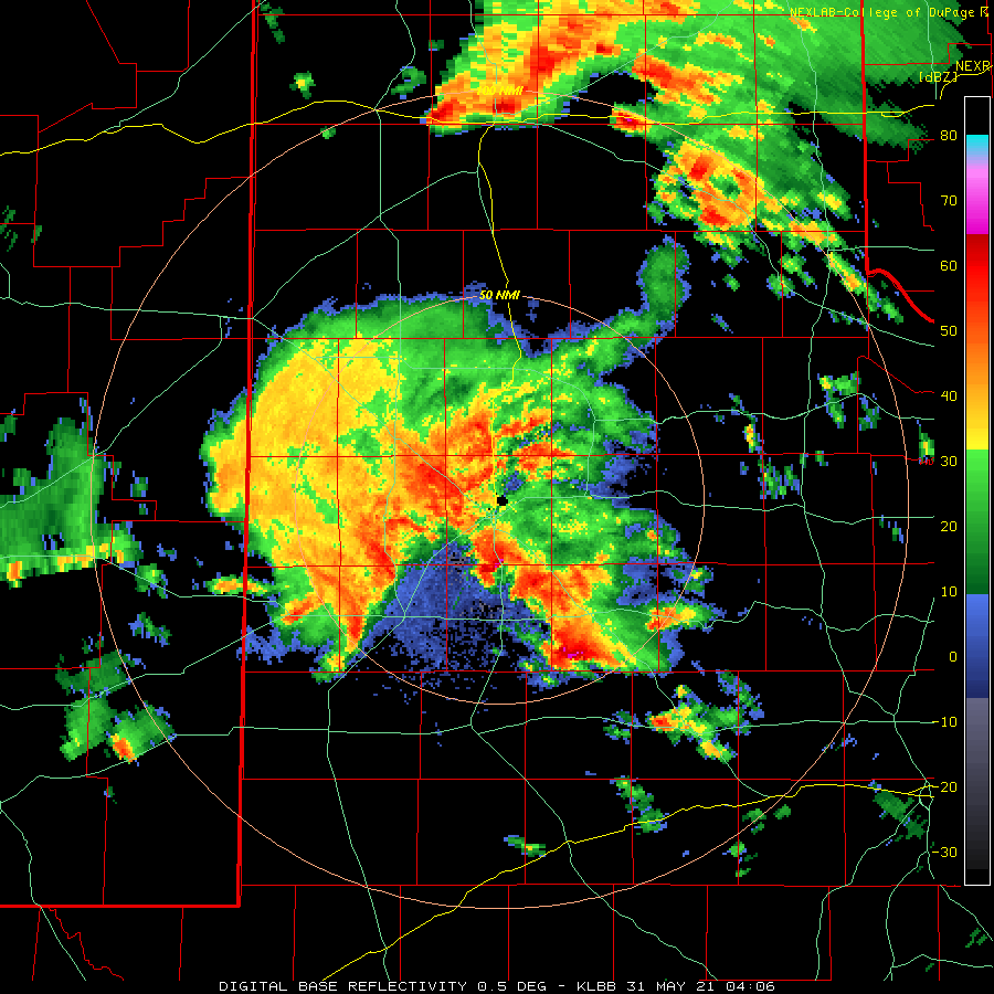
| Lubbock WSR-88D base reflectivity loop valid from 3:50 pm to 11:23 pm on Sunday (30 May 2021). An additional radar animation, valid from 11:06 pm on the 30th to 9:48 am on the 31st, can be VIEWED HERE. |
| |
| Lubbock officially tallied 3.91 inches of rain over this soggy end of May, a majority of which (2.00 inches) fell on the 24th. This rain, coupled with the active middle of the month, totaled to 5.86 for the entire month, or over twice the average of 2.86 inches. The widespread heavy rain also helped to significantly temper the ongoing and prolonged drought affecting the region. |
| |
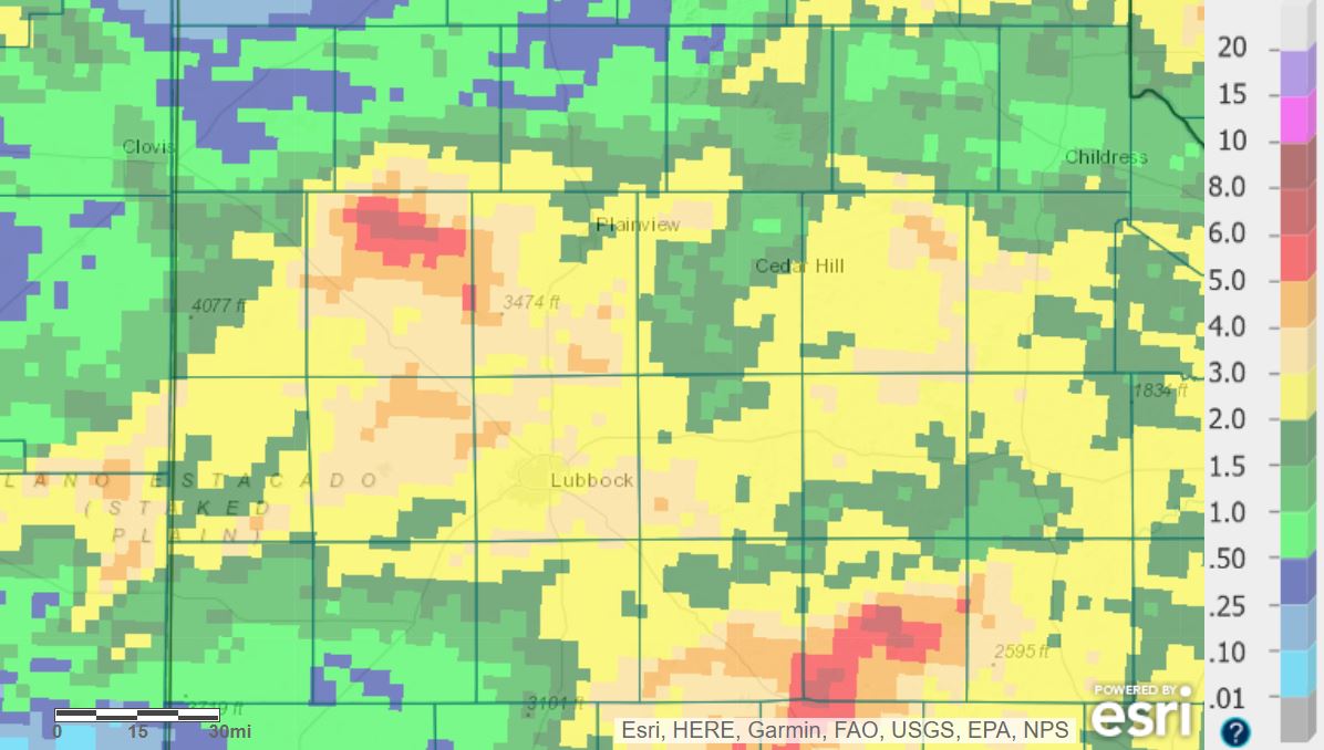 |
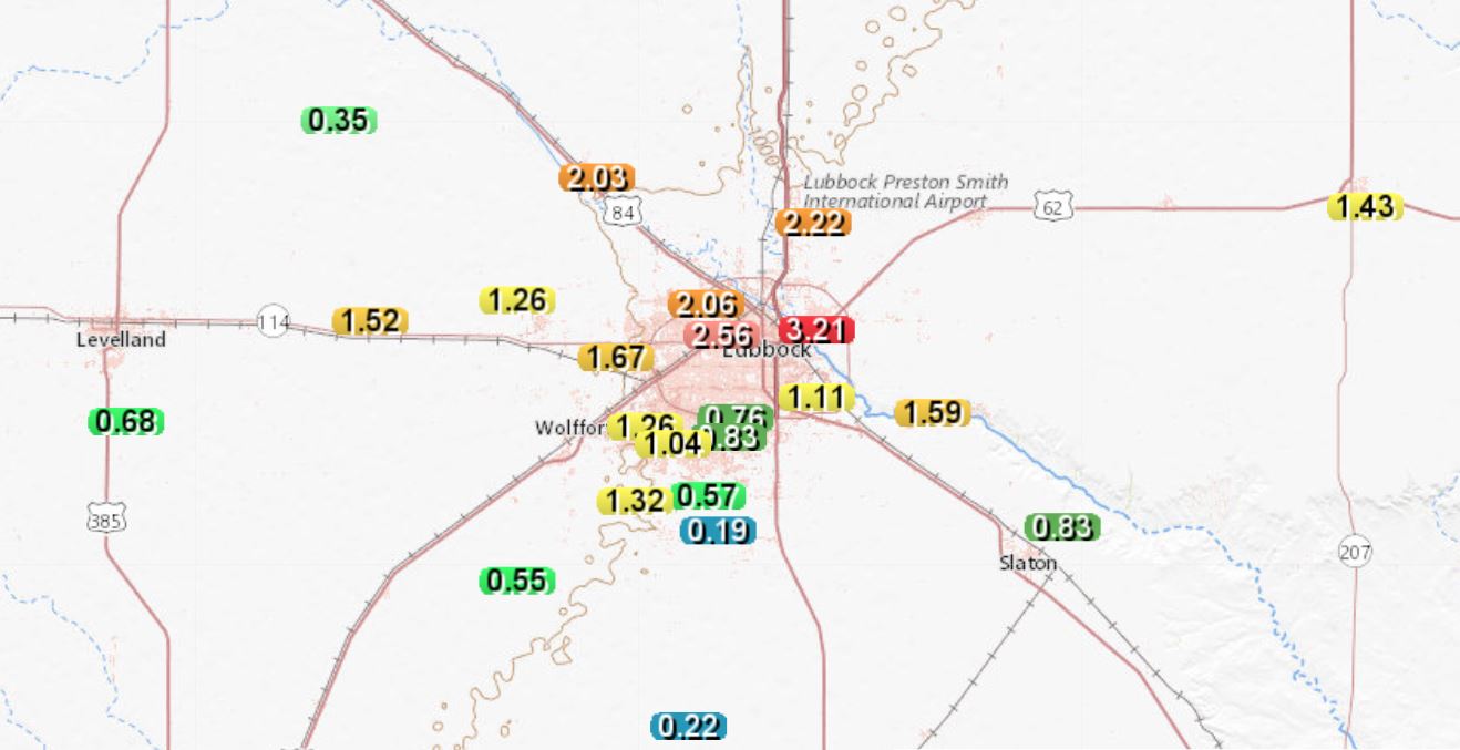
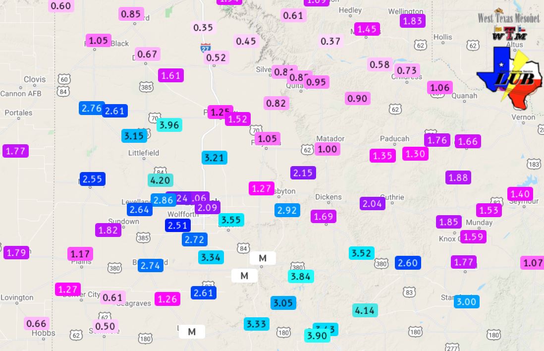
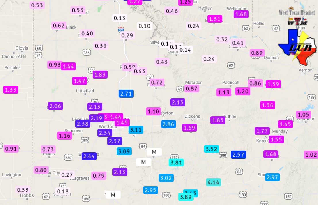
| Radar-estimated and bias-corrected 7-day rain totals through 7 am on 31 May 2021. The 6-day rain totals measured by the West Texas Mesonet ending at 2 pm on the 31st can be FOUND HERE. The 24-hour rain totals measured by the West Texas Mesonet ending at 2 pm on the 31st can be VIEWED HERE. |
| |
| Runoff from the heavy rain did fill up Lake Alan Henry, lifting it an additional 6 feet, and causing it to run over the spillway for the first time this year. White River Lake rose about 2 feet, lifting it from 12% to 17% of capacity. |
| |
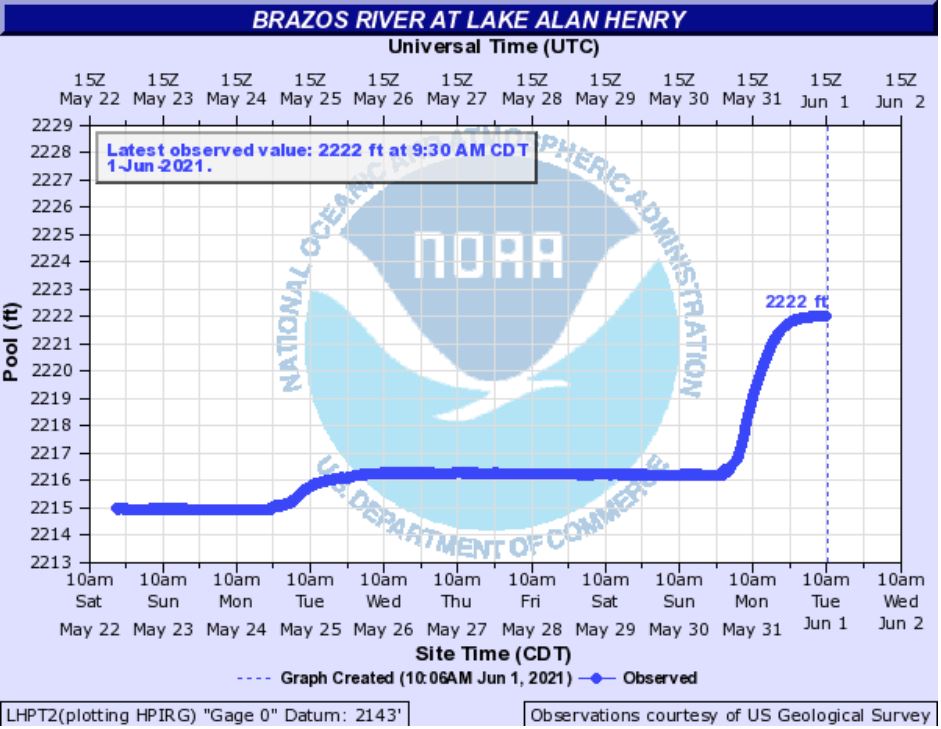 |
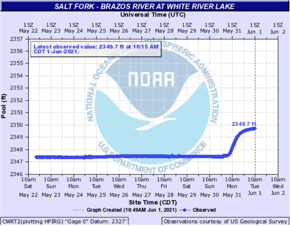 |
| Water levels observed at Lake Alan Henry (left) and White River Lake (right) in late May 2021. The conservation level (lake deemed full) is 2,220 feet for Lake Alan Henry. |
| |
|
The preliminary storm reports collected on the active late-May stretch can be found below.
|