Rounds of severe thunderstorms and widespread rainfall 14-19 May 2021
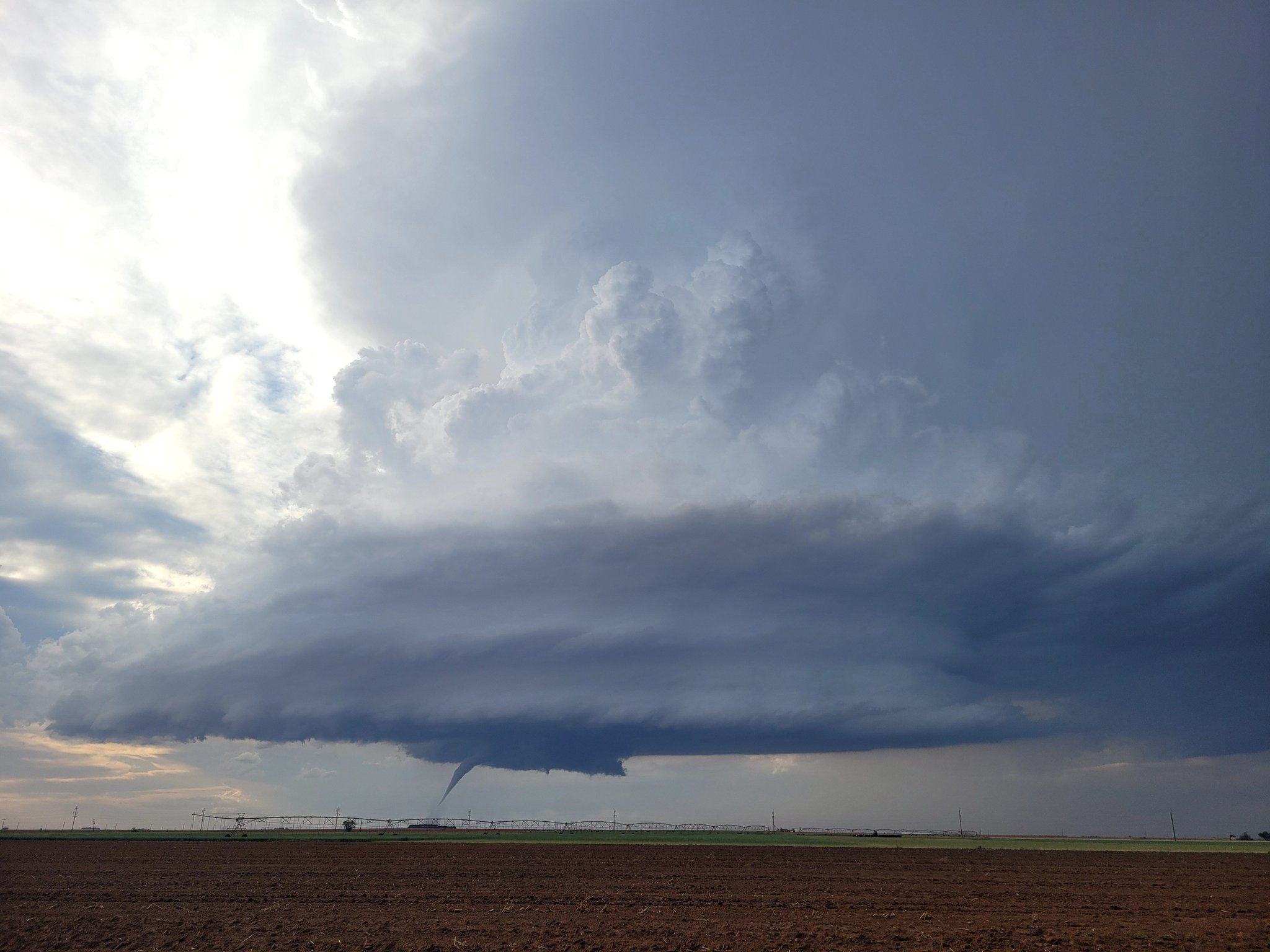
Severe thunderstorm approaching Lubbock Monday evening (17 May). The picture was captured at 7:20 pm.
The middle of May 2021 provided an active stretch of weather, complete with tornadoes, very large hail, damaging winds and torrential rainfall. Although the intense thunderstorms did cause spotty damage, they also brought widespread meaningful rainfall to the region for the first time in many months.
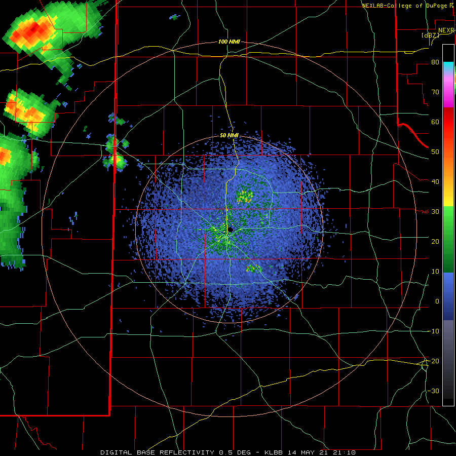
Lubbock WSR-88D base reflectivity loop valid from 4:10 pm to 10:14 pm on Friday (14 May 2021).
The return of Gulf moisture to West Texas, coupled with a large and slow-moving storm system dropping into the western states and an active dryline, set the stage for multiple rounds of thunderstorms in mid-May.
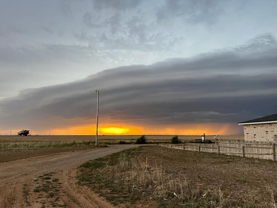
Storm approaching Plainview around sunset on Friday (14 May 2021). The picture was taken by Demetre Velazquez and relayed by Jacob Riley.
The action kicked off in earnest on Friday, May 14th, as thunderstorms developed across eastern New Mexico and the western Texas Panhandle during the afternoon, then spread eastward through the evening hours. A few of these storms were on the strong side, including in Bovina where one storm dropped quarter size hail. This activity brought a welcome shot of rainfall to much of the southern Texas Panhandle and northern South Plains before diminishing early Saturday morning.
Infrared satellite loop captured from GOES-16 valid 8:36 pm to 9:04 pm on Tuesday (15 May 2021).
The next day, Saturday the 15th, was even warmer and moister than the previous day which resulted in more energy for thunderstorms that formed to ingest. Thunderstorms erupted over eastern New Mexico during the afternoon, with more isolated storms developing over the western South Plains. Localized very heavy rain fell around Morton, where a small but intense storm formed and sat during the afternoon and early evening.
(left) Ominous storm clouds approaching Lubbock Tuesday evening (15 May 2021). (right) Flooded roads in Morton Tuesday evening, shared by Adam Young and Matt Ernst.
The thunderstorms eventually evolved into a line as they spread eastward across the South Plains through the evening hours. The most intense cells in the line generated hail and high winds, as strong as 67 mph at the Anton West Texas Mesonet, while welcome rainfall fell in a large swath. Rain totals near and in excess of an inch were recorded over much of the central and southern South Plains. Unfortunately, the thunderstorms quickly faded as the moved into the Rolling Plains late Saturday night.
Lubbock WSR-88D base reflectivity loop valid from 4:24 pm to 10:07 pm on Tuesday (15 May 2021).
The below image shows that the peak wind gusts Tuesday evening favoring the western and southwestern South Plains, where a solid line of thunderstorms moved through.
Peak wind gusts measured by the West Texas Mesonet on Tuesday, 15 May 2021.
The next day, Sunday (16 May), saw another round of thunderstorms. This time the storms develop along the dryline as well as an outflow boundary and effective cold front dipping out of Oklahoma and the Texas Panhandle. This activity favored spots the missed out on the heavier rain the day before, bringing an inch or more to many locations across the southeast Texas Panhandle into the Rolling Plains. The rain did come with intense storms too.
Lubbock WSR-88D base reflectivity loop valid from 4:43 pm to 10:19 pm on Sunday (16 May 2021). An additional radar animation, valid from 9:34 pm on the 16th to 1:56 am on the 17th can be VIEWED HERE.
Several of Sunday's storms were supercells (rotating thunderstorms) that tossed very large hail. One storm even produced a brief tornado as it tracked between the communities of Earth and Sudan during the evening. Thankfully the tornado occurred over open land and inflicted no known damage. This same storm went on to drop baseball size hail as it passed over Petersburg during the late-night hours. The thunderstorms gradually weakened early Sunday morning.
Tornadic thunderstorm between Earth and Sudan Sunday evening (16 May). The picture was taken around 7:40 pm and is courtesy of Cameron Nixon.
The lull in activity lasted until Monday afternoon when thunderstorms again erupted near the dryline located near the TX/NM line, as well as along the residual frontal boundary over the southern South and Rolling Plains. Many of the storms quickly began to rotate as they felt the impact of strong wind fields aloft as the western storm system drew closer.
Water Vapor satellite loop captured from GOES-16 valid 5:01 pm to 9:21 pm on Monday (17 May 2021).
The rotating storms tossed very large hail and a few of them produced wall clouds and funnel clouds. A storm near Muleshoe Wildlife Refuge dropped hail as large as baseballs, while a wind gust as high as 71 mph was measured by the Dimmitt West Texas Mesonet site.
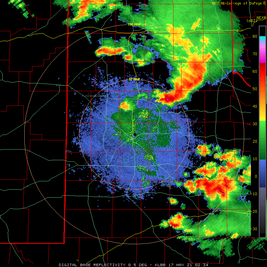
Lubbock WSR-88D base reflectivity loop valid from 2:09 pm to 9:19 pm on Monday (17 May 2021). An additional radar animation, valid from 12:35 am to 3:48 am on the 18th can be VIEWED HERE.
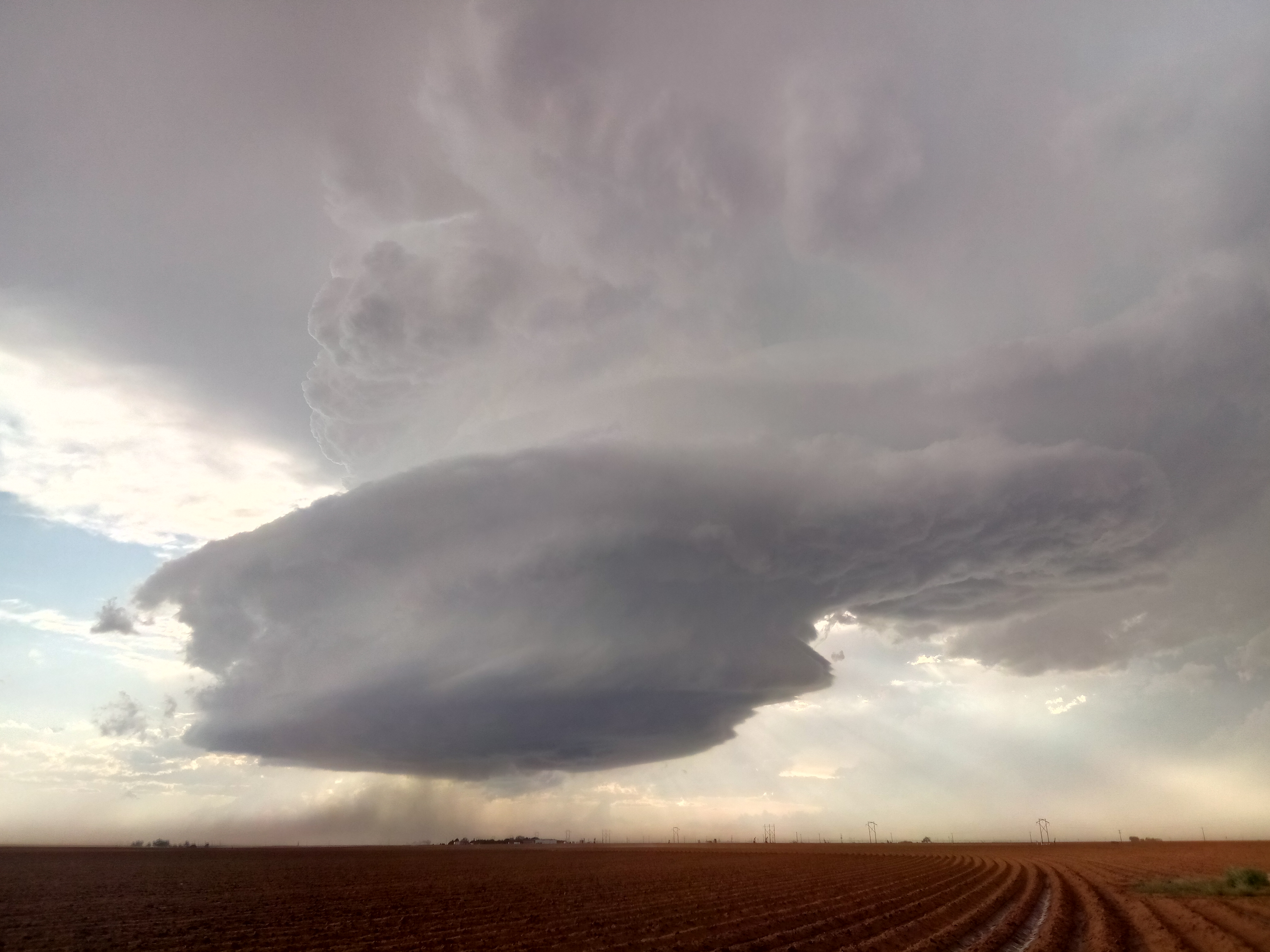
One particularly robust rotating storm developed immediately west of Lubbock Monday evening (pictured at the top of this page). This storm was quite picturesque, but it also generated several wall clouds and funnel clouds and at least one very brief tornado touchdown west of Lubbock. The strong rotation moved directly across the southern portion of Lubbock, but thankfully didn't produce any additional tornadoes. Instead, it brought brief heavy rain, gusty winds and up to golf ball size hail to portions of the city before shifting east and dissipating.
Large hail that fell northwest of the Muleshoe National Wildlife Refuge Monday evening. The picture is courtesy of Kaitlin Rutt.
Storms eventually accelerated off to the east, exiting into Oklahoma and western North Texas late Monday evening. After a brief lull, additional thunderstorms developed across the southeast South Plains and southern Rolling Plains as lift from the approaching upper level storm system spread over the region. These storms pulsed in intensity, but did dump heavy rainfall over the far southern Rolling Plains into the Big Country in the predawn hours of Tuesday.
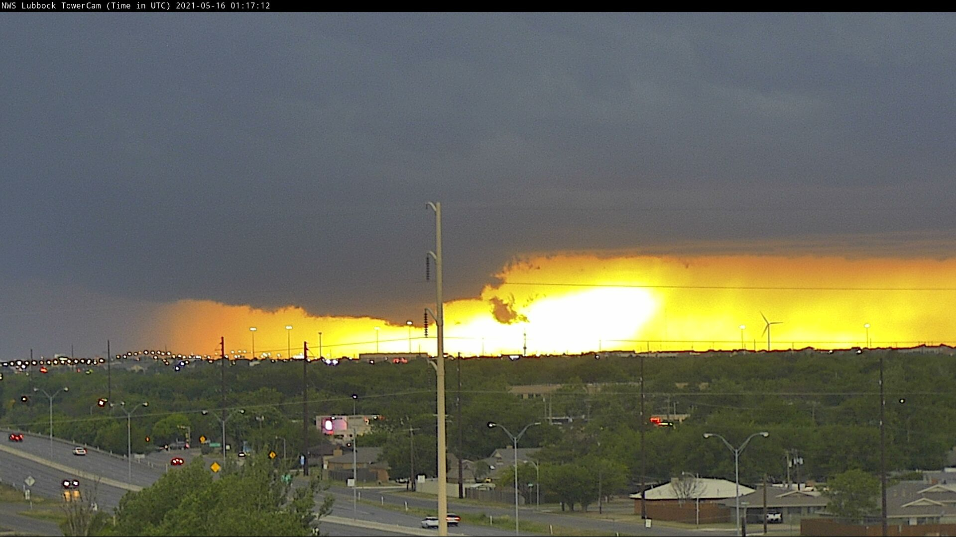
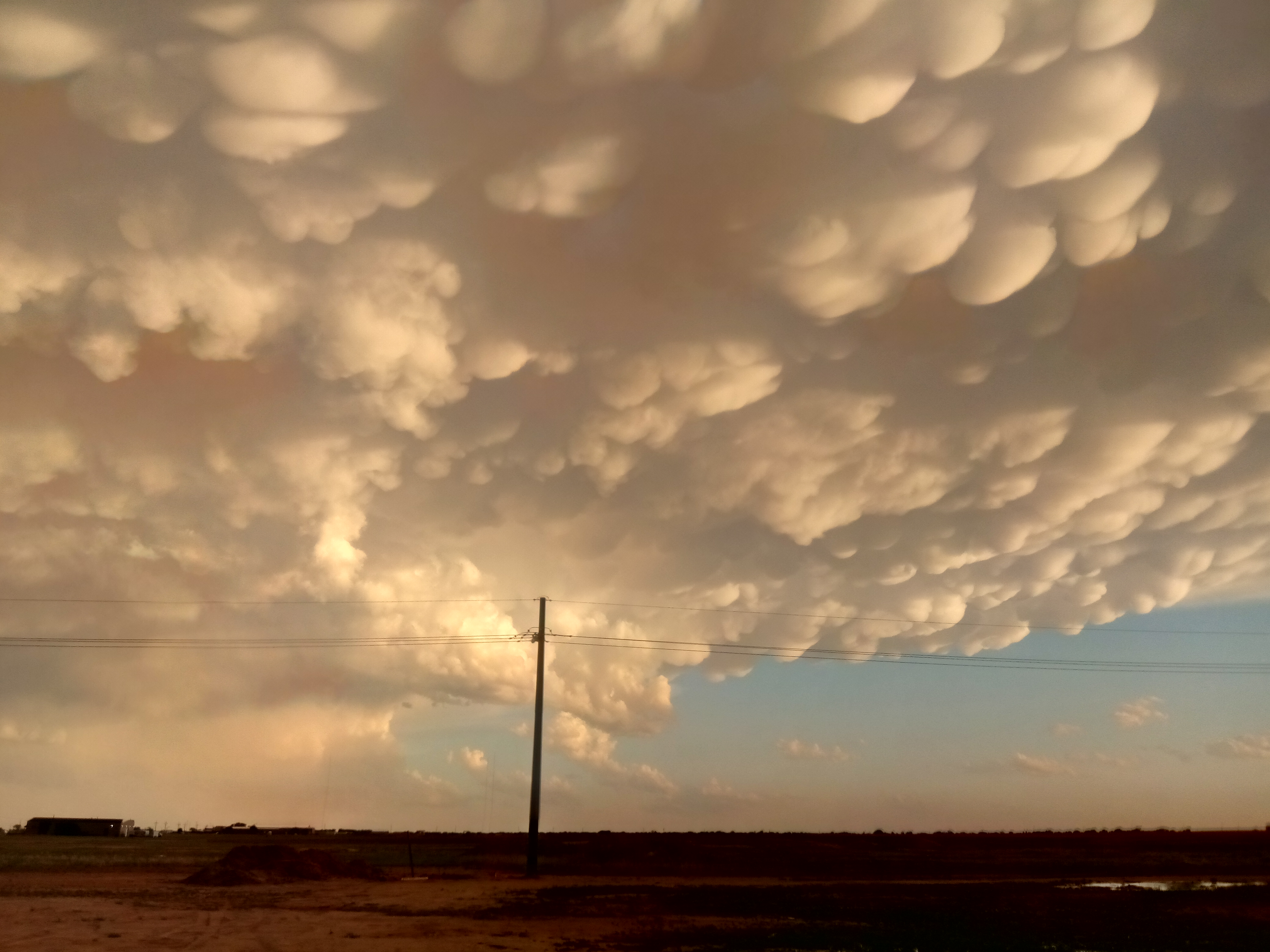
A fine ending to an active afternoon and evening. The picture is looking south from just south from South Lubbock around sunset Monday (17 May 2021).
Tuesday afternoon and evening (18 May) supplied another round of thunderstorms in the form of a broken line that marched from west to east across the South Plains, congealing into a continuous line as it moved into the Rolling Plains and southeast Texas Panhandle. In general, this activity wasn't as organized or intense as the 17th, but the line did generate a wind gust of 64 mph at the Amherst West Texas Mesonet site and widespread rainfall.
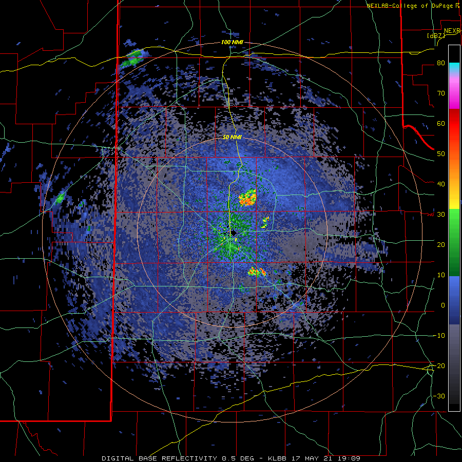
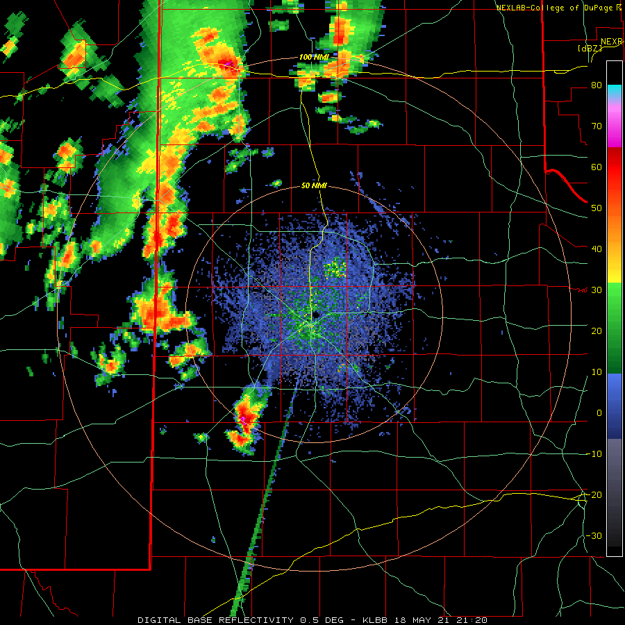
Lubbock WSR-88D base reflectivity loop valid from 4:20 pm to 7:53 pm on Tuesday (18 May 2021). An additional radar animation, valid from 7:40 pm to 11:21 pm on the 19th can be VIEWED HERE.
Shortly after the line of storms pushed off to the east, additional non-severe thunderstorms redeveloped across the southern South Plains very early Wednesday morning as the upper level system began to pivot overhead. This round of moderate to heavy rain expanded northward through the central and northeastern South Plains through Wednesday morning before diminishing as it shifted off into the Rolling Plains.
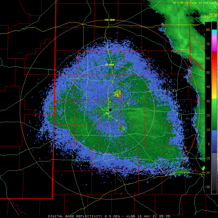
Lubbock WSR-88D base reflectivity loop valid from 1:48 am to 10:28 am on Wednesday (19 May 2021).
A final round of isolated to widely scattered thunderstorms developed Wednesday afternoon and evening as the upper level system began to pull away from the region. A few of these storms were on the strong side, with the greatest coverage across the southeast Texas Panhandle into the Rolling Plains.
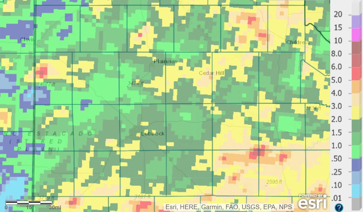
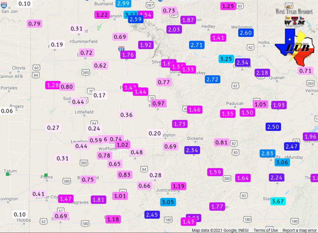
Radar-estimated and bias-corrected 7-day rain totals through 7 am on 21 May 2021. The 6-day rain totals measured by the West Texas Mesonet ending at 3 pm on the 21st can be FOUND HERE.
Over the course of this active mid-May stretch widespread meaningful rainfall fell across the entire South Plains region. Rain totals in excess of an inch were common, while 2 to 4+ inches fell in many spots. Officially the Lubbock Airport measured 1.87 inches of rain, boosting the yearly total to 5.68 inches and lifting it back above average for mid-May. Childress officially recorded 2.45 inches over this same stretch, which lifted their yearly total to 7.18 inches for the year.
The preliminary storm reports collected on the active mid-May stretch can be found below.
Storm Reports from May 15th
PRELIMINARY LOCAL STORM REPORT...SUMMARY
NATIONAL WEATHER SERVICE LUBBOCK TX
351 AM CDT SUN MAY 16 2021

..TIME...   ...EVENT...      ...CITY LOCATION...     ...LAT.LON...
..DATE...   ....MAG....      ..COUNTY LOCATION..ST.. ...SOURCE....
            ..REMARKS..

0640 PM     HAIL             MORTON                  33.72N 102.76W
05/15/2021  E1.00 INCH       COCHRAN            TX   CO-OP OBSERVER

0702 PM     FLOOD            MORTON                  33.72N 102.76W
05/15/2021                   COCHRAN            TX   CO-OP OBSERVER

            STREET FLOODING REPORTED.

0702 PM     FLOOD            MORTON                  33.72N 102.76W
05/15/2021                   COCHRAN            TX   LAW ENFORCEMENT

            MULTIPLE VEHICLES STUCK IN THE CITY OF MORTON DUE TO
            HIGH WATER.

0805 PM     TSTM WND GST     7 WNW DENVER CITY       32.99N 102.94W
05/15/2021  M60 MPH          YOAKUM             TX   MESONET

            WEST TEXAS MESONET REPORT

0825 PM     HAIL             LEVELLAND               33.58N 102.36W
05/15/2021  M1.00 INCH       HOCKLEY            TX   EMERGENCY MNGR

            REPORTED FROM SOUTH PLAINS COLLEGE

0855 PM     TSTM WND GST     6 SSW ANTON             33.73N 102.19W
05/15/2021  M67 MPH          HOCKLEY            TX   MESONET

            WEST TEXAS MESONET REPORT

0930 PM     FLOOD            5 SW LUBBOCK            33.52N 101.94W
05/15/2021                   LUBBOCK            TX   EMERGENCY MNGR

            STREET FLOODING REPORTED 50TH AND SLIDE
Storm Reports on May 16th
PRELIMINARY LOCAL STORM REPORT...SUMMARY
NATIONAL WEATHER SERVICE LUBBOCK TX
553 AM CDT MON MAY 17 2021

..TIME...   ...EVENT...      ...CITY LOCATION...     ...LAT.LON...
..DATE...   ....MAG....      ..COUNTY LOCATION..ST.. ...SOURCE....
            ..REMARKS..

0533 PM     HAIL             KIRKLAND                34.39N 100.07W
05/16/2021  E0.75 INCH       CHILDRESS          TX   LAW ENFORCEMENT

0550 PM     HAIL             KIRKLAND                34.39N 100.07W
05/16/2021  E1.00 INCH       CHILDRESS          TX   LAW ENFORCEMENT

            SHERIFF REPORTS QUARTER SIZED HAIL IN TOWN.

0728 PM     HAIL             1 S EARTH               34.22N 102.41W
05/16/2021  E1.50 INCH       LAMB               TX   TRAINED SPOTTER

0735 PM     HAIL             10 NNW PADUCAH          34.15N 100.37W
05/16/2021  E1.25 INCH       COTTLE             TX   SOCIAL MEDIA

0740 PM     TORNADO          5 SSW EARTH             34.17N 102.44W
05/16/2021                   LAMB               TX   TRAINED SPOTTER

            PHOTO OF TORNADO RECEIVED VIA SOCIAL MEDIA NE OF SUDAN.

0742 PM     HAIL             1 S HAPPY               34.73N 101.86W
05/16/2021  E1.00 INCH       SWISHER            TX   PUBLIC

            MPING REPORT

0908 PM     TSTM WND GST     2 S LESLEY              34.65N 100.81W
05/16/2021  M67 MPH          HALL               TX   MESONET

            WEST TEXAS MESONET MEASURED WIND GUST OF 67 MPH.

0928 PM     TSTM WND GST     2 S LESLEY              34.65N 100.81W
05/16/2021  M73 MPH          HALL               TX   MESONET

            WEST TEXAS MESONET MEASURED WIND GUST OF 73 MPH.

1031 PM     HAIL             6 S HALE CENTER         33.98N 101.84W
05/16/2021  M1.00 INCH       HALE               TX   TRAINED SPOTTER

            1.1 TO 1.2 INCH DIAMETER HAIL REPORTED.

1035 PM     HAIL             7 SSE HALE CENTER       33.97N 101.80W
05/16/2021  M1.50 INCH       HALE               TX   TRAINED SPOTTER

            1.5 INCH DIAMETER HAIL FOUND ON GROUND. TIME ESTIMATED
            FROM RADAR.

1054 PM     HAIL             8 NW PETERSBURG         33.95N 101.70W
05/16/2021  E1.25 INCH       HALE               TX   TRAINED SPOTTER

1059 PM     HAIL             5 NW PETERSBURG         33.92N 101.66W
05/16/2021  M3.00 INCH       HALE               TX   SOCIAL MEDIA

            TIME ESTIMATED FROM RADAR.

1116 PM     HAIL             PETERSBURG              33.87N 101.60W
05/16/2021  E1.75 INCH       HALE               TX   FIRE DEPT/RESCUE

            ACCUMULATING PEA TO GOLF BALL SIZED HAIL REPORTED BY
            PETERSBURG FIRE DEPT.

1130 PM     HAIL             PETERSBURG              33.87N 101.60W
05/16/2021  M2.50 INCH       HALE               TX   SOCIAL MEDIA
Storm Reports on May 17th
PRELIMINARY LOCAL STORM REPORT...SUMMARY
NATIONAL WEATHER SERVICE LUBBOCK TX
1128 PM CDT MON MAY 17 2021

..TIME...   ...EVENT...      ...CITY LOCATION...     ...LAT.LON...
..DATE...   ....MAG....      ..COUNTY LOCATION..ST.. ...SOURCE....
            ..REMARKS..

1116 PM     HAIL             PETERSBURG              33.87N 101.60W
05/16/2021  E1.75 INCH       HALE               TX   FIRE DEPT/RESCUE

            ACCUMULATING PEA TO GOLF BALL SIZED HAIL REPORTED BY
            PETERSBURG FIRE DEPT.

1130 PM     HAIL             PETERSBURG              33.87N 101.60W
05/16/2021  M2.50 INCH       HALE               TX   SOCIAL MEDIA

0502 PM     HAIL             2 S SPUR                33.45N 100.85W
05/17/2021  M1.00 INCH       DICKENS            TX   EMERGENCY MNGR

0507 PM     HAIL             9 SW GIRARD             33.27N 100.77W
05/17/2021  E1.00 INCH       KENT               TX   TRAINED SPOTTER

0515 PM     HAIL             9 SW GIRARD             33.27N 100.77W
05/17/2021  E1.75 INCH       KENT               TX   STORM CHASER

0515 PM     HAIL             GIRARD                  33.36N 100.66W
05/17/2021  M2.75 INCH       KENT               TX   STORM CHASER

            2.75" HAIL MEASURED NEAR GIRARD, TX.

0540 PM     HAIL             MATADOR                 34.02N 100.82W
05/17/2021  E1.50 INCH       MOTLEY             TX   LAW ENFORCEMENT

            PING PONG BALL SIZED HAIL REPORTED AT THE SHARIFF
            OFFICE.

0548 PM     HAIL             2 NW JAYTON             33.27N 100.60W
05/17/2021  E1.75 INCH       KENT               TX   LAW ENFORCEMENT

0603 PM     HAIL             JAYTON                  33.25N 100.57W
05/17/2021  E1.50 INCH       KENT               TX   LAW ENFORCEMENT

0612 PM     HAIL             10 NW NEEDMORE          34.13N 102.86W
05/17/2021  M2.00 INCH       BAILEY             TX   STORM CHASER

0617 PM     FUNNEL CLOUD     9 SW MULESHOE           34.14N 102.84W
05/17/2021                   BAILEY             TX   SOCIAL MEDIA

0617 PM     TORNADO          9 SW MULESHOE           34.14N 102.84W
05/17/2021                   BAILEY             TX   STORM CHASER

            TWITTER VIDEO INDICATES A LIKELY BRIEF TORNADO.

0619 PM     HAIL             SUNDOWN                 33.46N 102.49W
05/17/2021  E1.00 INCH       HOCKLEY            TX   TRAINED SPOTTER

            TIME ESTIMATED FROM RADAR.

0620 PM     TSTM WND GST     2 NE FRIONA             34.65N 102.69W
05/17/2021  M64 MPH          PARMER             TX   MESONET

0633 PM     HAIL             MULESHOE                34.23N 102.73W
05/17/2021  E1.00 INCH       BAILEY             TX   LAW ENFORCEMENT

            MULESHOE PD REPORTS QUARTER SIZE HAIL.

0634 PM     HAIL             5 NW MULESHOE           34.28N 102.79W
05/17/2021  E2.00 INCH       BAILEY             TX   NWS EMPLOYEE

0635 PM     HAIL             MULESHOE                34.23N 102.73W
05/17/2021  M1.00 INCH       BAILEY             TX   CO-OP OBSERVER

0647 PM     HAIL             SUDAN                   34.07N 102.52W
05/17/2021  E2.00 INCH       LAMB               TX   SOCIAL MEDIA

0657 PM     HAIL             N NEEDMORE              34.03N 102.74W
05/17/2021  M2.00 INCH       BAILEY             TX   STORM CHASER

0658 PM     HAIL             6 SW LEVELLAND          33.52N 102.44W
05/17/2021  E1.25 INCH       HOCKLEY            TX   STORM CHASER

0703 PM     HAIL             6 SSE LEVELLAND         33.50N 102.32W
05/17/2021  E1.75 INCH       HOCKLEY            TX   SOCIAL MEDIA

            PHOTO VIA TWITTER. TIME ESTIMATED FROM RADAR.

0720 PM     TSTM WND GST     2 NE DIMMITT            34.57N 102.29W
05/17/2021  M71 MPH          CASTRO             TX   MESONET

            WEST TEXAS MESONET

0729 PM     HAIL             5 SW SMYER              33.54N 102.22W
05/17/2021  M2.50 INCH       HOCKLEY            TX   STORM CHASER

0733 PM     HAIL             4 NNW SUDAN             34.12N 102.55W
05/17/2021  E1.00 INCH       LAMB               TX   STORM CHASER

0735 PM     HAIL             4 SSW LUBBOCK           33.53N 101.88W
05/17/2021  M1.25 INCH       LUBBOCK            TX   NWS OFFICE

0736 PM     HAIL             TURKEY                  34.39N 100.90W
05/17/2021  E2.00 INCH       HALL               TX   STORM CHASER

0748 PM     HAIL             LUBBOCK                 33.58N 101.88W
05/17/2021  E1.00 INCH       LUBBOCK            TX   TRAINED SPOTTER

            QUARTER SIZED HAIL AT 108TH ST AND INDIANA AVE

0750 PM     FUNNEL CLOUD     7 N ROPESVILLE          33.52N 102.15W
05/17/2021                   HOCKLEY            TX   SOCIAL MEDIA

            PHOTO OF FUNNEL CLOUD RECEIVED VIA TWITTER.

0750 PM     TORNADO          3 W WOLFFORTH           33.51N 102.06W
05/17/2021                   LUBBOCK            TX   STORM CHASER

            VIDEO RECEIVED VIA TWITTER OF BRIEF TORNADO TOUCHDOWN
            IN OPEN FIELD.

0810 PM     FUNNEL CLOUD     4 SSW LUBBOCK           33.53N 101.88W
05/17/2021                   LUBBOCK            TX   NWS OFFICE

            FUNNEL CLOUD OBSERVED VIA NWS LUBBOCK TOWERCAM.

0819 PM     HAIL             1 ENE WOLFFORTH         33.51N 101.99W
05/17/2021  E1.00 INCH       LUBBOCK            TX   STORM CHASER

0823 PM     HAIL             4 SSW LUBBOCK           33.53N 101.88W
05/17/2021  M1.00 INCH       LUBBOCK            TX   NWS OFFICE

            NWS EMPLOYEE MEASURES QUARTER-SIZED HAIL AT NWS LUBBOCK
            OFFICE.

0825 PM     HAIL             WOLFFORTH               33.51N 102.01W
05/17/2021  M1.75 INCH       LUBBOCK            TX   SOCIAL MEDIA

            PHOTO RECEIVED VIA TWITTER.

0831 PM     HAIL             3 ESE LUBBOCK SOUTH PLA 33.53N 101.87W
05/17/2021  M1.00 INCH       LUBBOCK            TX   BROADCAST MEDIA

            QUARTER-SIZED HAIL AT KLBK STUDIOS.

0832 PM     HAIL             LUBBOCK                 33.58N 101.88W
05/17/2021  M1.00 INCH       LUBBOCK            TX   SOCIAL MEDIA

            QUARTER-SIZED HAIL AT 63RD AND ELKHART.

0832 PM     HAIL             1 W LUBBOCK SOUTH PLAI  33.54N 101.93W
05/17/2021  M1.00 INCH       LUBBOCK            TX   PUBLIC

0838 PM     FUNNEL CLOUD     7 S LUBBOCK             33.47N 101.88W
05/17/2021                   LUBBOCK            TX   FIRE DEPT/RESCUE

            FUNNEL CLOUD REPORTED AT FM 1585 AND I-27.

0838 PM     HAIL             2 N LOCKETTVILLE        33.42N 102.32W
05/17/2021  M1.00 INCH       HOCKLEY            TX   STORM CHASER

1035 PM     TSTM WND GST     2 NNE CHILDRESS         34.46N 100.20W
05/17/2021  M63 MPH          CHILDRESS          TX   MESONET

            WEST TEXAS MESONET


