A quick shot of winter hits West Texas
26 January 2022
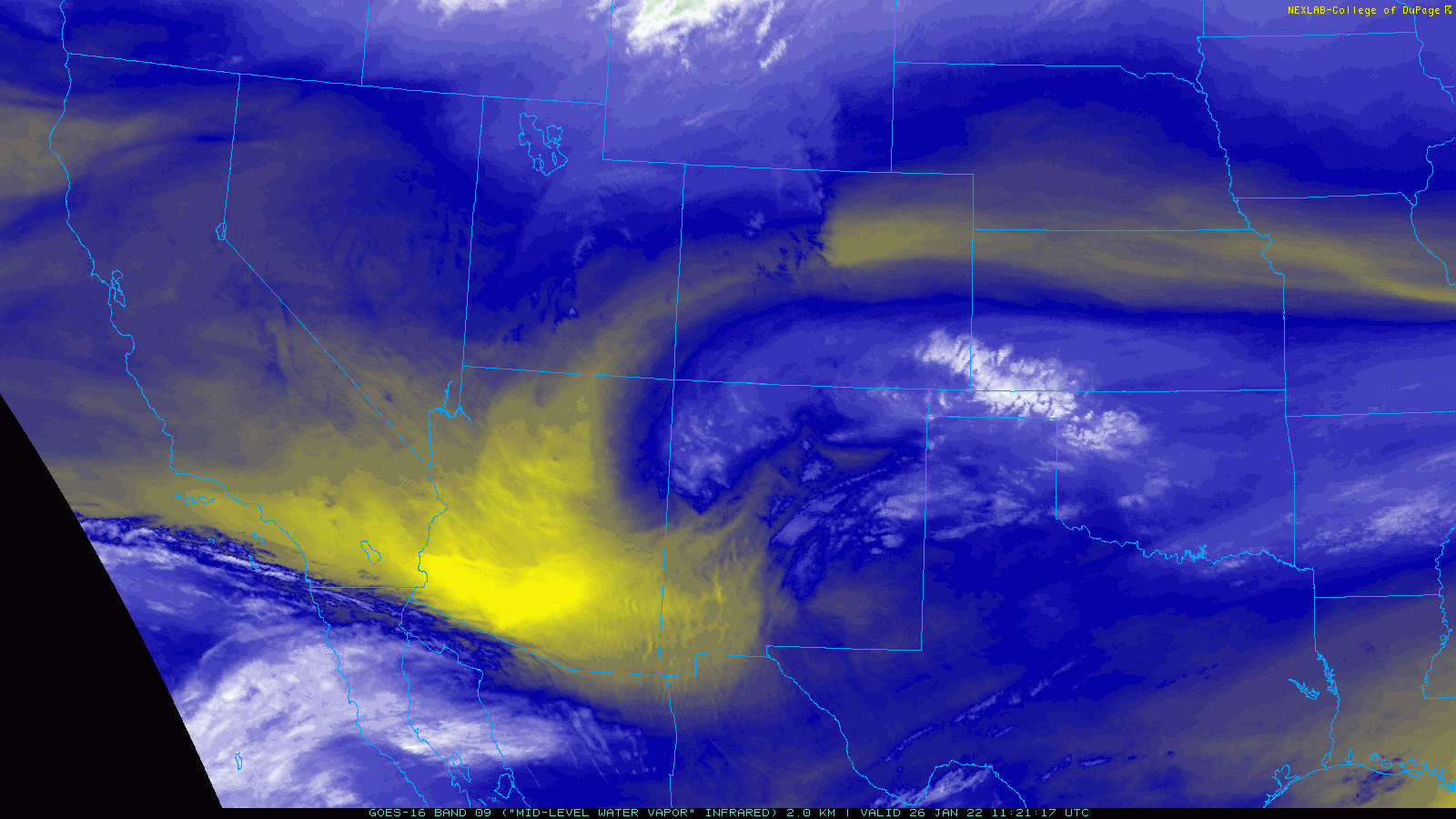
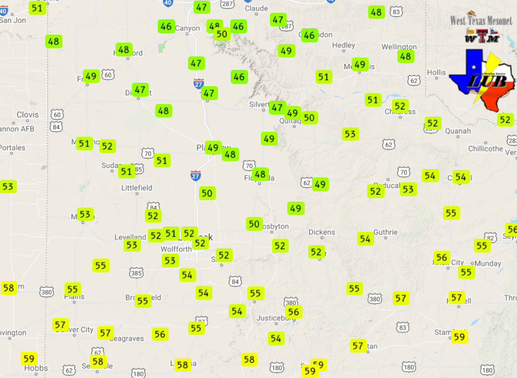
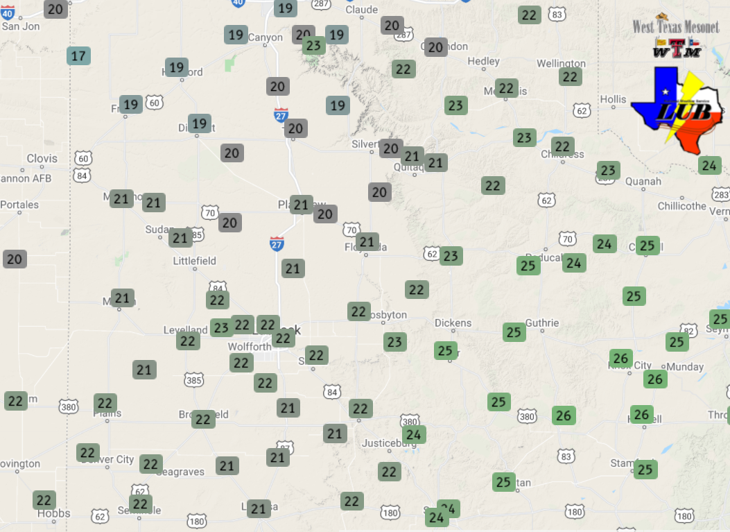
A strong cold front and compact upper level storm system joined forces to bring a brief bout of wintry weather in late January. The initial cold front moved through the region Tuesday evening (25 January), complete with gusty easterly winds and temperatures tumbling from the upper 40s and 50s into the lower to middle 20s by early the next morning.
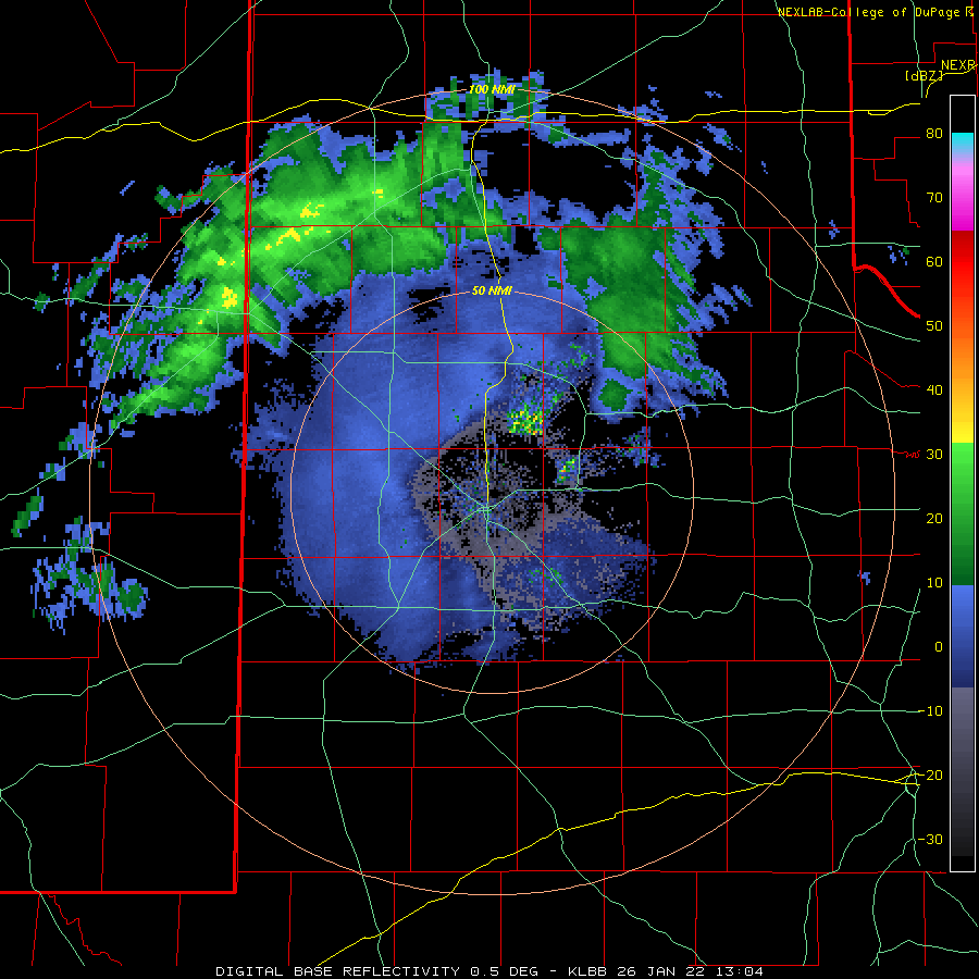
The freezing drizzle switched to snow in spots, as stronger lift from the approaching system spread over the region. One intense band of snow formed over the central South Plains, just north of Lubbock, and advanced northeastward across Floydada, Flomot, Memphis and Childress during the afternoon.
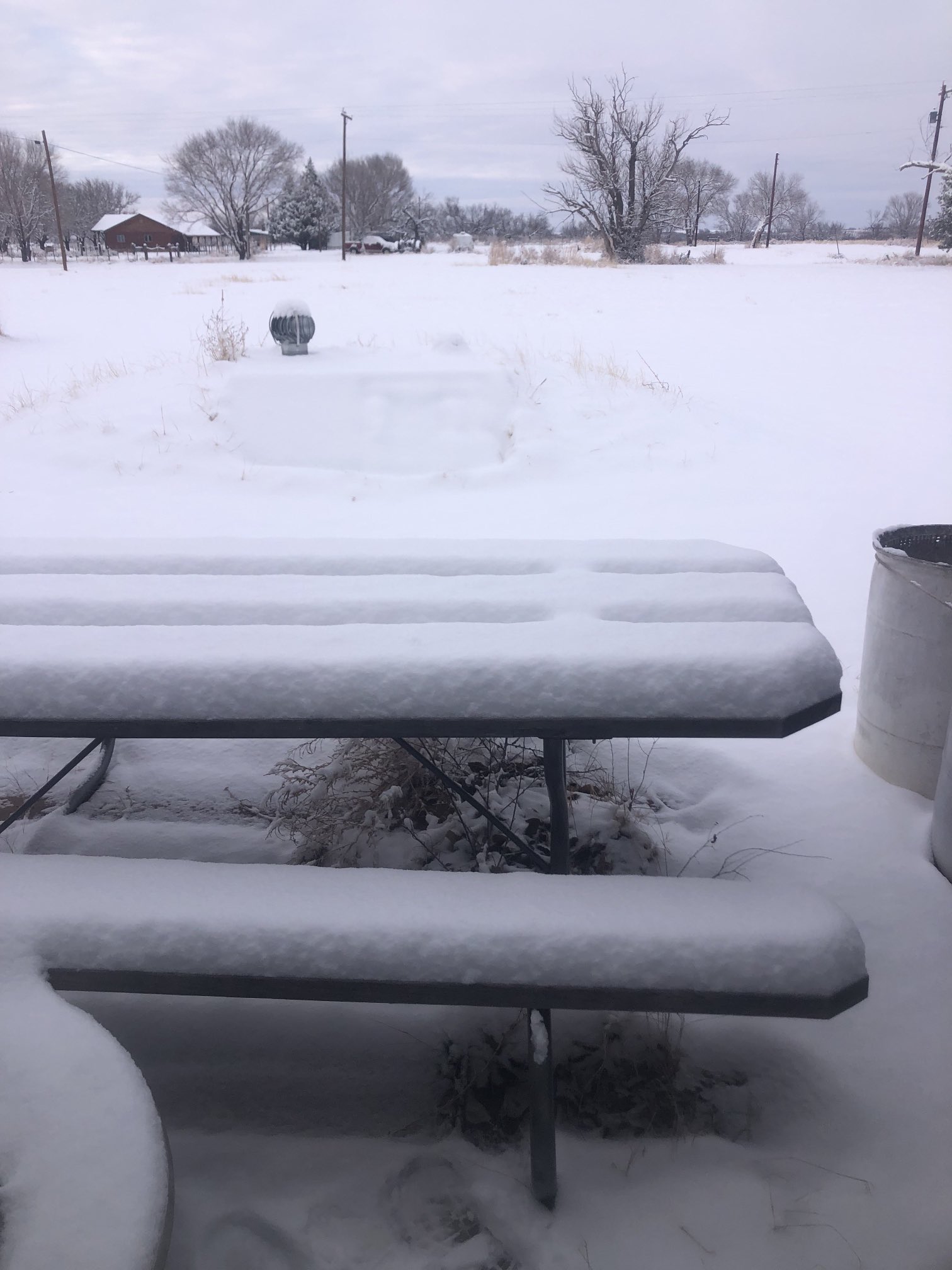
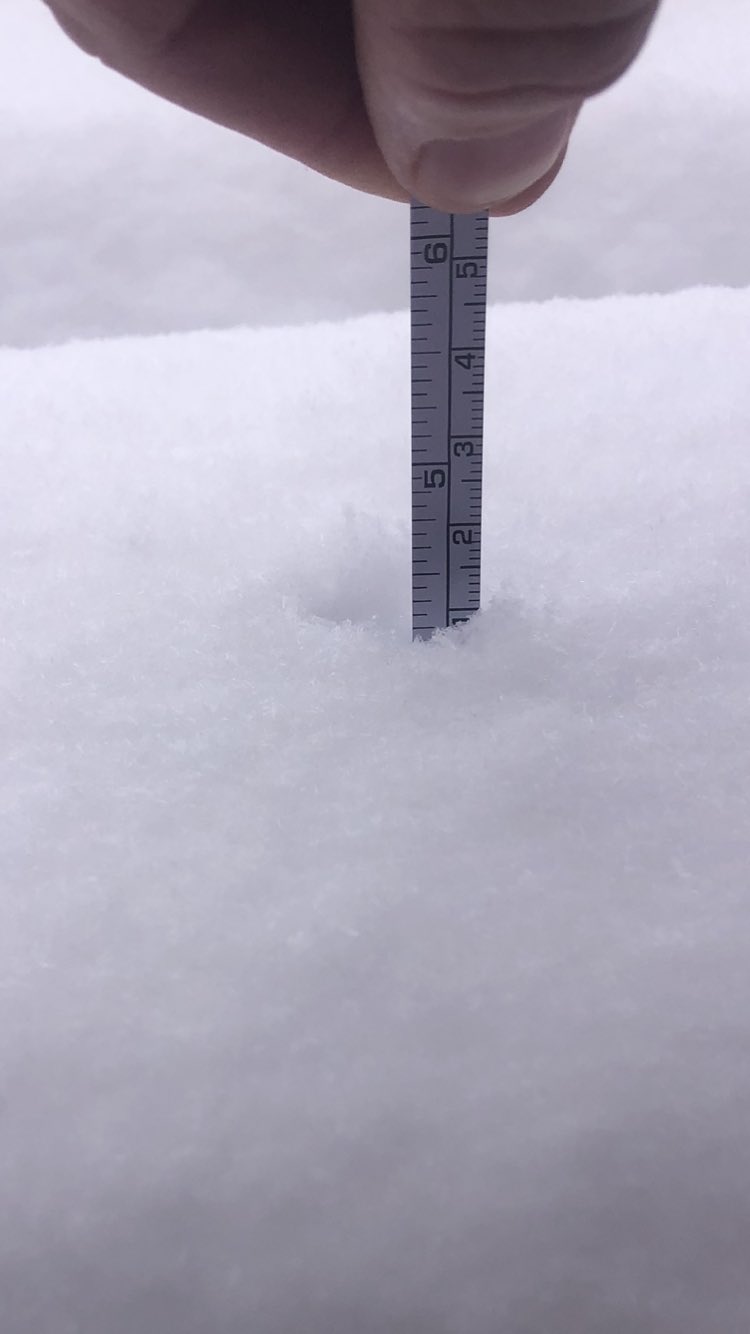
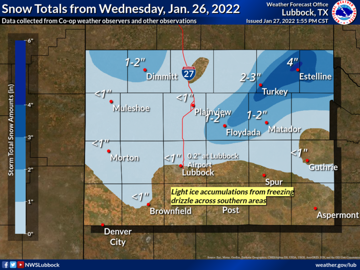
Where the snow band lingered longest, many locations recorded 1 to 3 inches of snow, while Estelline measured an impressive 4.3 inches. The snow quickly diminished from west-to-east through the late afternoon and early evening hours, finishing with another brief bout of freezing drizzle in spots.
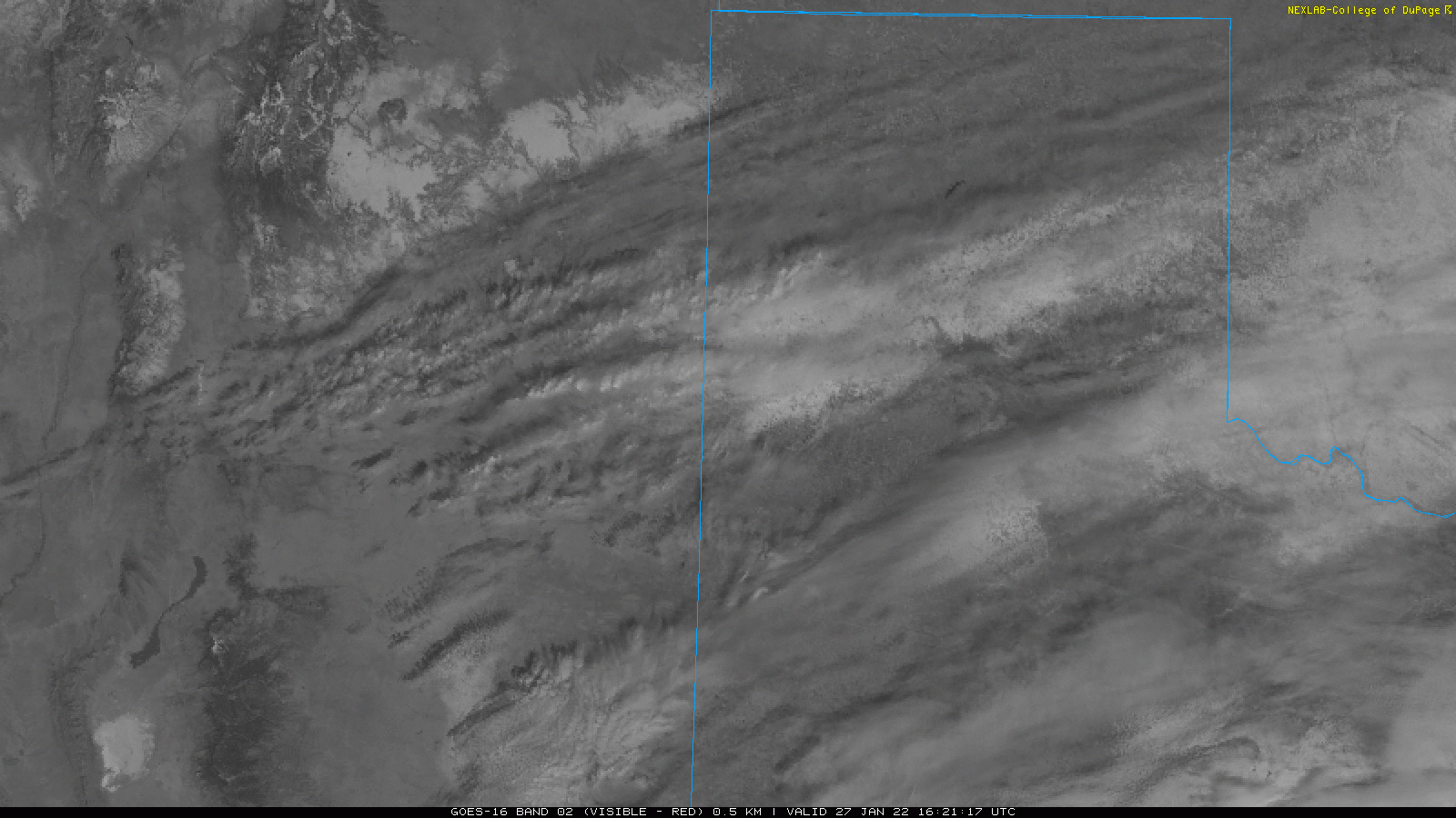
The snow was even visible from space the next day as skies cleared. As the sun came out and temperatures warmed, the snow melted nearly as fast as it came, becoming merely a memory by late Thursday afternoon in most spots.
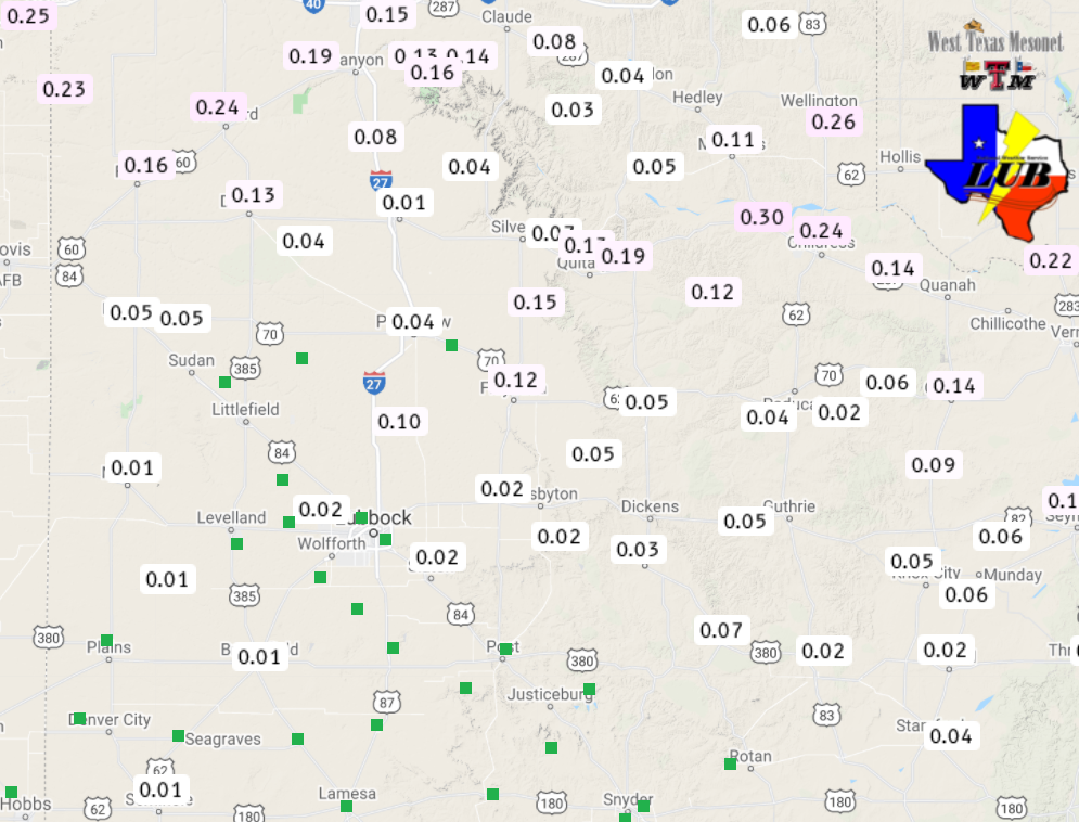
Officially, Lubbock recorded 0.2 inches of snowfall, along with light freezing drizzle and even sleet. Altogether, the snow and ice only melted down to 0.03 inches of liquid. However, where the heavier snow fell, anywhere from a tenth to three tenths of an inch of liquid were common
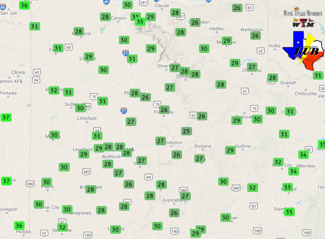
The preliminary storm reports collected over this cold and wintry day can be found below.