A damp end to 2021 and cold and wintry start to 2022
31 Dec 2021 - 1 Jan 2022
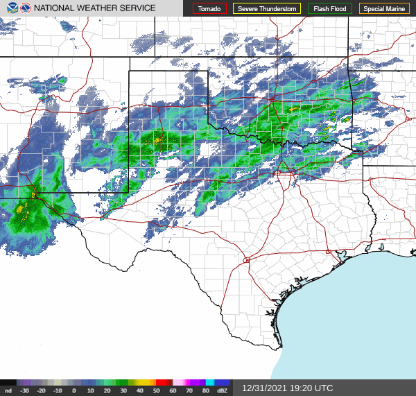
The end of 2021 and start of 2022 provided an unsettled stretch of weather for West Texas. The driver of the weather change was a broad storm system that approached the southern High Plains from the west. As it approached, it tapped a long fetch of subtropical moisture off of the eastern Pacific that streamed over the region. The result was plentiful cloud cover and widespread rain showers on Friday, December 31st. Temperatures were on the mild side, mostly in the 50s, and the rain totals were on the modest side, generally from several hundredths to a few tenths of an inch.
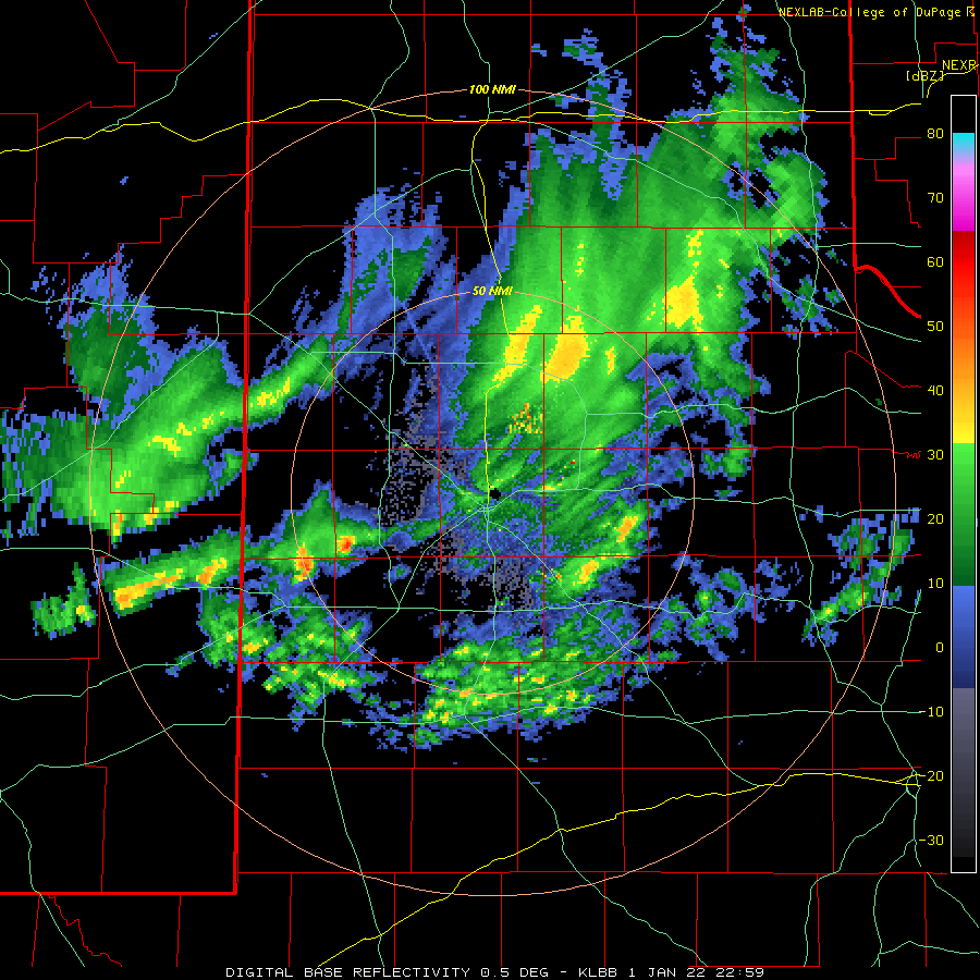
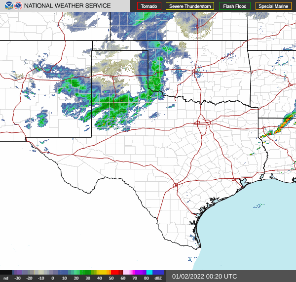
The cold air wasn't the only "gift" provided by the new year. A final upper level low move over New Year's Day evening (Saturday), inducing a quick bust of precipitation, in the form of a wintry mix that quickly transitioned to all snow.
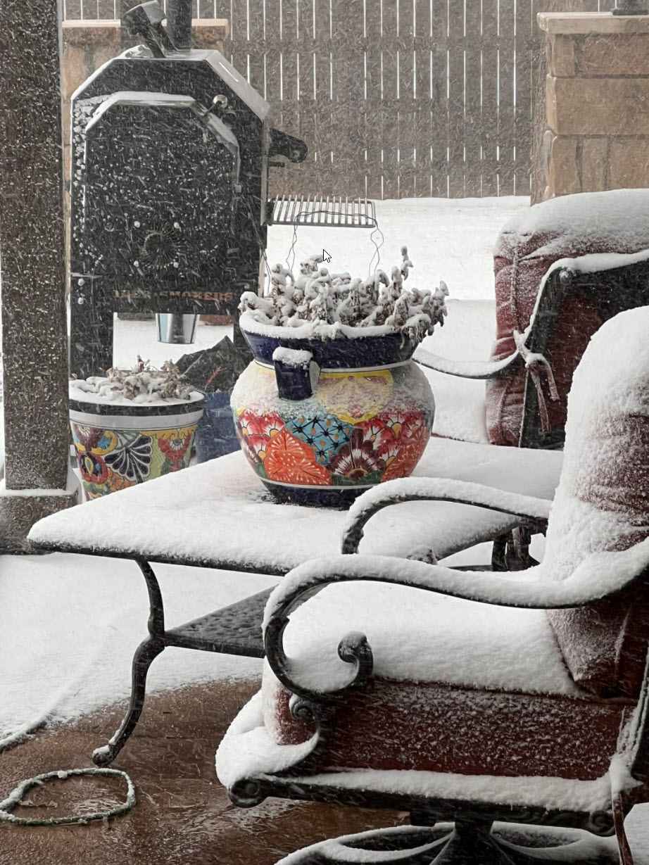
One well-defined band that developed and moved across the central South Plains, including Lubbock, during the evening, dropped a quick dusting to 2" of snow in many spots. Warm roads melted the initial snow in places, but as temperatures tumbled through the teens, roads quickly iced up and created hazardous travel conditions Saturday night into Sunday morning.
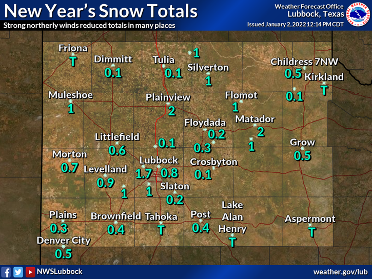
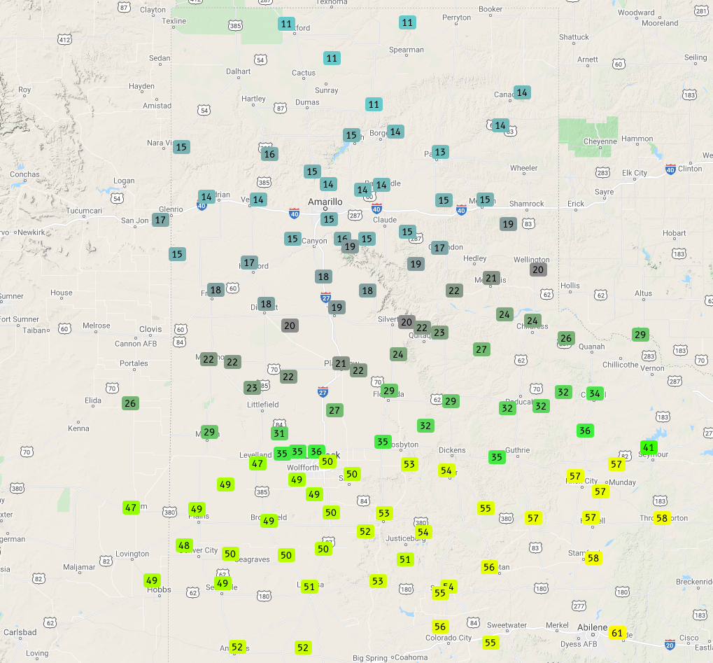
As the above map illustrates, snow totals were mostly on the light side, from a few tenths of an inch to an inch, with isolated totals around 2 inches. Regardless, the moisture on the frozen roadways made travel difficult and dangerous Saturday night into Sunday morning (January 1st & 2nd).
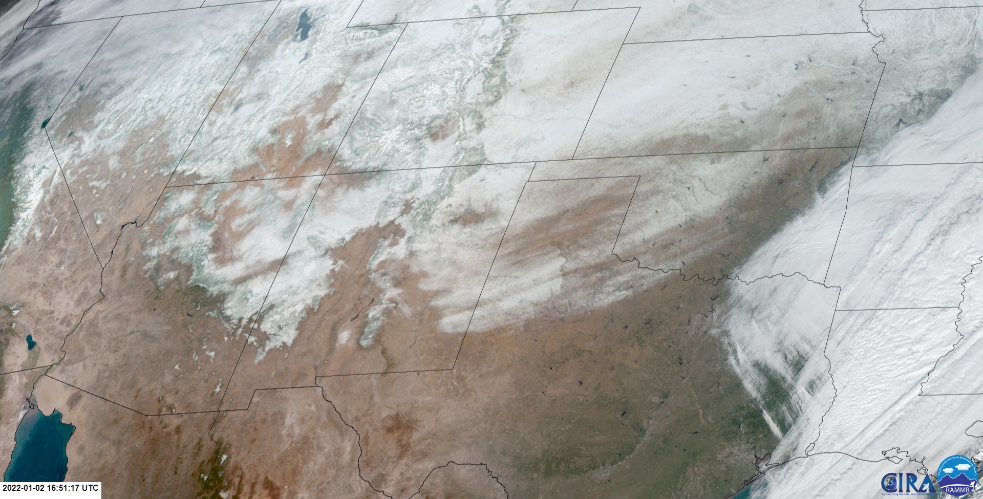 |
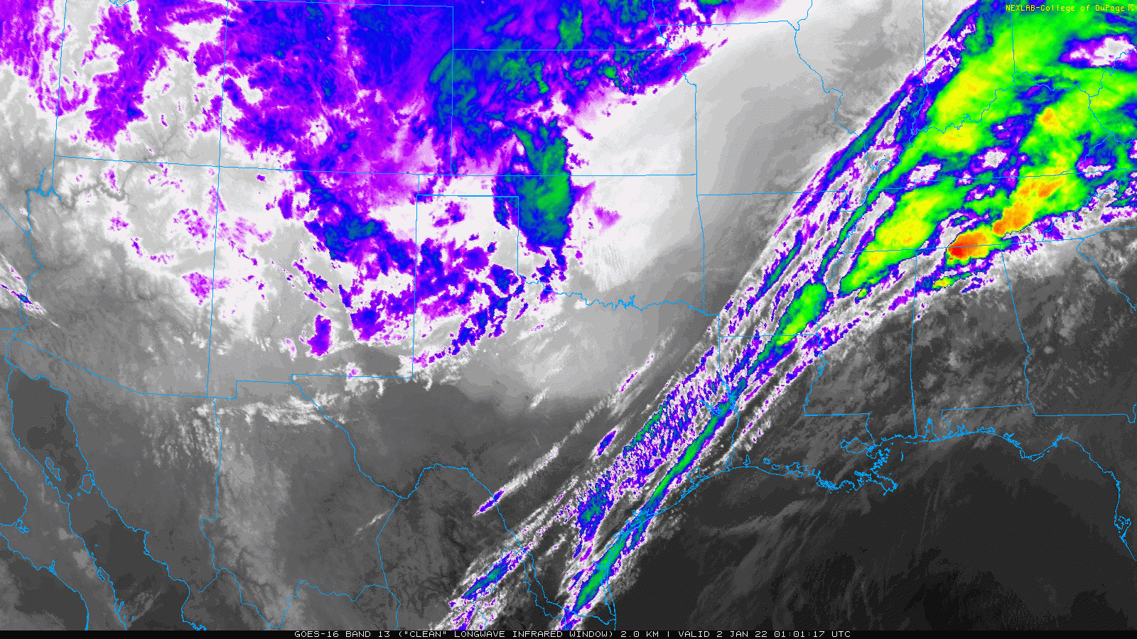
The snow could even be seen from space (above) the following day after skies cleared and the sun rose. The departing storm system left behind snow from much of the South and Rolling Plains, with even heavier snow totals measured in many locations further north and west of the region.
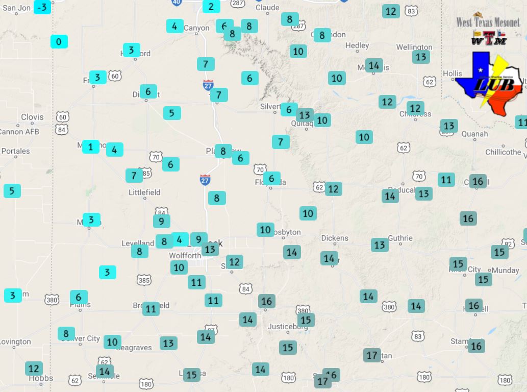
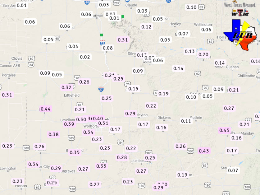
The rain and snow brought much-needed moisture to the region, though amounts were relatively light. When melted down, liquid equivalent totals from the rain and snow generally ranged from several hundredths to a couple tenths of an inch over the southern Texas Panhandle and most of the Rolling Plains to 0.20" to 0.45" across much of the South Plains. Officially, the Lubbock Airport recorded 0.40" of liquid over this stretch and 0.8" of snow.
The preliminary storm reports collected over this New Year's Day storm can be found below.
Snow Reports from NWS Lubbock on January 1st-2nd
PRELIMINARY LOCAL STORM REPORT...SUMMARY
NATIONAL WEATHER SERVICE LUBBOCK TX
328 PM CST SUN JAN 02 2022

..TIME...   ...EVENT...      ...CITY LOCATION...     ...LAT.LON...
..DATE...   ....MAG....      ..COUNTY LOCATION..ST.. ...SOURCE....
            ..REMARKS..

0340 PM     NON-TSTM WND GST 7 WNW DENVER CITY       32.99N 102.94W
01/01/2022  M64 MPH          YOAKUM             TX   MESONET

            WEST TEXAS MESONET

0357 PM     HEAVY SNOW       LITTLEFIELD             33.92N 102.33W
01/01/2022  M1.0 INCH        LAMB               TX   SOCIAL MEDIA

            A PICTURE SENT IN VIA TWITTER SHOWING 1 INCH OF SNOW
            MEASURED.

0600 PM     HEAVY SNOW       SHALLOWATER             33.69N 101.99W
01/01/2022  M1.0 INCH        LUBBOCK            TX   NWS EMPLOYEE

0600 PM     HEAVY SNOW       MULESHOE                34.23N 102.73W
01/01/2022  M1.0 INCH        BAILEY             TX   CO-OP OBSERVER

0916 PM     HEAVY SNOW       3 ESE LUBBOCK SOUTH PLA 33.51N 101.87W
01/01/2022  M2.9 INCH        LUBBOCK            TX   PUBLIC

            BROADCAST METEOROLOGIST SHARED PHOTO ON SOCIAL MEDIA OF
            SNOW DEPTH BEING MEASURED WITH TAPE MEASURE.

1000 PM     HEAVY SNOW       PLAINVIEW               34.19N 101.72W
01/01/2022  M2.0 INCH        HALE               TX   CO-OP OBSERVER

            PLAINVIEW WATER TREATMENT PLANT

1000 PM     HEAVY SNOW       VIGO PARK               34.65N 101.50W
01/01/2022  M1.0 INCH        SWISHER            TX   CO-OP OBSERVER

1120 PM     HEAVY SNOW       1 SW LUBBOCK            33.56N 101.88W
01/01/2022  M1.5 INCH        LUBBOCK            TX   NWS EMPLOYEE

1150 PM     HEAVY SNOW       4 SSW LUBBOCK           33.53N 101.88W
01/01/2022  M1.4 INCH        LUBBOCK            TX   NWS OFFICE

            FROM 6Z OB AT OFFICE

0100 AM     HEAVY SNOW       SILVERTON               34.47N 101.30W
01/02/2022  M1.0 INCH        BRISCOE            TX   CO-OP OBSERVER

            CITY HALL

0330 AM     HEAVY SNOW       1 NW MATADOR            34.03N 100.83W
01/02/2022  M2.0 INCH        MOTLEY             TX   CO-OP OBSERVER