 |
| Large hail that fell about 35 miles east of Post on Tuesday evening (26 October 2021). The picture is courtesy of Chad Casey. |
| |
|
The approach and passage of a vigorous upper level storm system supplied three days of strong winds for West Texas during late October 2021. Ahead of the storm system, strong southerly winds provided a warm/hot day, along with increasing moisture east of a dryline. Highs reached the upper 80s and lower 90s on the Caprock, with middle 90s in the Rolling Plains.
|
| |
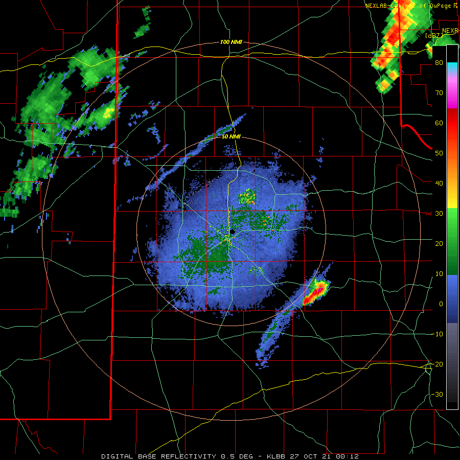 |
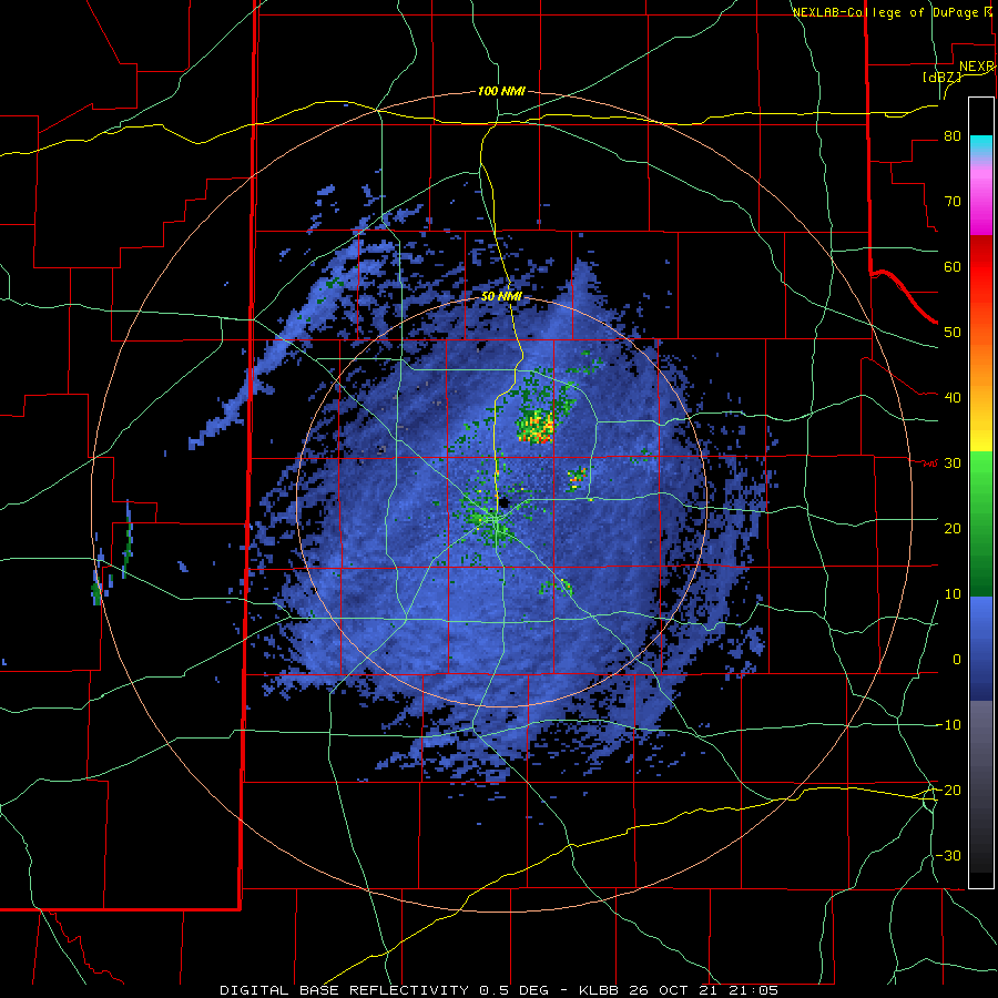
| Lubbock WSR-88D base reflectivity loop valid from 7:12 pm to 8:57 pm 26 October 2021. An additional radar animation, valid from 4:05 pm on the 26th to 6:40 am on the 27th, can be VIEWED HERE. |
| |
|
As lift from the approaching system increased, storms rapidly developed along the dryline Tuesday evening across the central and eastern Rolling Plains. Strong wind shear and decent instability caused several of these storms to become severe as they rapidly evolved into a line. Ping pong ball sized hail was reported in rural Kent County. Even more impressive, a wind gust of 96 mph was measured by the West Texas Mesonet near Hackberry as the storms moved through. Thankfully, minimal damage was reported in and around Hackberry.
|
| |
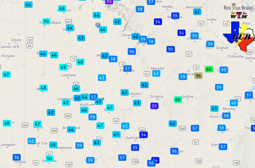 |
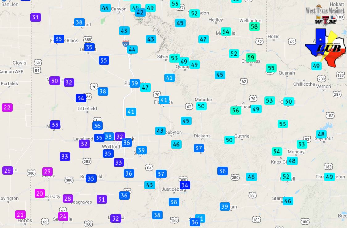
| Peak wind gusts recorded by the West Texas Mesonet on Tuesday, 26 October 2021. |
| |
| The above map shows the distribution of peak wind gusts on Tuesday. Aside from the 60+ mph gusts in the Rolling Plains, associated with the evening thunderstorm activity, the remainder of the strongest winds occurred under mostly sunny, though occasionally dusty skies, Tuesday afternoon. |
| |
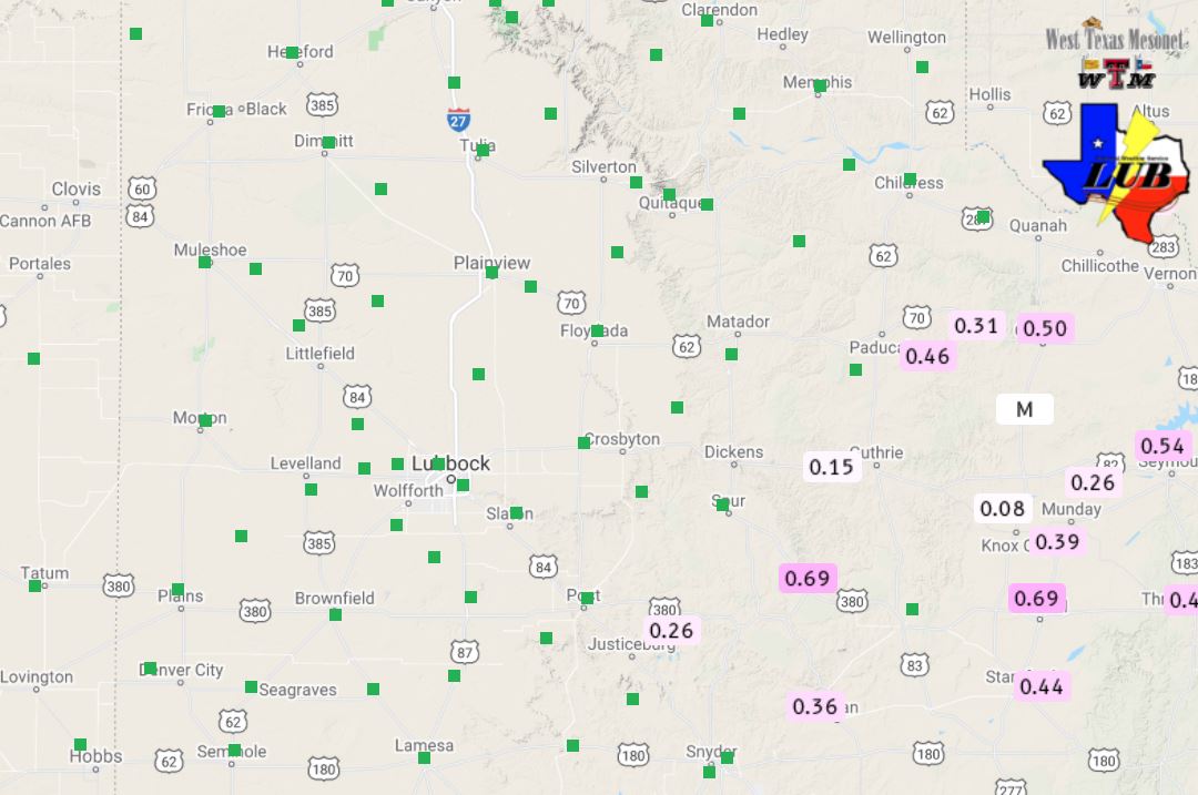 |
| 24-hour rainfall ending at 6 am on 27 October 2021. The data are courtesy of the West Texas Mesonet. |
| |
| In addition to the severe wind gusts, Tuesday evening's storms also brought rainfall to parts of the central and eastern Rolling Plains. Rain totals of a quarter to two-thirds of an inch were common where the storms tracked, while the South Plains and Rolling Plains remained dry. Further east, the squall line did bring rain to much of central and eastern Texas Tuesday night into Wednesday. |
| |
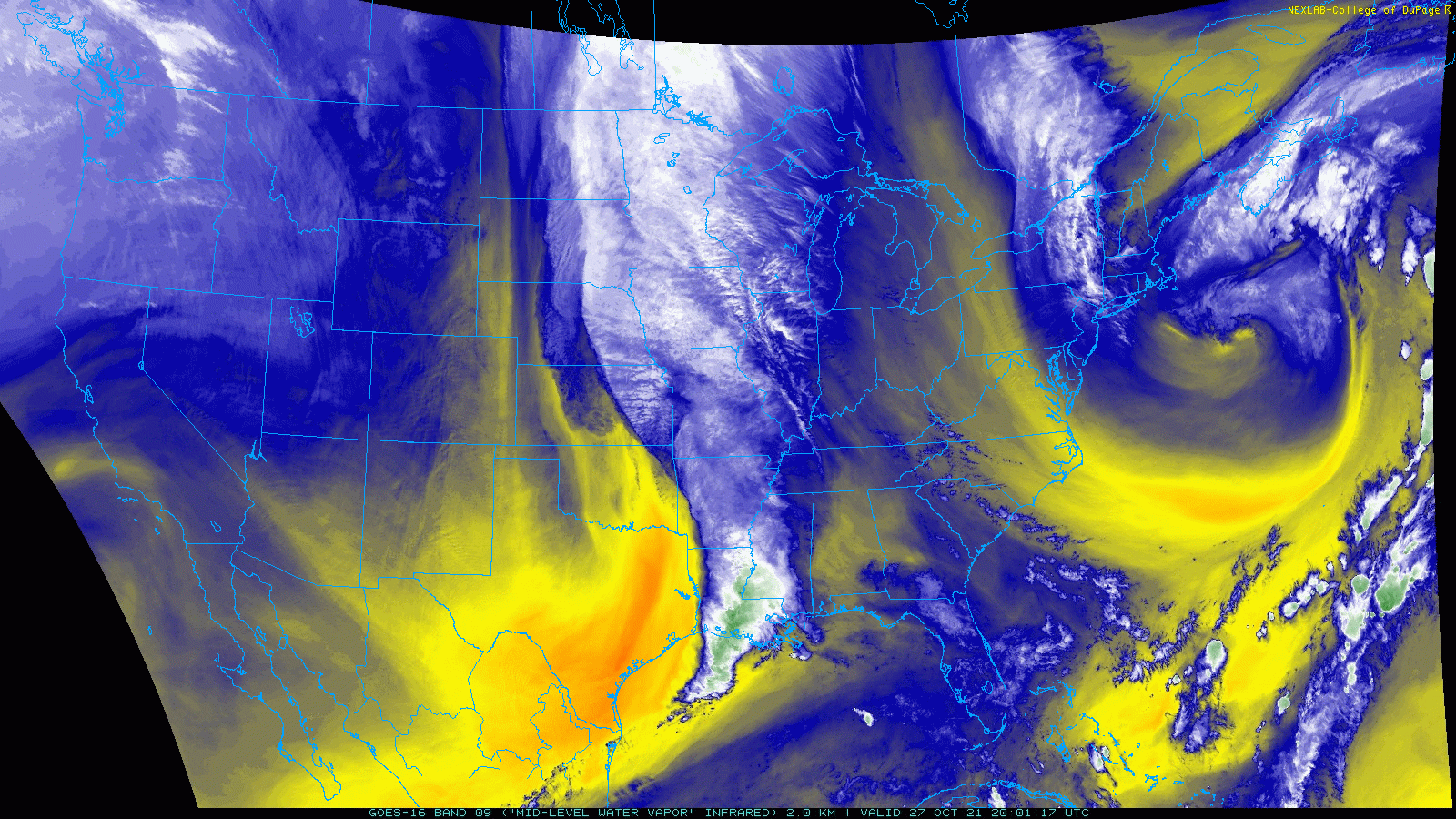 |
| Water vapor loop from 3:01 pm on the 27th to 8:01 pm on the 28th. |
| |
| The upper level storm system then shifted eastward (see the water vapor imagery above), allowing a cold front to slip through the region Tuesday night. In response, temperatures dropped 20-25 degrees the following day, when highs only reached the 60s and lower 70s. However, the main story was the wind on the back side of the slowly departing system. |
| |
|
|
| Peak wind gusts recorded by the West Texas Mesonet on Wednesday, 27 October 2021. |
| |
| Stout northwesterly winds, gusting over 50 mph, affected most of the South Plains region Wednesday, adding to the chill in the air. Several locations recorded peak gusts of 58 to 61 mph, primarily near and east of the edge of the Caprock. The wind did kick up pockets of blowing dust and caused localized damage, including to a tree and fence in Memphis (see below). |
| |
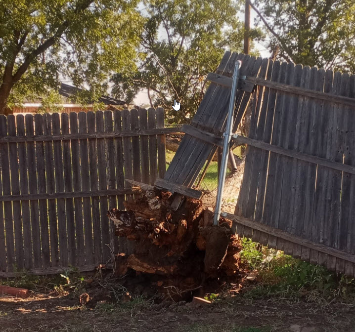 |
| Fence and tree damage in Memphis on Wednesday, 27 October. The picture is courtesy of @Roman715 on Twitter. |
| |
| The slow-moving storm system only made minor eastward progress on Thursday, which ensured another day of strong northerly winds for West Texas. The most intense winds, gusting in excess of 50 mph, affected the eastern Texas Panhandle into the northern Rolling Plains, closest to the slowly departing system. A peak gust of 64 mph was recorded by the ASOS located at the Childress Airport Wednesday afternoon. |
| |
 |
| Peak wind gusts recorded by the West Texas Mesonet on Thursday, 28 October 2021. |
| |
|
The preliminary storm reports collected over this windy late-October stretch can be found below.
|
