 |
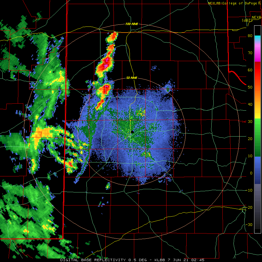
| Lubbock WSR-88D base reflectivity loop valid from 9:45 pm to 11:30 pm June 6th. |
| |
|
After a brief reprieve from the active weather, thunderstorms returned to West Texas Sunday evening (6 June). Scattered thunderstorms developed across the southwest Texas Panhandle and western South Plains during the evening as an outflow boundary moved out of eastern New Mexico. This activity moved eastward through the late evening and overnight hours, passing both north and south of Lubbock before congealing in the Rolling Plains.
|
| |
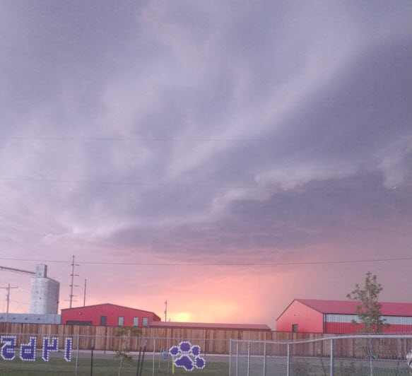 |
| Shelf cloud near Dimmit Sunday evening (6 June). The picture is courtesy of Russell Stringfield. |
| |
| The activity produced gusty winds, measured as high as 57 mph by the O'Donnell West Texas Mesonet (WTM) and 56 mph at the Rolling Springs WTM. The bigger impact was the widespread rain, especially in parts of the Rolling Plains. The heaviest rain, in places in excess of an inch, fell in a swath from southeast Motley County into King and northern Stonewall Counties. |
| |
 |
| Lubbock WSR-88D base reflectivity loop valid from 6:36 pm on June 7th to 6:28 am on June 8th. |
| |
| The next evening and night provided another round of thunderstorms. This activity also initially took off across the southwest Texas Panhandle and then developed east and southeastward through the late evening and overnight hours. One storm early on generated a 69 mph wind gust as it tracked over the Dimmitt WTM site Monday evening (7 June). |
| |
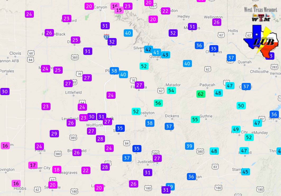 |
| Peak wind gusts measured by the West Texas Mesonet during the earlier morning hours of the 8 June 2021. |
| |
| Additional strong wind gusts occurred late Monday night into early Tuesday morning as the squall line moved through the Rolling Plains. The strongest wind gust, 62 mph, was measured by the Paducah WTM around 5 AM as a heat burst occurred under a decaying rain shower. The heat burst caused the temperature to rise from the middle 70s to the middle 90s in the predawn hours of Tuesday, 8 June. |
| |
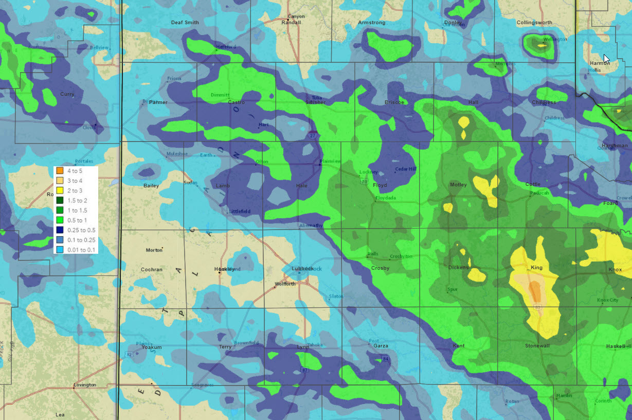 |
| 5-day radar-estimated and bias-corrected rain totals ending at 7 am on 9 June 2021. The rain measured by the West Texas Mesonet over this same stretch can be VIEWED HERE. |
| |
|
The two rounds of evening and overnight thunderstorms brought widespread rainfall to much of the southern Texas Panhandle, northeast South Plains and Rolling Plains, while coverage was spotty over the central and southern South Plains. Rain totals of 1/2" to 1"+ were common where the two rounds of late-night storms tracked, with pockets near and above 2" in parts of the Rolling Plains.
The preliminary storm reports collected on these two active nights be viewed below.
|