June starts on a thundery note (1-2 June 2021) 1-2 June 2021
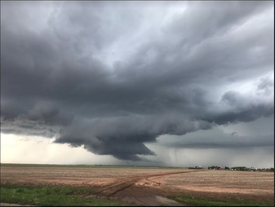
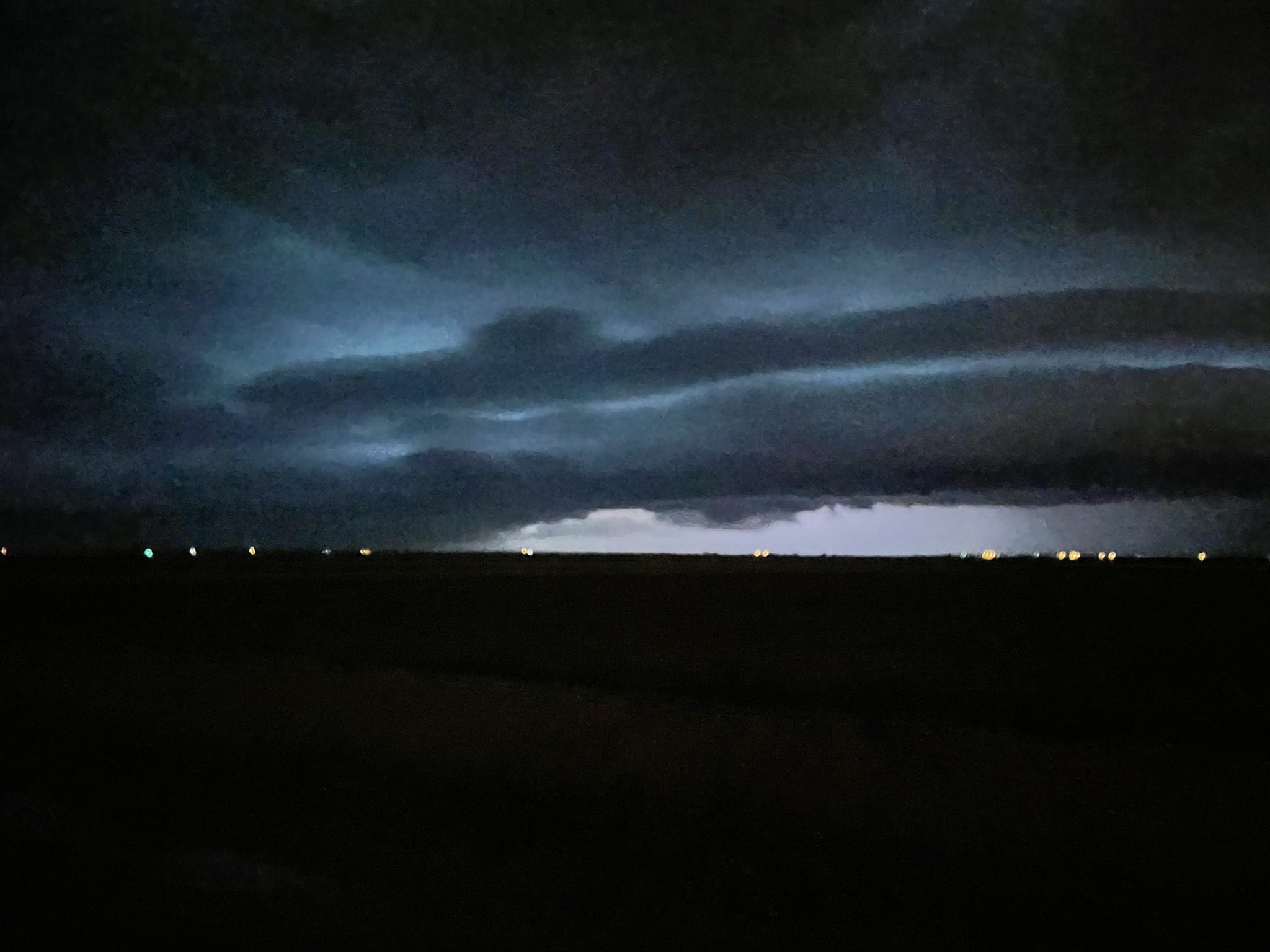
Tier wall cloud photographed by Bruce Haynie west of Hale Center Tuesday evening (1 June 2021).
June 2021 began just as May ended, on the stormy and wet side. Tuesday, June 1st, brought late morning and early afternoon sunshine which provided enough warming, when combined with residual low-level moisture, to spur the development of isolated late afternoon and evening thunderstorms.
There was sufficient wind shear to cause a few of the thunderstorms to gain organization and rotate broadly. Although the storms were not very large, the most intense cores did generate small hail, gusty winds and brief torrential rains as they advanced southeastward through the evening hours.
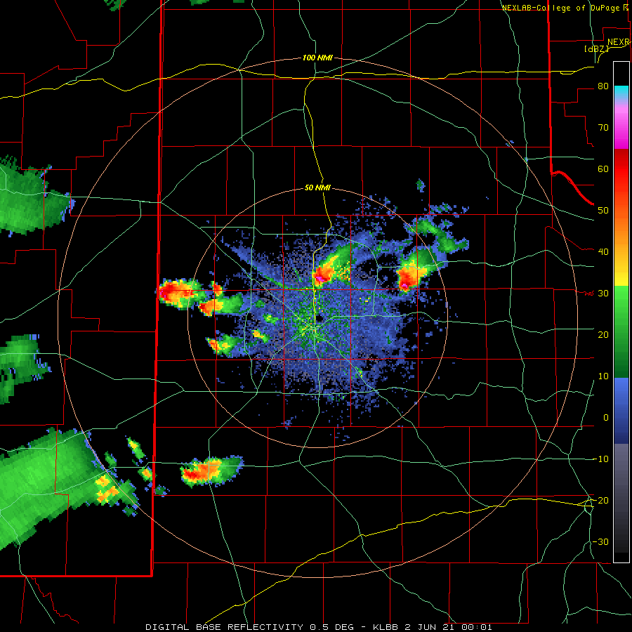
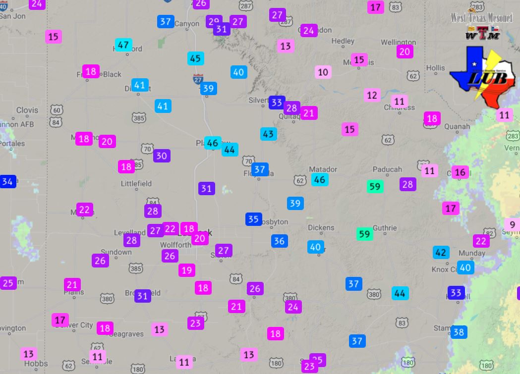
Peak wind gusts measured by the West Texas Mesonet during the earlier morning hours of the 2 June 2021.
The evening activity gradually shifted southward and diminished, but the lull didn't last long. A much broader complex of thunderstorms, originating in Colorado, plunged southeastward across the region late Tuesday night into Wednesday morning. The bulk of the overnight storms were focused north and east of the Highway 84 Corridor, where they provided strong to severe wind gusts and brief heavy rainfall. Peak wind gusts of 40 to 50 mph were common, while the Paducah and Guthrie West Texas Mesonet sites measured top gusts of 59 mph.
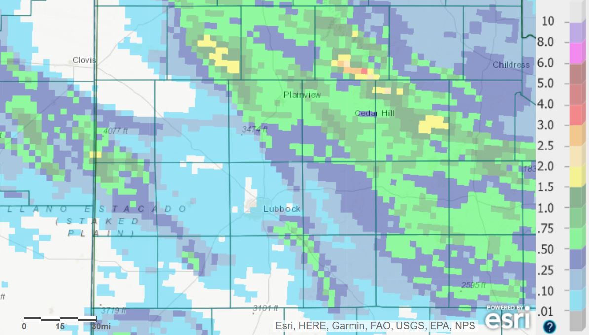
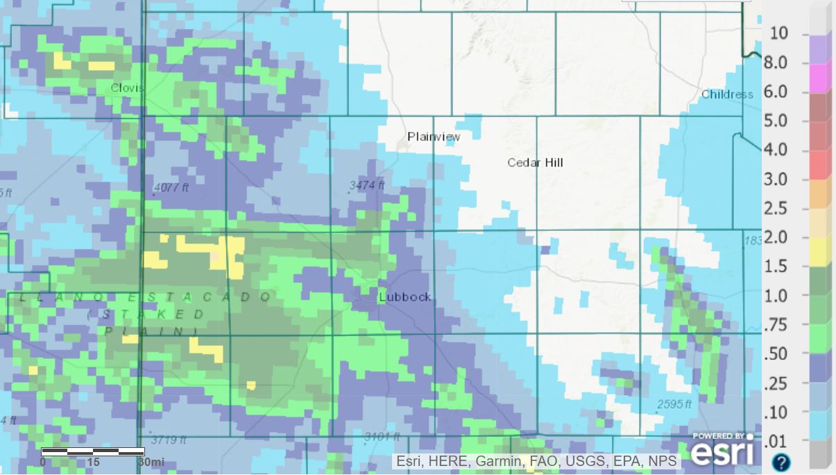
24-hour radar-estimated and bias-corrected rainfall ending at 7 am on Wednesday (2 June 2021).
A swath of a half inch to an inch plus of rain fell over much of the south-central Texas Panhandle into the northeast South Plains and central and southeastern Rolling Plains with this overnight activity.
Squall line and associated shelf cloud approaching Lubbock late Wednesday evening. The image is courtesy of Sam Trujillo.
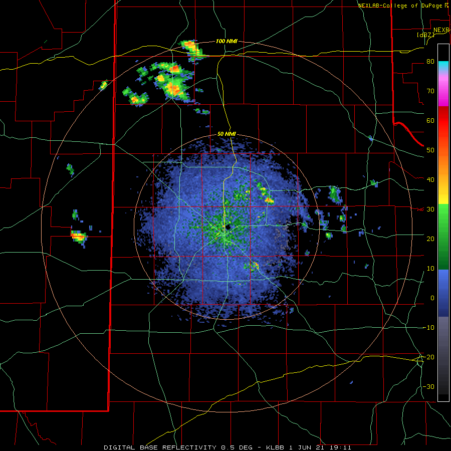
Wednesday afternoon provided a couple of isolated storms in the Rolling Plains, though the bulk of the thunderstorms occurred further south, into the Permian Basin, as well as over the higher terrain of New Mexico.
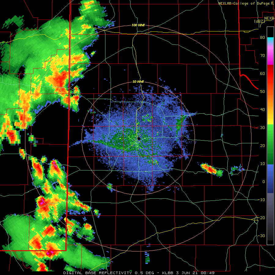
Lubbock WSR-88D base reflectivity loop valid from 7:49 pm to 11:07 pm on Wednesday (2 June 2021). An additional radar animation, valid from 7:22 pm on the 2nd to 8:05 am on the 3rd, can be VIEWED HERE.
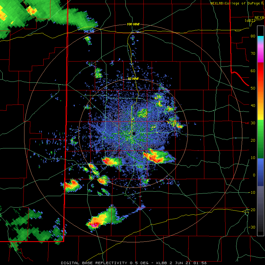
The storms in New Mexico managed to organize into a complex, which rolled east and southeastward into West Texas late Wednesday evening, and persisted in early Thursday morning. This time the majority of the rain was focused along and south of the Highway 84 Corridor. Rain totals of a half inch to over an inch were common with this second late-night activity in as many days.
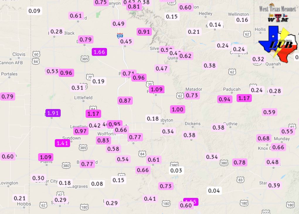
48-hour rain totals measured by the West Texas Mesonet, through 11 on 3 June 2021. The 24-hour radar-estimated and bias-corrected rainfall ending at 7 am on the 3rd can be VIEWED HERE.
In total, the first couple days of June provide more widespread rainfall for the South Plains region. Most locations recorded 1/4 to 1/2 inch of rain, with several spots getting an inch or more. Officially, the Lubbock Airport recorded exactly 1 inch of rain, boosting the yearly total to 10.61 inches (or 4 inches above average through June 2nd).
The preliminary storm reports collected on first couple of days of June can be found below.
Storm Reports late June 1st into early the 2nd
PRELIMINARY LOCAL STORM REPORT
NATIONAL WEATHER SERVICE LUBBOCK TX
1035 PM CDT WED JUN 02 2021

..TIME...   ...EVENT...      ...CITY LOCATION...     ...LAT.LON...
..DATE...   ....MAG....      ..COUNTY LOCATION..ST.. ...SOURCE....
            ..REMARKS..

0723 PM     HAIL             MCADOO                  33.73N 101.01W
06/01/2021  M0.88 INCH       DICKENS            TX   LAW ENFORCEMENT

0534 AM     TSTM WND GST     10 WSW GUTHRIE          33.57N 100.48W
06/02/2021  M59 MPH          KING               TX   MESONET

            WEST TEXAS MESONET REPORT

0542 AM     TSTM WND GST     10 SW PADUCAH           33.89N 100.40W
06/02/2021  M59 MPH          COTTLE             TX   MESONET

            WEST TEXAS MESONET REPORT