Severe wind gusts and spotty rainfall
7 May 2021
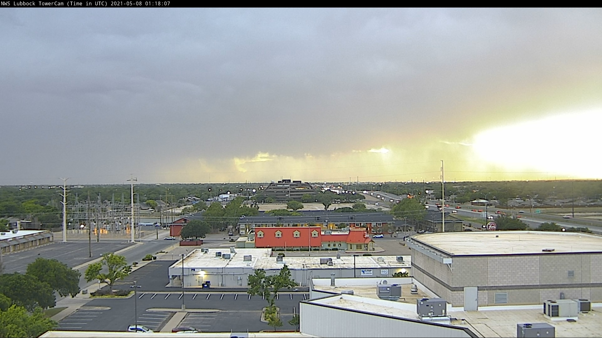
A weak mid-level disturbance, improved moisture aloft and strong heating caused scattered high-based showers and thunderstorms to develop Friday afternoon. As temperatures soared into the lower 90s, thunderstorms initially developed over the higher terrain of eastern New Mexico, while additional activity formed further east, across the western Texas Panhandle.
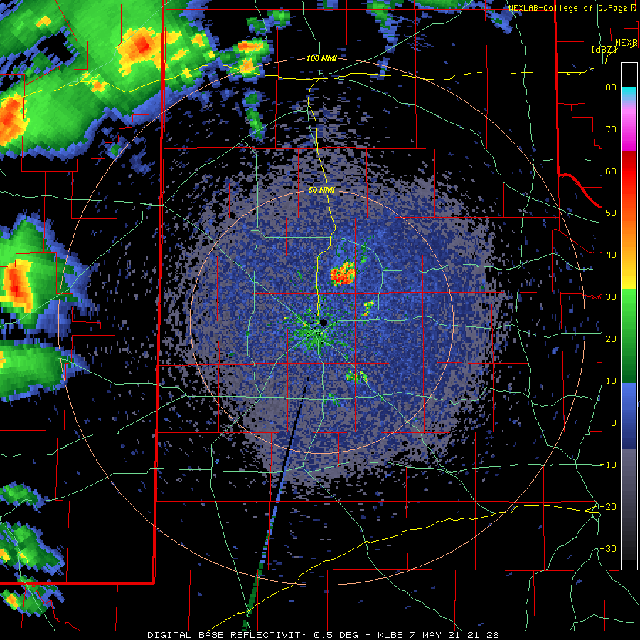
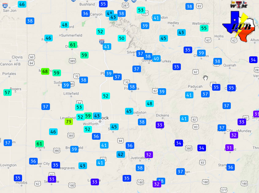
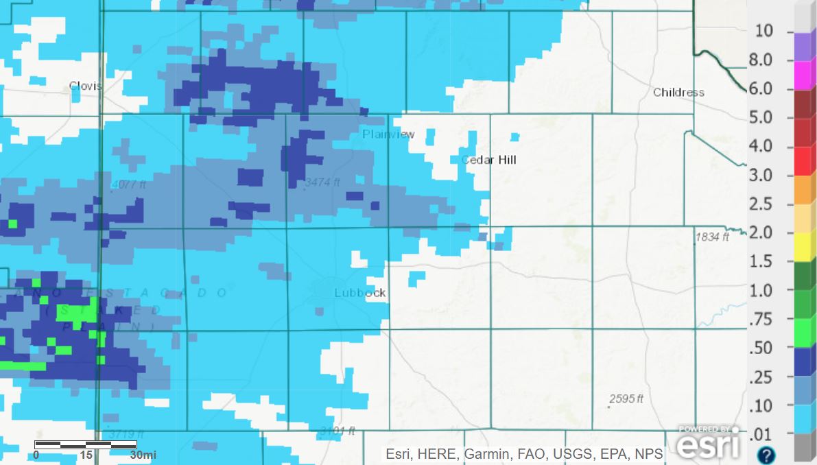
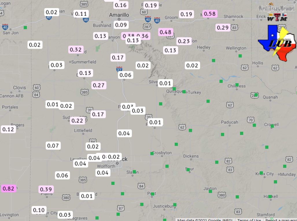
A final band of showers and thunderstorms spread across the western and central South Plains late Friday evening. By this time, low levels had cooled modestly and more of the light rain made it to the ground. Although rain totals were relatively light, much of the southwest Texas Panhandle and western and central South Plains did receive a little rain. The biggest rainfall winner in the region was around Tatum, where the West Texas Mesonet site recorded 0.82 inches.
The preliminary storm reports collected on May 7th can be found below.
Preliminary Storm Reports from May 7th
PRELIMINARY LOCAL STORM REPORT...SUMMARY
NATIONAL WEATHER SERVICE LUBBOCK TX
813 AM CDT SAT MAY 08 2021

..TIME...   ...EVENT...      ...CITY LOCATION...     ...LAT.LON...
..DATE...   ....MAG....      ..COUNTY LOCATION..ST.. ...SOURCE....
            ..REMARKS..

0630 PM     TSTM WND GST     2 NE DIMMITT            34.57N 102.29W
05/07/2021  M61 MPH          CASTRO             TX   MESONET

0630 PM     TSTM WND GST     3 N HART                34.42N 102.11W
05/07/2021  M59 MPH          CASTRO             TX   MESONET

0635 PM     TSTM WND GST     2 SSW MULESHOE          34.21N 102.74W
05/07/2021  M68 MPH          BAILEY             TX   MESONET

0651 PM     TSTM WND GST     9 WSW EARTH             34.19N 102.56W
05/07/2021  M59 MPH          LAMB               TX   MESONET

0738 PM     HAIL             HALFWAY                 34.19N 101.95W
05/07/2021  E1.00 INCH       HALE               TX   PUBLIC

            TIME ESTIMATED FROM RADAR

0740 PM     TSTM WND GST     3 N PLAINS              33.23N 102.84W
05/07/2021  M61 MPH          YOAKUM             TX   MESONET

0754 PM     TSTM WND DMG     1 S EUNICE              34.46N 101.77W
05/07/2021                   SWISHER            TX   BROADCAST MEDIA

            DOWNED UTILITY LINE

0800 PM     TSTM WND GST     4 S LEVELLAND           33.53N 102.36W
05/07/2021  M73 MPH          HOCKLEY            TX   MESONET

0858 PM     NON-TSTM WND GST REESE CENTER            33.61N 102.05W
05/07/2021  M59 MPH          LUBBOCK            TX   MESONET

0907 PM     NON-TSTM WND GST 6 NNE LUBBOCK           33.67N 101.82W
05/07/2021  M58 MPH          LUBBOCK            TX   ASOS