|
Two days with tornadic thunderstorms, then a day with wind
12-14 March 2021
|
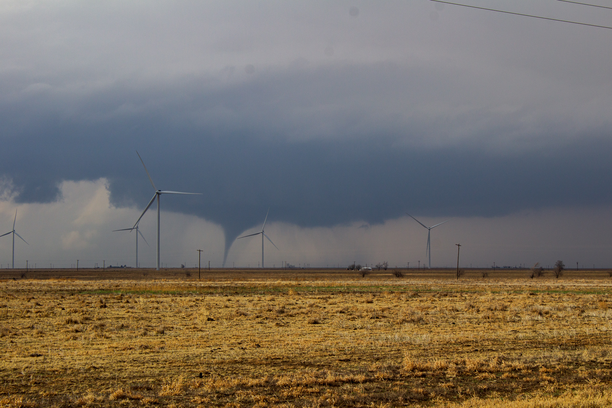 |
| Tornadic thunderstorm east of Hale Center Saturday afternoon (13 March). The picture is courtesy of Isaac Arseneau. |
| |
|
A powerful and slow-moving mid-upper level storm system provided three days of impactful weather to the southern High Plains. In advance of the system, Gulf moisture helped fuel several rounds of severe thunderstorms, including tornadic thunderstorms Friday evening (12 March) and again Saturday afternoon and evening (13 March). The active March weekend concluded with gusty and drier westerly winds as the storm system emerged to the north of the region on the 14th.
|
| |
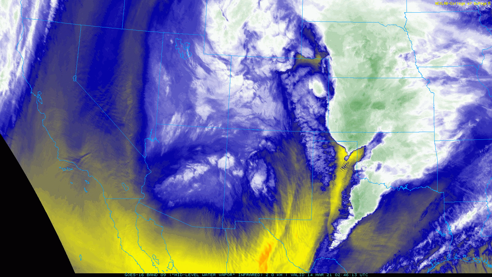 |
| GOES-16 mid-level water vapor loop captured Saturday evening (13 March 2021). |
| |
| The first round of thunderstorms developed late Friday afternoon and continued late into night. The most intense storm of the day formed over northeast Hockley County, then underwent several cell mergers while tracking east-northeast through the evening hours. |
| |
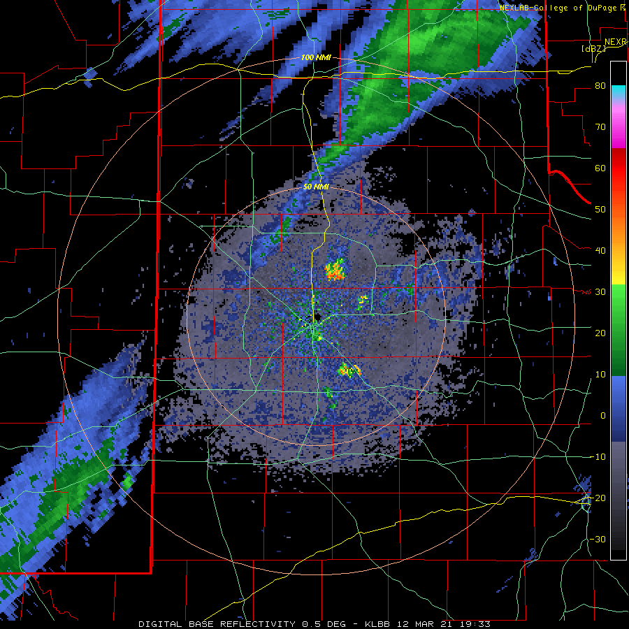 |
| Lubbock WSR-88D radar animation valid from 2:33 pm to 10:28 pm on 12 March 2021. |
| |
|
The severe storm dropped hail as large as tennis balls near Petersburg, and produced at least three relatively short-lived tornadoes as it propagated from the central South Plains through the central Rolling Plains. Tornadoes were sighted northwest Shallowater, north of Ralls and southwest of Paducah.
|
| |
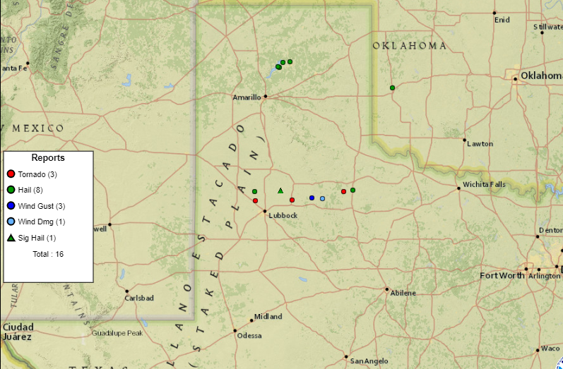 |
| Plot of the preliminary storm reports for Friday (12 March). |
| |
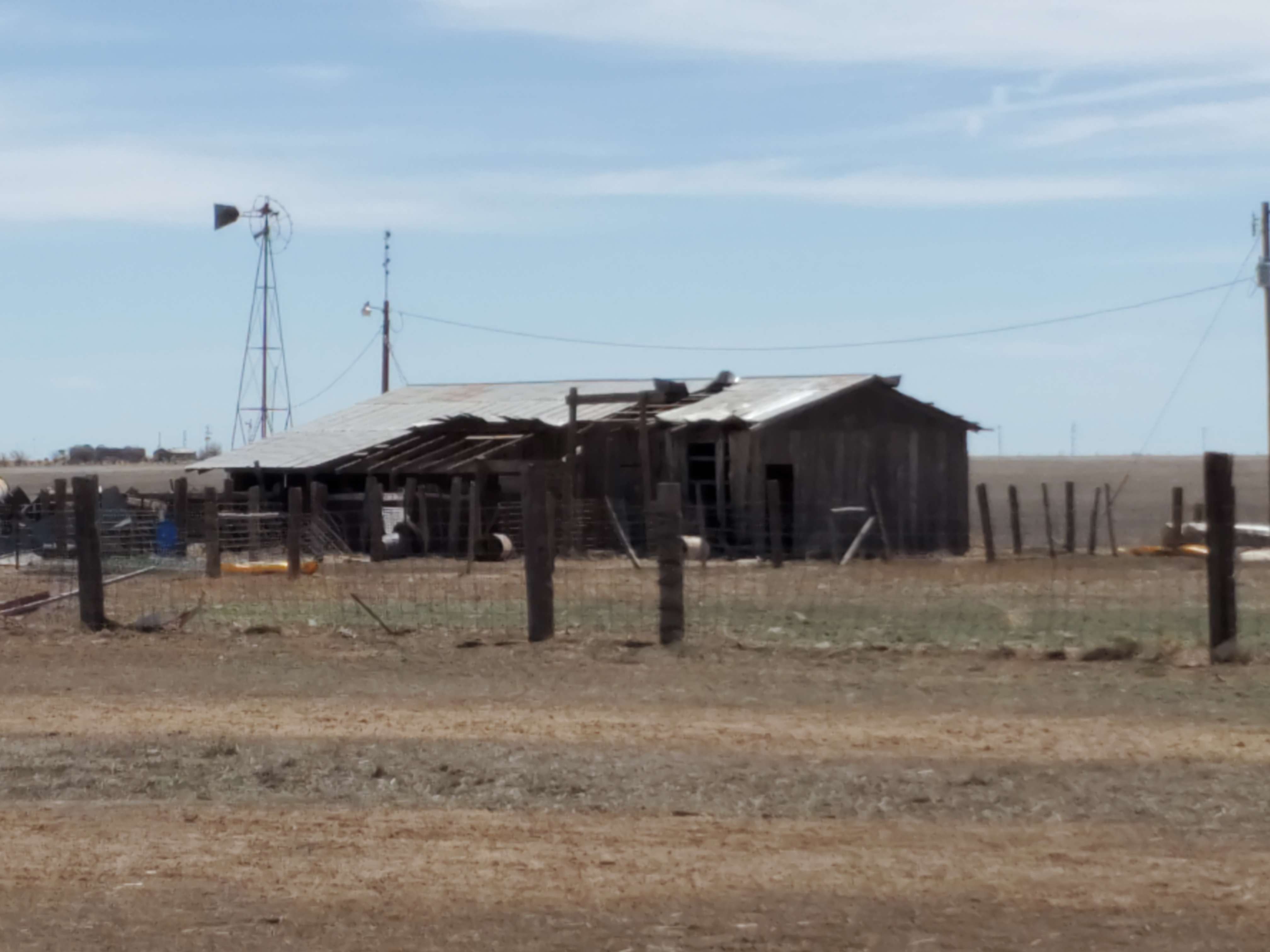
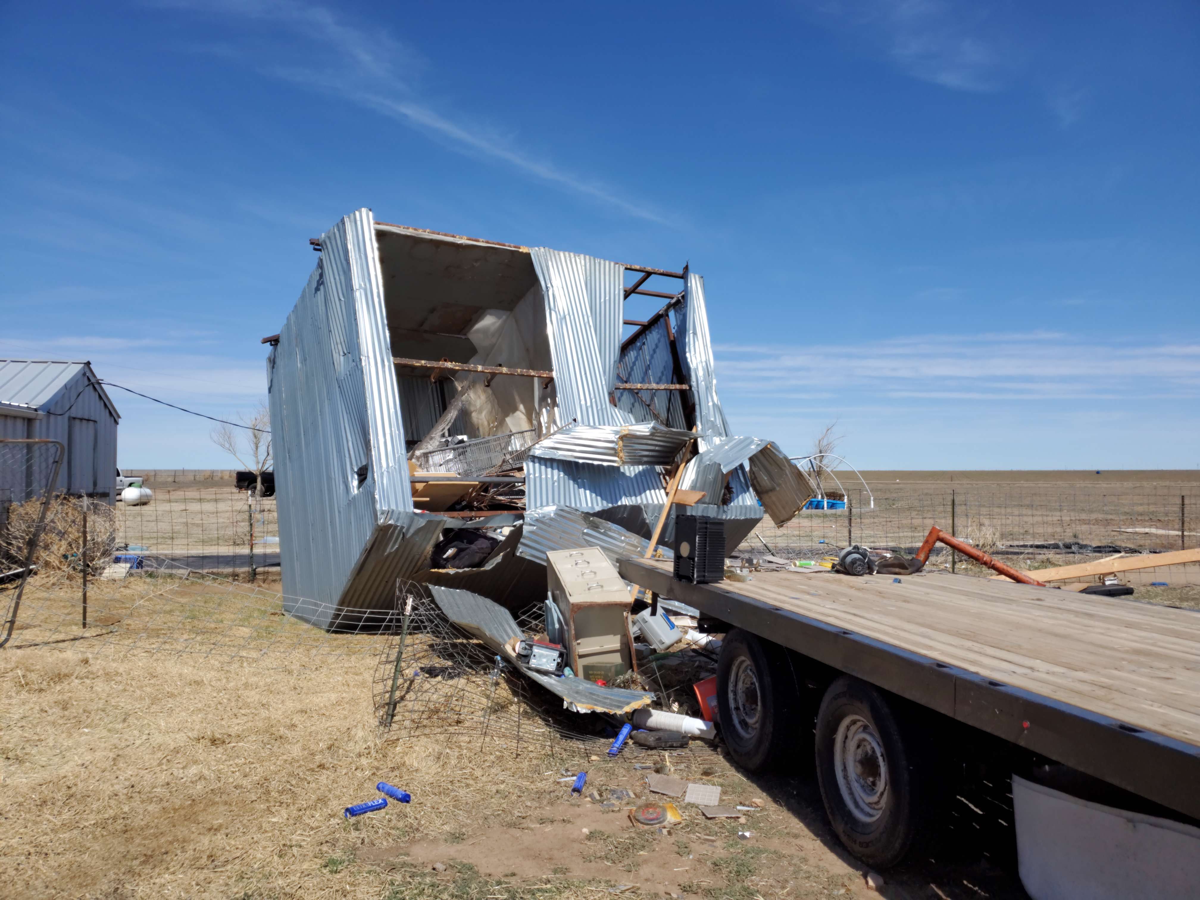
| As illustrated below, the tornado that touched down northwest of Shallowater inflicted damage to powerlines and flipped a trailer. |
| |
 |
 |
| Tornado damage incurred northwest of Shallowater on March 12th. The pictures are courtesy of Larry Rodriques. |
| |
|
After a lull in activity early Saturday, scattered thunderstorms developed across the southwest Texas Panhandle and western South Plains during the afternoon. Several of these storms quickly began to rotate, became severe, then tornadic, across the south-central Texas Panhandle. The Lubbock NWS received its first two reports of a tornado near Nazareth around 3 pm.
|
| |
 |
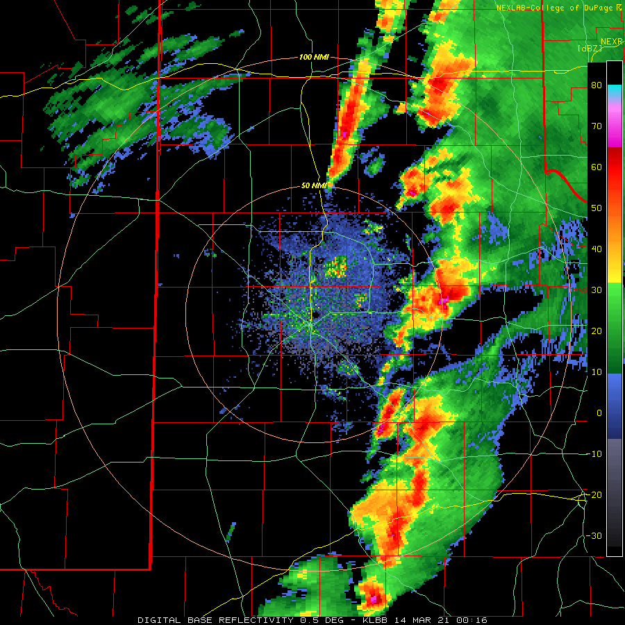
| Radar loop with warnings overlaid for Saturday (13 March 2021). The imagery is courtesy of the Iowa Environmental Mesonet. Additional radar imagery, valid for the Lubbock WSR-88D from 7:16 pm to 9:59 pm on the 13th can be VIEWED HERE. |
| |
|
Shortly thereafter, a confirmed tornado touched down west-southwest of the town of Happy. This tornado went on to become the largest and longest duration tornado of the day and obtained a maximum damage rating of EF-1 while in Lubbock`s service area. It had a long path that extended well into the Texas Panhandle, where it caused EF-2 damage, as determined by a survey conducted by the NWS Forecast Office in Amarillo, Texas. The tornado began on ranch land and damaged mainly power poles and a few structures as it moved northeast through northwestern Swisher County.
|
|
|
| |
 |
| Plot of the preliminary storm reports for Saturday (13 March). This map is incomplete, as additional tornadoes were confirmed after the event. |
| |
| Below is a picture of the large tornado as it moved north of Happy Saturday afternoon. The tornado continued well into Randall County, before eventually dissipating near Palo Duro Canyon. To view WFO Amarillo's summary of Saturday's tornadoes CLICK HERE. |
| |
|
|
| Large tornado north of Happy, Texas, Saturday afternoon (13 March). The picture is courtesy of Jay McCoy. |
| |
|
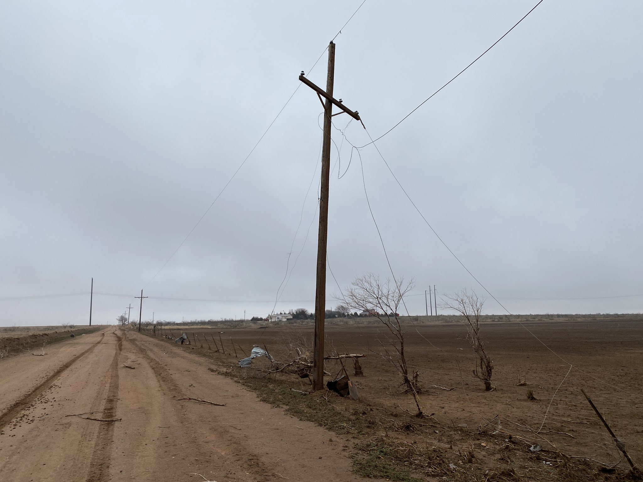
Below can be found several damage pictures from around the south-central Texas Panhandle. The flipped center pivot north of Hart (below and left) was caused by a subsequent short-lived EF-0 tornado that also contributed to an 87 mph gust measured at the nearby West Texas Mesonet site.
|
| |
 |
 |
| Flipped center pivot north of Hart (left) and downed power pole west of Happy (right). The damage occurred on March 13th, with the photos taken on the 15th. |
| |
| The remaining damage (upper right and lower left and lower right pictures) was caused by the more intense and longer track tornado that moved from northwest Swisher County into south-central Randall County. |
| |
 |
 |
| Damaged buildings located west of Happy, Texas. |
| |
|
Another tornado impacted north-central Swisher County, this time east of Happy, about 50 minutes after the long track tornado. This tornado, which was associated with a different storm, tracked over rural land and was rated EF-0. The only damage observed were two broken power poles near the intersection of County Road B and County Road 16. This tornado crossed into Randall County, where it was surveyed by WFO Amarillo. The surveyed damage can be viewed in detail on the Damage Assessment Toolkit (DAT) Viewer. Once on the DAT page, be sure to include March 13th in your selected time window to view the collected data for this event.
|
| |
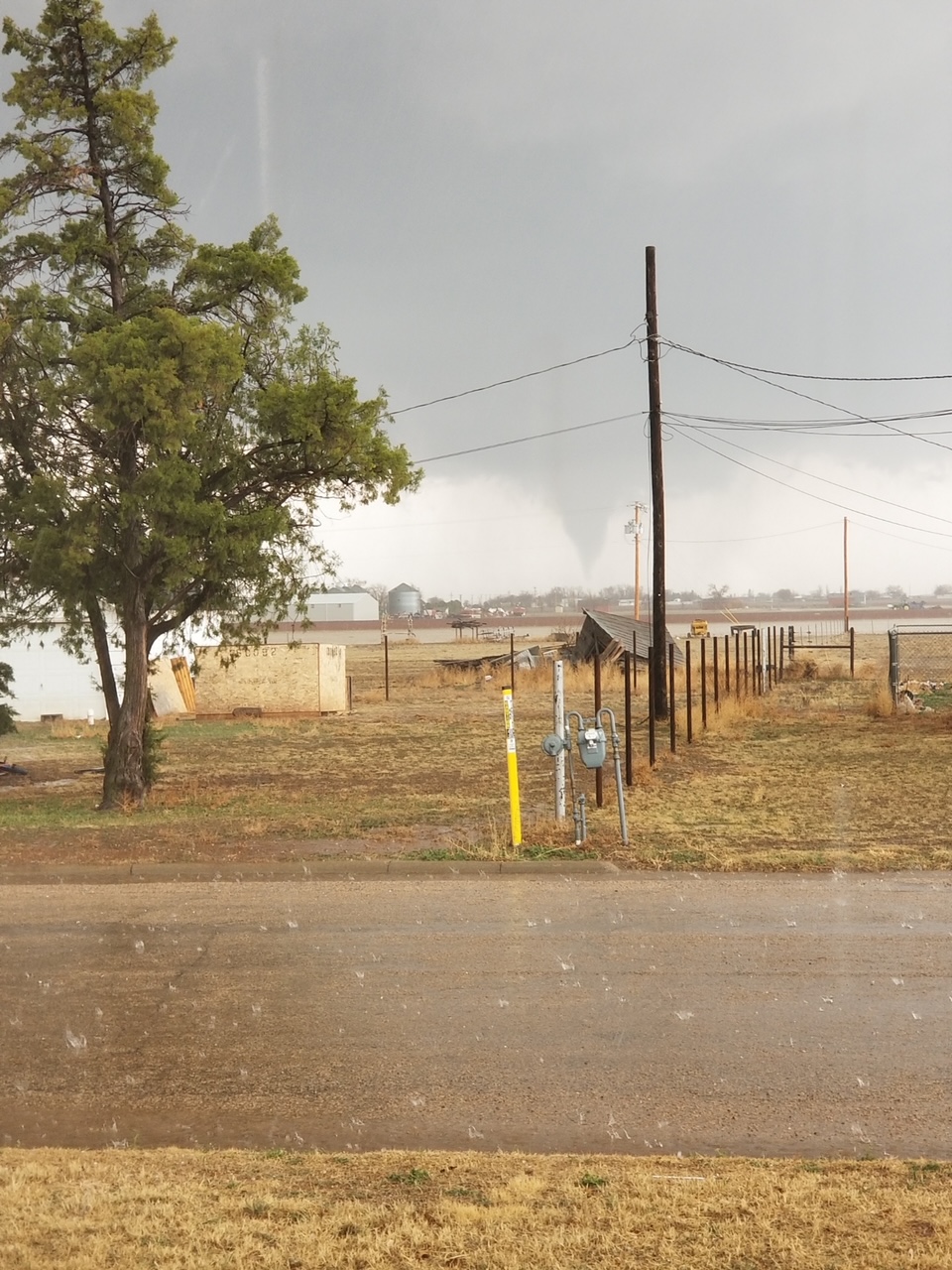 |
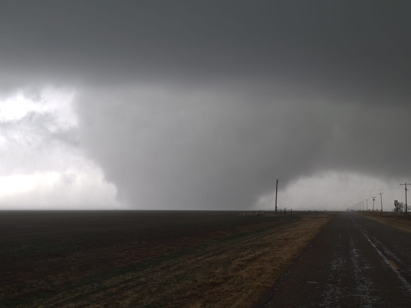
| Tornado south of Plainview, Texas, Saturday afternoon (13 March). The picture is courtesy of Leslie Daugherty and KAMC. |
| |
| In addition to the tornadoes discussed above, at least four other tornadoes were confirmed through eye-witness reports, but had no reports of damage and all of them were short-lived. All four of these tornadoes will be assigned an EF-U rating unless damage is discovered. This includes the above pictured tornado south of Plainview and east of Hale Center. |
| |
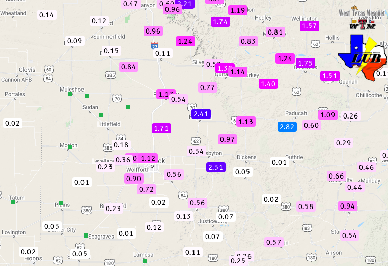 |
| 48-hour West Texas Mesonet rainfall tally ending at 10:30 pm on March 13th. |
| |
| The severe thunderstorms did bring welcome rainfall to much of the region, as the above map shows. Many locations from the central South Plains into the northern Rolling Plains and the central and eastern Texas Panhandle recorded 1 to 2+ inches of rain over the course of the two active weather days. |
| |
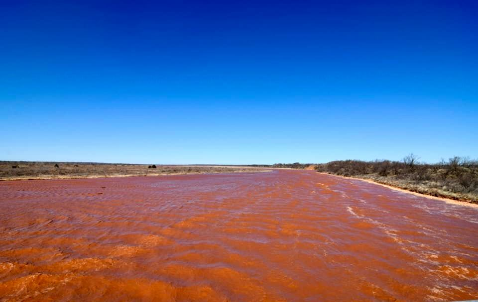 |
| The flowing Prairie Dog Town Fork of the Red River north of Estelline on Sunday (14 March 2021). |
| |
| Runoff from the widespread rain filled the Prairie Dog Town Fork of the Red River, causing a robust flow through the southeastern Texas Panhandle. |
| |
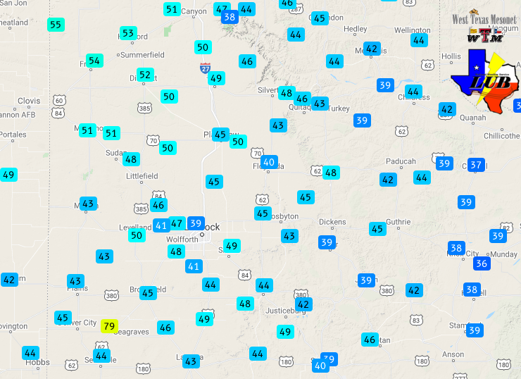 |
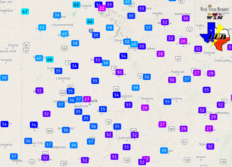
| Peak wind gusts (mph) measured by the West Texas Mesonet on Sunday (14 March 2021). The highest sustained wind speeds (mph) for the 14th can be VIEWED HERE. |
| |
|
The active weekend of weather concluded with a windy Sunday as the storm system that brought the severe thunderstorms the previous two days emerged to the north of the region. Westerly wind gusted as high 40 to 50+ mph.
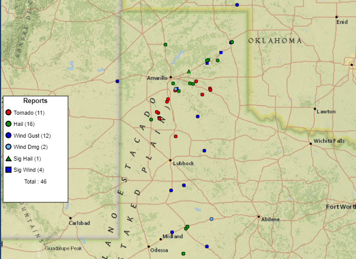
The preliminary storm reports collected during this active weekend can be found below. Also included is a damage survey summary for the March 13th tornadoes.
|