Bitter cold and periods of wintry weather freeze West Texas 10-18 February 2021
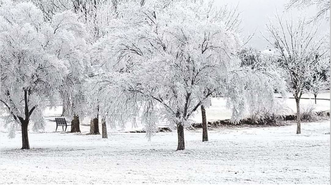
Clifford H Andrews Park, in Lubbock, covered in white Thursday morning (11 February). The picture is courtesy of Gary Cloud and KCBD.
Mid-February 2021 brought some of the coldest air that the South Plains region has experienced in decades. Initially, the cold air eased into the area from the east, keeping the eastern Texas Panhandle and Rolling Plains cool while spots on the Caprock enjoyed mild to warm afternoons. This changed on Tuesday, February 9th, when the cold air advanced westward across the entire South Plains, beginning the long stretch of entrenched cold, complete with bouts of frozen precipitation.
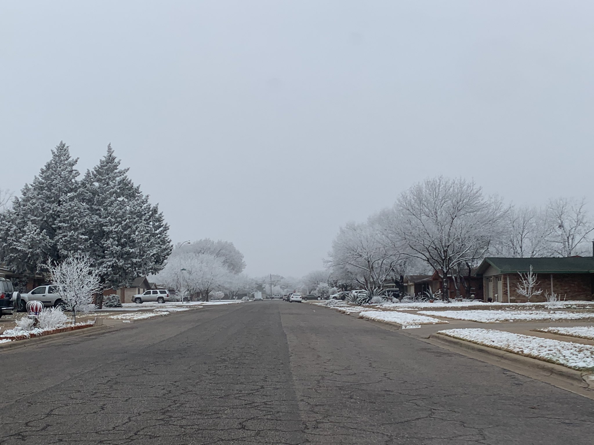
Northwest Lubbock plants covered in white after periods of freezing fog and freezing drizzle. The image was taken by @SAMT_WX on Wednesday evening (10 February).
Freezing fog and freezing drizzle developed early Wednesday morning (February 10th) as a shallow, cold and moist airmass advanced westward across the South Plains. Precipitation was very light, but with temperatures falling into the lower and middle 20s, the light icing created many problems on area roadways. Light ice and snow accumulations did create pretty sights though, as trees and grass, and really anything that was exposed, were coated in white.
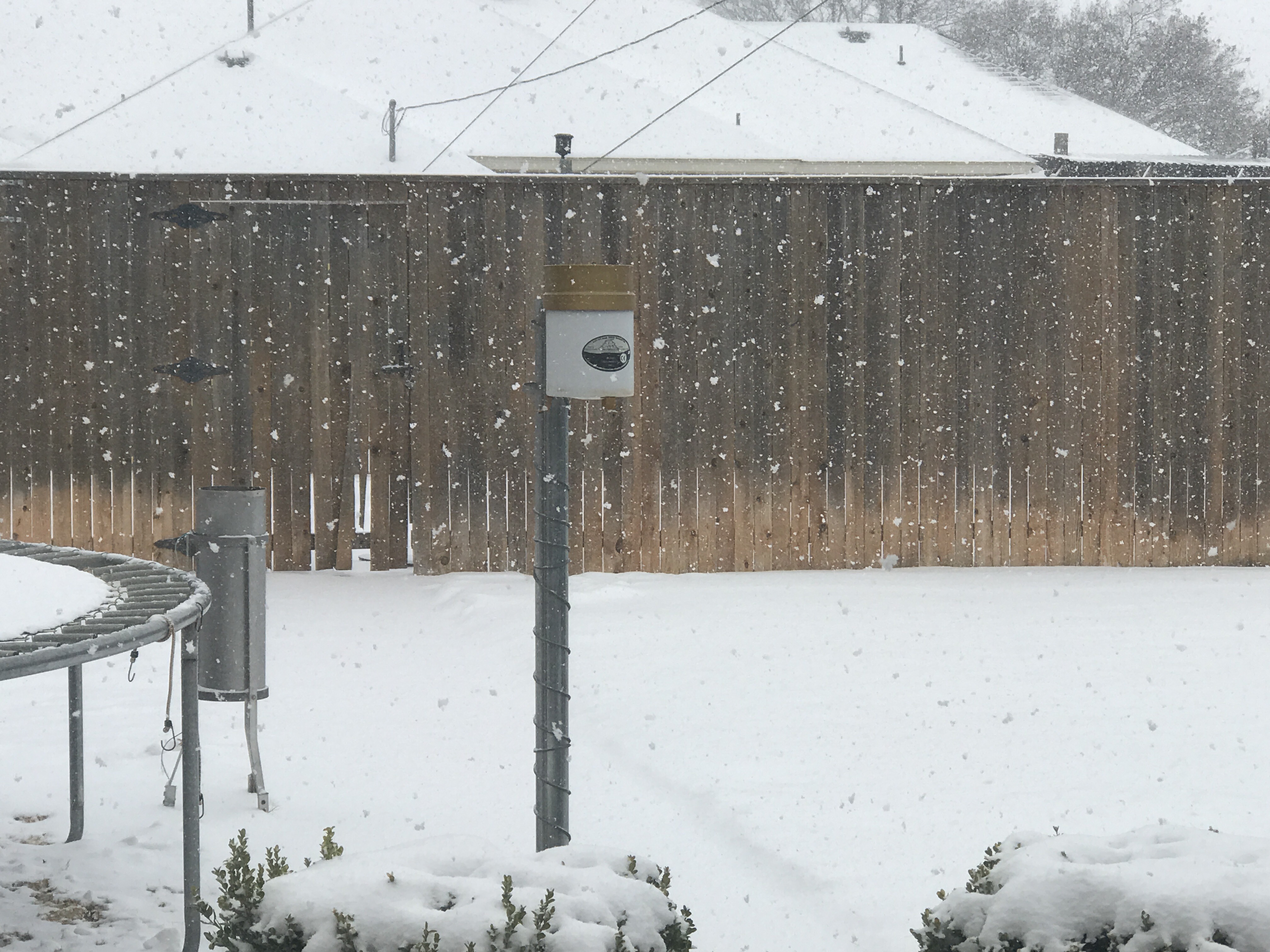
What freezing drizzle, freezing rain and freezing fog can do to a wind anemometer. The 3-cup anemometer can freeze solid, preventing the measurement of the wind until the ice melts.
Freezing drizzle, freezing fog and patchy light snow continued through much of Wednesday and Wednesday night, as temperatures fell into the teens and lower 20s. Drier air did move in from the north and east overnight, bringing an end to the light wintry precipitation (and fog) over the southern Texas Panhandle. The modest drying continued through the day on Thursday (February 11th), with sunshine making an appearance across the western and northern sections of the South Plains region.
Mid-level water vapor imagery from GOES-16 valid from 11:31 am to 12:01 pm on 14 February 2021. A storm system approaching the region is seen supplying moisture and lift, which supported periods of snow.
Still, it was slow to warm on Thursday. Highs only reached the 20s and 30s for most, though the western South Plains did make it into the balmy 40s. A low cloud deck lingered over the southeast South Plains in the afternoon (where it stayed the coolest), then moved west-northwest in the evening. This brought areas of freezing fog to the western South Plains. Elsewhere, low clouds filled in late Thursday night, then produced areas of freezing drizzle and light snow. A solid coating of very light, fluffy snow covered Lubbock by Friday morning (February 12th). Officially the Lubbock Airport recorded 0.4 inches of snow, but it melted down to a meager 0.01 inches of liquid. The light wintry precipitation, when coupled with lows in the teens, did create slick spots on area roadways. Friday afternoon was mostly dry, but still cold, only warming into the lower to middle 20s.
Lubbock radar animation valid from 5:18 am to 11:59 am on 14 February 2021.
Saturday (February 13th), similar to Friday, was mostly dry, aside from patchy flurries and very light snow, but it remained cloudy and cold. Temperatures only "warmed" into the upper teens to middle 20s, then promptly dropped back into the teens, then single digits by early Sunday.
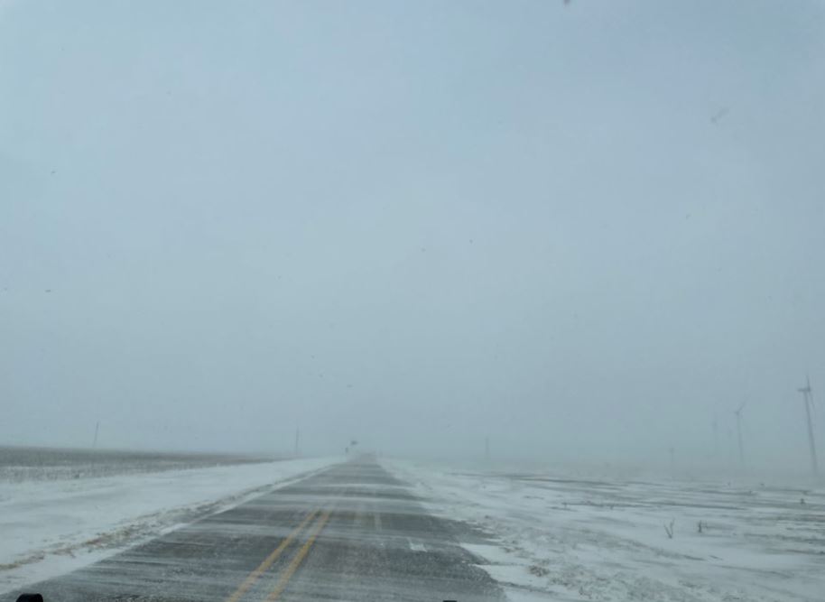
Snow and blowing snow west of Crosbyton on Sunday (14 February). The picture is courtesy of Connie McMahon and KCBD.
Snow picked up in earnest late Saturday night and continued, off and on, much of Sunday (Valentine's Day). Snow totals of 2 to 4 inches were common during this stretch, though exact amounts were tough to measure because of the blowing and drifting. A few higher totals were measured, including 6.5 inches in Friona, 5.8 inches in Muleshoe and 5 inches in Slaton and Guthrie. The fluffy snow was easily tossed around by northeasterly winds of 15-25 mph, occasionally gusting over 30 mph. Snow drifts of a couple feet or more were common. The snow covered roadways and reduced visibility in snow and blowing snow did create hazardous travel. Even more impressive than the snow was the very cold temperatures and bitterly cold wind chills. Temperatures on Sunday were only in the single digits, and with the gusty northeasterly winds, it felt like 10 to 20 degrees below zero.
Visible satellite animation taken by GOES-16 between 2:11 pm and 2:31 pm on 15 February 2021. On this rare mostly clear afternoon, widespread snow (stationary white areas) can be seen over much of Texas, as well as adjacent states to the north and west. The lakes and river valleys also stand out, including Palo Duro Canyon.
The accumulating snow diminished Sunday evening, and the winds gradually weakened too, but temperature fell even further, especially where skies cleared. Lows early Monday (February 15th) dropped below zero over most of the region, as low as -10 to -16 degrees over the southwestern Texas Panhandle. Where clouds were more persistent, portions of the central and southwest South Plains stayed at or just above zero. These bitterly cold temperatures, when coupled with breezy northeasterly winds, created dangerous wind chills of -10 to -20 degrees and lower Sunday into Monday morning.
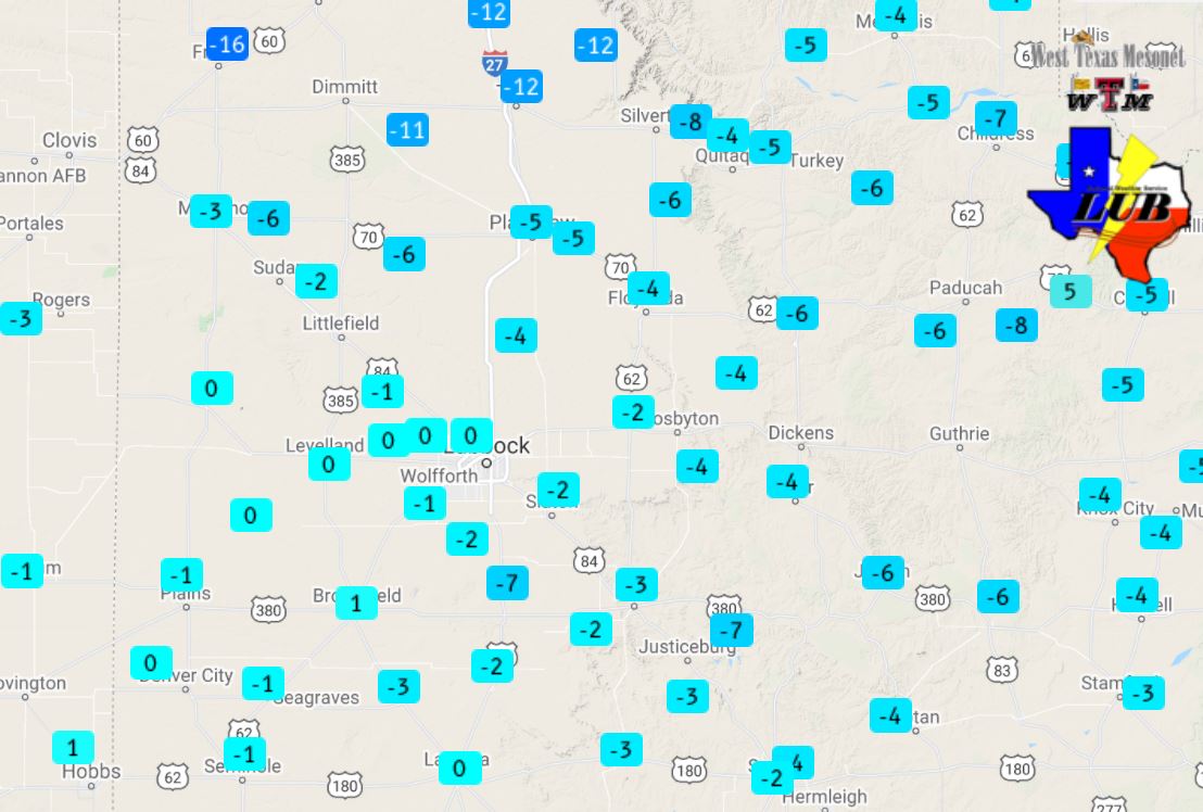
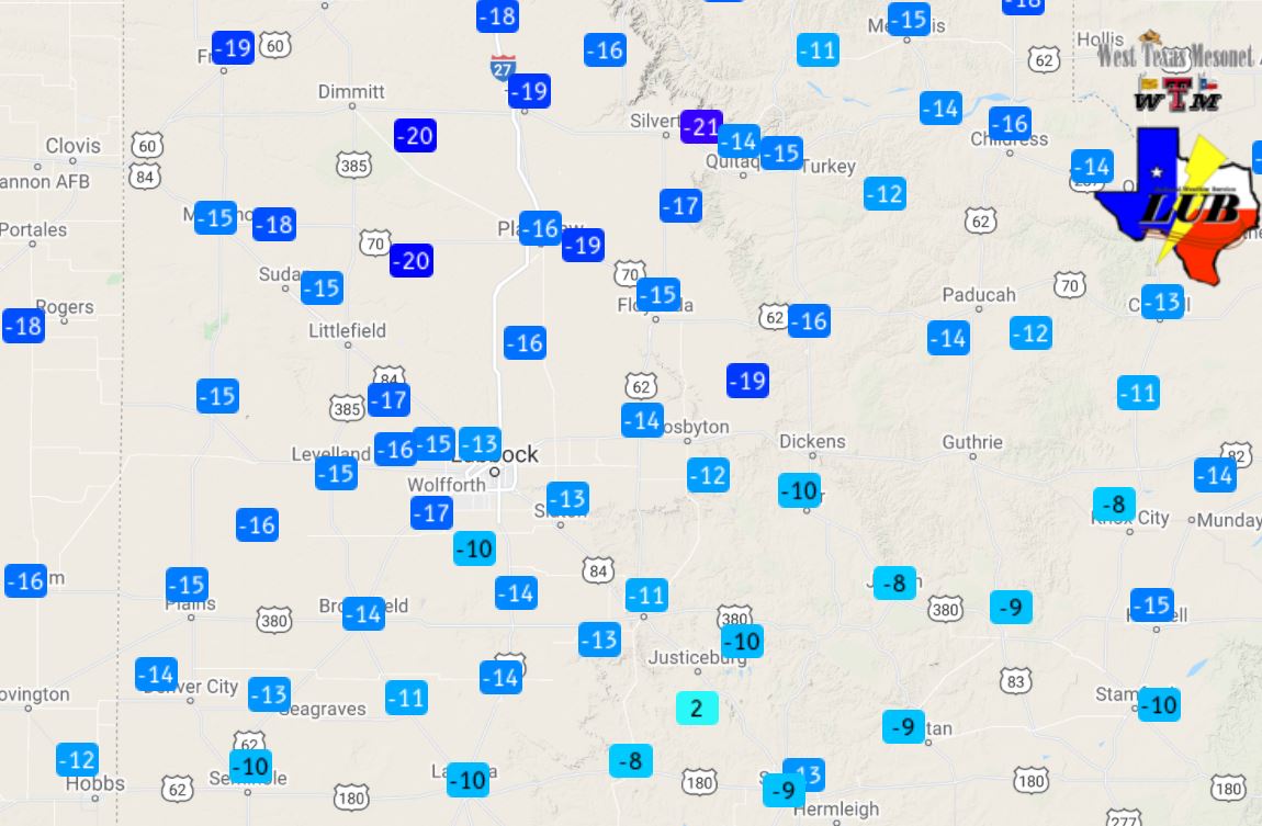
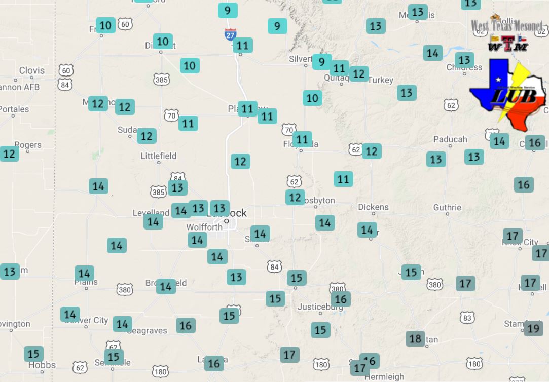
Low temperatures measured by the West Texas Mesonet on Monday (15 February). The wind chill values, observed at 9:30 pm on the 14th can be VIEWED HERE. Highs temperatures can be found at: Highs Sunday, 14 February and Highs Monday, 15 February.
The sun did return, at least at times, on Monday (February 15th), but it remained cold as Arctic high pressure continued to dominate the region. Even with the sunshine, highs only reached the upper single digits to teens. This still felt "mild" compared to Sunday, thanks to the relatively light winds and the sunshine.
Lubbock radar animation valid from 8:55 am to 12:40 pm on 16 February 2021.
Temperatures again dipped into the single digits area wide early Tuesday (February 16th), with portions of the southern Texas Panhandle and Rolling Plains dropping below zero. This occurred in advance of the next mid-level disturbance that tracked over the region on Tuesday. In addition to spurring a return to southerly and southeasterly breezes and gradually moderating temperatures, the disturbance also brought another round of widespread light to moderate snow. Additional snow totals of 1 to 3 inches were common. The snow acted to further exacerbate the already hazardous travel conditions. On the positive side, locations across the central and western South Plains did see temperatures rebound into the 20s.
Snow falling in Shallowater early Tuesday afternoon (16 February 2021). The image is courtesy of Bruce Haynie.
The snow gradually diminished over the central and southern South Plains by early Tuesday evening, but snow lingered over the southern Texas Panhandle and northern South Plains into the night. In fact, cloudy skies and periods of light snow and flurries persisted over much of the region into Wednesday, complete with areas of freezing fog early in the day. After starting the day in the single digits, temperatures managed to rebound into the 20s for most spots during the afternoon.
Snow falling in Slaton early Tuesday afternoon (16 February 2021). The image is courtesy of KAMC.
Mid-February brought a week plus of round after round of frozen precipitation, from freezing drizzle (and freezing fog) to bouts of flurries and light to moderate (and briefly heavy) snow. In total, Lubbock experienced 9 straight days (February 10-18th) with at least a trace of frozen precipitation. The Lubbock Airport officially recorded 3.8 inches of snow, though only 0.25 inches of liquid when the snow and ice was melted down. Other locations saw as much as 6+ inches of total snowfall. All of the wintry weather created a prolonged period of hazardous roadways, not just here in West Texas, but over nearly the entire state. Even during lulls in precipitation, the cold temperatures didn't support much improvement on the roadways as snow and ice held firm.
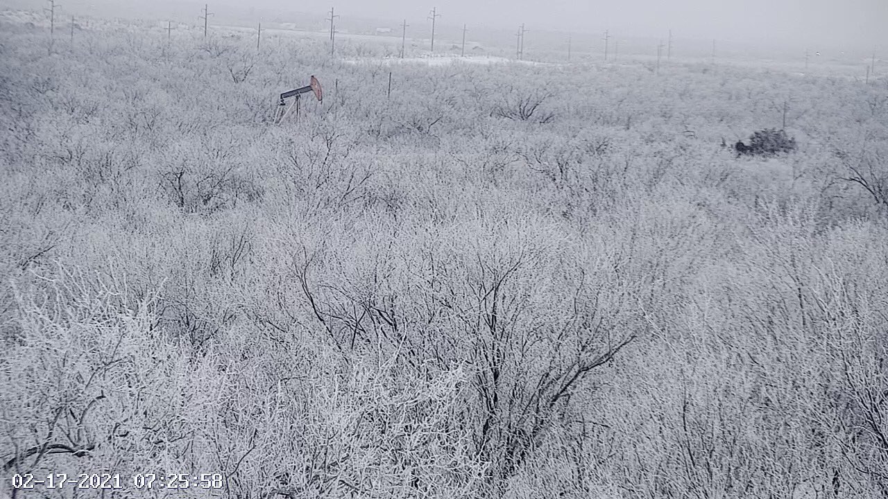
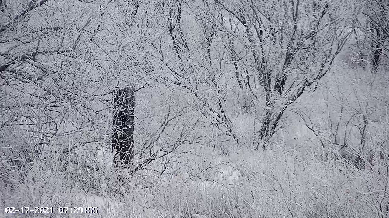
Wintry scenes near Lake Alan Henry early Wednesday morning (17 February 2021). The pictures are courtesy of Lake Alan Henry Weather (@lahwx). Periods of light snow and freezing fog helped craft the pretty scenes.
Even more impressive than the rounds of frozen precipitation were the magnitude and duration of the bitter cold. Lubbock officially dropped below the freezing mark early on the evening of the 11th and didn't warm back above freezing until midday on the 19th, making for over a solid week of sub-freezing conditions. Specifically, the mercury dipped below 32 degrees at 4:25 pm on the 11th, and didn't hit 32 degrees going the other direction until 10:45 am on the 19th, resulting in nearly 186.5 consecutive hours below freezing. The 7+ straight days below freezing ties late December and early January of 1982-1983 as the second longest stretch of sub-freezing conditions in Lubbock. Only December of 1983 (17th-26th) was below freezing longer, a total of 8+ days tallying 207 hours. The highs failed to make it out of the teens on the 14th and 15th, only reaching 14 degrees each day, while the lows both mornings were 0 degrees (occurred just before midnight on the 14th, and stayed around 0 through the morning of the 15th). Lubbock and Childress set numerous daily record lows and record minimum highs, as the charts below illustrate.
Mid-February 2021 Highs, Lows and Daily Records for Lubbock
Day
High
Record Minimum High
Low
Record Low
Feb. 8th
63
18 in 1933
29
-17 in 1933 (all-time)
Feb. 9th
44
21 in 1929
24
0 in 1933
Feb. 10th
28
21 in 1986
20
1 in 1929
Feb. 11th
36
24 in 1986
19
6 in 1981
Feb. 12th
22
23 in 1948
14
9 in 1958
Feb. 13th
21
23 in 1968
10
7 in 1963
Feb. 14th
14
25 in 1951
0
12 in 2004
Feb. 15th
14
30 in 1978
0
8 in 1951
Feb. 16th
17
27 in 1979
5
13 in 1979
Feb. 17th
24
22 in 1978
5
0 in 1979
Feb. 18th
25
26 in 1936
5
-2 in 1978
Feb. 19th
55
30 in 2019
9
2 in 1978
*NOTE: Highlighted days are when new records (minimum highs or lows) are set.
The coldest temperature at Lubbock during this brutal stretch, 0 degrees, reached late on the 14th and early on the 15th, was the lowest temperature recorded since late in 1989 when it dropped just below zero (-1 and -2 degrees on 12/23 and 12/22, respectively). The high of 14 degrees, experienced on the 14th and 15th, tied for the 8th lowest high on record, and was the coldest high temperature recorded since January 12th, 1997 (12 degrees). In addition, the average temperature of 7 degrees, also recorded on the 14th and 15th, tied for the 15th coldest day on record. The coldest average day on record in Lubbock is 0.5 degrees, recorded on February 8, 1933.
Mid-February 2021 Highs, Lows and Daily Records for Childress
Day
High
Record Minimum High
Low
Record Low
Feb. 8th
37
22 in 1936
24
-4 in 1933
Feb. 9th
27
22 in 1933
21
-2 in 1933
Feb. 10th
24
23 in 1982
20
-1 in 1933
Feb. 11th
33
25 in 1986
17
-3 in 1986
Feb. 12th
26
7 in 1905
14
-5 in 1986
Feb. 13th
24
24 in 1968
12
-10 in 1905
Feb. 14th
14
24 in 2007
4
6 in 1905
Feb. 15th
12
29 in 2007
-4
8 in 1936
Feb. 16th
12
23 in 1979
-4
9 in 1936
Feb. 17th
20
18 in 1993
3
8 in 1978
Feb. 18th
27
22 in 1936
0
5 in 1978
Feb. 19th
42
31 in 2006
6
9 in 1936
*NOTE: Highlighted days are when new records (minimum highs or lows) are tied or set.
The coldest temperature at Childress during this deep chill, -4 degrees, reached on the 15th and 16th, tied for the 6th coldest on record and was the lowest temperature recorded since late in 1989 when it dropped to -5 degrees (12/23/1989). The high of 12 degrees, experienced on the 15th and 16th, tied for the 7th lowest high on record, and was the coldest high temperature recorded since December 22nd, 1990 (10 degrees). In addition, the average temperature of 4 degrees, also recorded on the 15th and 16th, tied for the 3rd coldest day on record. The coldest average day on record in Childress is -4.5 degrees, recorded on January 17, 1930 (number two is 2 degrees, recorded 2/12/1905).
Not surprisingly, the intense and long-duration cold resulted in huge impacts locally, regionally and nationally. In addition to keeping roads hazardous, since lingering snow and ice refused to melt, numerous pipes froze and/or burst causing significant property damage. The power grids were also stretched beyond their limit, forcing rolling blackouts. The blackouts were relatively short-lived and localized around Lubbock, but much of Texas (on ERCOT) endured blackouts that lasted for days.
Preliminary snow reports collected during a couple of periods during this prolonged sub-freezing event can be found below.
Snow reports for February 14-15th
PRELIMINARY LOCAL STORM REPORT
NATIONAL WEATHER SERVICE LUBBOCK TX
1134 AM CST MON FEB 15 2021

..TIME...   ...EVENT...      ...CITY LOCATION...     ...LAT.LON...
..DATE...   ....MAG....      ..COUNTY LOCATION..ST.. ...SOURCE....
            ..REMARKS..

0800 AM     HEAVY SNOW       3 S ESTELLINE           34.50N 100.44W
02/15/2021  M4.3 INCH        HALL               TX   EMERGENCY MNGR

            STORM TOTAL SNOWFALL.

0800 AM     HEAVY SNOW       SILVERTON               34.47N 101.30W
02/15/2021  E3.0 INCH        BRISCOE            TX   BROADCAST MEDIA

            STORM TOTAL SNOWFALL.

0800 AM     HEAVY SNOW       HART                    34.39N 102.11W
02/15/2021  E3.5 INCH        CASTRO             TX   CO-OP OBSERVER

            STORM TOTAL SNOWFALL.

0800 AM     HEAVY SNOW       15 S PADUCAH            33.80N 100.30W
02/15/2021  E4.5 INCH        KING               TX   CO-OP OBSERVER

            STORM TOTAL SNOWFALL.

0800 AM     HEAVY SNOW       10 S PADUCAH            33.87N 100.30W
02/15/2021  E4.0 INCH        COTTLE             TX   CO-OP OBSERVER

            STORM TOTAL SNOWFALL.

0800 AM     HEAVY SNOW       JAYTON                  33.25N 100.57W
02/15/2021  E4.0 INCH        KENT               TX   LAW ENFORCEMENT

            STORM TOTAL SNOWFALL.

0800 AM     HEAVY SNOW       DICKENS                 33.62N 100.84W
02/15/2021  E4.0 INCH        DICKENS            TX   LAW ENFORCEMENT

            STORM TOTAL SNOWFALL.

0800 AM     HEAVY SNOW       TURKEY                  34.39N 100.90W
02/15/2021  E4.0 INCH        HALL               TX   EMERGENCY MNGR

            STORM TOTAL SNOWFALL.

0800 AM     HEAVY SNOW       9 SE FLOYDADA           33.89N 101.23W
02/15/2021  E3.8 INCH        FLOYD              TX   CO-OP OBSERVER

            STORM TOTAL SNOWFALL.

0800 AM     HEAVY SNOW       CROSBYTON               33.64N 101.24W
02/15/2021  E2.0 INCH        CROSBY             TX   CO-OP OBSERVER

            STORM TOTAL SNOWFALL.

0800 AM     HEAVY SNOW       PLAINVIEW               34.19N 101.72W
02/15/2021  M1.6 INCH        HALE               TX   CO-OP OBSERVER

            STORM TOTAL SNOWFALL.

0800 AM     HEAVY SNOW       TAHOKA                  33.16N 101.79W
02/15/2021  E4.0 INCH        LYNN               TX   CO-OP OBSERVER

            STORM TOTAL SNOWFALL.

0800 AM     HEAVY SNOW       PLAINS                  33.19N 102.83W
02/15/2021  E3.5 INCH        YOAKUM             TX   CO-OP OBSERVER

            STORM TOTAL SNOWFALL.

0800 AM     HEAVY SNOW       MORTON                  33.72N 102.76W
02/15/2021  E3.5 INCH        COCHRAN            TX   CO-OP OBSERVER

            STORM TOTAL SNOWFALL.

0800 AM     HEAVY SNOW       MULESHOE                34.23N 102.73W
02/15/2021  E5.8 INCH        BAILEY             TX   CO-OP OBSERVER

            STORM TOTAL SNOWFALL.

0800 AM     HEAVY SNOW       SLATON                  33.44N 101.64W
02/15/2021  E5.0 INCH        LUBBOCK            TX   CO-OP OBSERVER

            STORM TOTAL SNOWFALL.

0800 AM     HEAVY SNOW       7 NW CHILDRESS          34.50N 100.34W
02/15/2021  M2.1 INCH        CHILDRESS          TX   CO-OP OBSERVER

            STORM TOTAL SNOWFALL.

0600 PM     HEAVY SNOW       4 SSW LUBBOCK           33.53N 101.88W
02/14/2021  M3.4 INCH        LUBBOCK            TX   NWS OFFICE

            STORM TOTAL SNOWFALL.

0800 AM     HEAVY SNOW       FRIONA                  34.64N 102.72W
02/15/2021  M6.5 INCH        PARMER             TX   CO-OP OBSERVER

            STORM TOTAL SNOWFALL.

0800 AM     HEAVY SNOW       LITTLEFIELD             33.92N 102.33W
02/15/2021  E2.5 INCH        LAMB               TX   CO-OP OBSERVER

            STORM TOTAL SNOWFALL.

0800 AM     HEAVY SNOW       LEVELLAND               33.58N 102.36W
02/15/2021  M4.0 INCH        HOCKLEY            TX   CO-OP OBSERVER

            STORM TOTAL SNOWFAL

0800 AM     HEAVY SNOW       LAKE ALAN HENRY         33.06N 101.05W
02/15/2021  E3.0 INCH        GARZA              TX   CO-OP OBSERVER

            STORM TOTAL SNOWFALL.

0800 AM     HEAVY SNOW       GUTHRIE                 33.63N 100.32W
02/15/2021  E5.0 INCH        KING               TX   CO-OP OBSERVER

            STORM TOTAL SNOWFALL. HARD TO ESTIMATE DUE TO LARGER
            DRIFTS.

0800 AM     HEAVY SNOW       ASPERMONT               33.14N 100.22W
02/15/2021  M4.0 INCH        STONEWALL          TX   CO-OP OBSERVER

            STORM TOTAL SNOWFALL.

0933 AM     HEAVY SNOW       BROWNFIELD              33.18N 102.27W
02/15/2021  M2.0 INCH        TERRY              TX   CO-OP OBSERVER

            STORM TOTAL SNOWFALL.

0831 AM     HEAVY SNOW       MATADOR                 34.02N 100.82W
02/15/2021  M4.0 INCH        MOTLEY             TX   CO-OP OBSERVER

            STORM TOTAL SNOWFALL. DRIFTS UP TO 3 FEET.
24 hour weather report from 8 AM to 8 AM February 16-17th
AGOLUB
Daily Temperature and Precipitation Summary...Updated
National Weather Service Lubbock TX
1036 AM CST Wed Feb 17 2021

 The following data are for the previous 24 HRS (8AM - 8AM)
 Highs typically from the previous day.  Low can be either day.

                                                        7-8AM
                      24 HOUR  TODAY   24HR       SNOW  SNOW
  LOCATION            HI  LOW  7-8AM   PCPN       FALL  DEPTH
 Aspermont            18    0   12     0.12        1.5   5
 Big Spring AWOS      27   11   14       0
 Brownfield           25    7    7     0.10        1.0   2
 Childress            11    5    9     0.01        3.5   5
 Childress ASOS       12    6    8     0.06
 Crosbyton            14    4    6     0.09        2.0   3
 Denver City          32   12   13     0.30        3.0   3
 Dimmitt              20    3    7       M         2.0   4
 Floydada             12    2    4     0.02        1.0   3
 Friona               25  -12    9     0.01        0.5   4
 Guthrie              12    2   11     0.02        0.5   2
 Hart                 16    2    5     0.10        2.0   4
 Jayton                M    M    M       M          M    M
 Lake Alan Henry      22    3    8     0.07        1.0   4
 Levelland            25    5    7     0.07        2.3   3
 Littlefield 5SE      21    4    7       M         1.0   2
 Lubbock              17    5    8     0.14        1.2   2
 Matador              12    4    6     0.12        2.0   6
 Memphis              10    2    4       M         3.0   4
 Morton               27    7    8     0.21        1.0   3
 Muleshoe             24    4    5     0.05        1.0   4
 Muleshoe Refuge      26    7    9       M          M    M
 Olton                18    3    6     0.10        1.0   3
 Paducah 15S (Grow)   12    0    9     0.05        1.5   5
 Plainview Wtr Plnt   16    2    5     0.12        1.4   1
 Plainview Dly Hrld   15    2    5       M         1.5   1
 Plains               28   10   11     0.03        2.0   1
 Post                 20    5    8     0.10        0.5   2
 Silverton            13    4    5     0.20        2.5   4
 Snyder               23    3   10       0          M    M
 Spur                 15    4    9       M         0.5   3
 Tahoka               24    2    7     0.14        1.0   4
 Tulia                14    1    4     0.20        2.0   2
 Turkey               13    6   11        M        0.0   6
 White River Lake      M    M    M       M          M    M

  Automated Stations                   High Low  7AM    Rain
 Muleshoe Wildlife Refuge                26   7    9    0.14
 Caprock Canyons State Park RAWS         13   4    7      0
 Jayton RAWS                             18   4   10      0

 The following mesonet data show 24hr highs and lows
 and precipitation 8am-8am.

 Texas Tech West Texas Mesonet...
                      24-HR   8AM   8AM-8AM
                      HI LOW
 Abernathy 5NE        15   3    7       0
 Aiken 3WSW           14   2    6       0
 Adrian 6WSW          26   6   11       0
 Amarillo 7SSE        15   2    4       0
 Amarillo 9NNE        16   3    6       0
 Amarillo 15NNW       19   4    7       0
 Amherst 1NE          22   4    7       0
 Andrews 2NE          30  12   16     0.01
 Anton 6S             21   4    6       0
 Aspermont 3NE        17   3   11       0
 BBNP Persimmon Gap   45  29   33       0
 BBNP Castolon 1NW    64  28   41       0
 Big Lake 1WNW        29  18   25       0
 Bootleg 11WNW        28   4    8       0
 Boys Ranch 1WSW      23   6    7       0
 Brownfield 2S        26   8    9     0.01
 Canadian 6E          11  -1    4       0
 Caprock Canyons      12   3    6       0
 Childress 2NNE       10   1    7       0
 Clarendon 2WSW        8   0    3       0
 Claude 12SW           9   0    3       0
 Clyde  2WNW          20   2   15       0
 Colorado City 5NW    24  11   12       0
 Comanche Springs     11   2    9       0
 Coyanosa             35  11   25     0.06
 Crane 1NNW           37  15   25       0
 Crowell 1E           12   2   11       0
 Dell City 1N         46  22   23       0
 Denver City 7W       32  12   14       0
 Dimmitt 2NE           M   M    M       M
 Dora NM 2SW          37  12   13     0.09
 Doole 3WNW           24   8   21     0.01
 Dozier 2W             M   M    M       M
 Earth 9WSW           23   4    6       0
 Endee NM 2SW         35  11   14       0
 Estelline 3SSE       12   4    8       0
 Floydada 2NE         13   3    7       0
 Fluvanna 3W          21   7    8       0
 Fort Chadborne       23   7   17       0
 Fort Lancaster       34  21   30     0.04
 Fort Lewis CO        31  -1    9     0.16
 Fort McKavett         M   M    M       M
 Friona 2NE           22   4    8       0
 Fritch 1WNW          14   5    7       0
 Gail 2SE             25   9    9       0
 Goodlett 3W           9   1    9       0
 Goodnight             8   0    5       0
 Graham 5SW           22   6    8       0
 Guadalupe N.P.       38  31   33     0.07
 Guthrie 10W          14   3    9       0
 Hackberry 2SSE       12   1    9       0
 Happy 1E             15   2    4       0
 Hart 3N              18   2    6       0
 Haskell 1NW          16   9   12       0
 Hefner 1SW           14   2   13     0.01
 Hereford 2NW         20   3    6       0
 Hobbs NM 5NW         38  12   17     0.01
 Jayton 1S            18   4   10       0
 Junction 1SSW        38  13   33     0.33
 Kent 9E              51  35   40       0
 Knox City 3NW        16   3   13       0
 Lake Alan Henry 1NW  22   4    8       0
 Lake McClellan 2NW    8   1    4       0
 Lamesa 2SE           26  10   10       0
 Lesley 2S            12   4    8       0
 Levelland 4S         25   6    7       0
 Lomax 1SSE           28  15   15       0
 Lubbock (TX Tech)    19   4    7       0
 Lubbock (Reese Ctr)  21   5    7       0
 McAdoo 3NNW          12   3    6       0
 McLean 1E             7  -1    1       0
 Memphis 1NE          10   1    4       0
 Menard 2NWE          36  13   23     0.09
 Mertzon 3NNE         31  19   25     0.03
 Morton 1NE           27   8    9       0
 Muleshoe 2S          25   5    7     0.07
 New Home             22   6    8       0
 Northfield 1S        12   5    8       0
 O'Donnell 1N         25   8    8       0
 Olton 6S             17   2    6       0
 Odell 4ENE           10  -1   10       0
 Paducah 10SW         12   3    8       0
 Paloduro 4E JA Ranch 11   2    6       0
 Palo Duro Canyon Rim 13   2    4       0
 Palo Duro Cnyn Floor 14   4    5       0
 Palo Duro Reservoir  15   2    6       0
 Pampa 2E              8   0    3       0
 Panhandle 1SSW        8   1    4       0
 Plains 3N            29  11   12     0.08
 Plainview 1S         15   6    M       M
 Post 1NE             20   8    9       0
 Ralls 1SE            13   4    7       0
 Roaring Springs 3N   12   3    6       0
 Rotan 5W             21   3   11       0
 San Angelo 7NW       29  10   22     0.01
 Seagraves 1SW        29  11   12     0.02
 Segovia 7SSW         36  13   32     0.03
 Seminole 2N          29  12   15       0
 Seymour 3NW          14   0   12       0
 Sierra Blanca 1SSE   47  27   36     0.25
 Silverton 7E         10   1    4       0
 Slaton 2NE           15   5    7       0
 Smyer                23   5    7       0
 Snyder 3E            23   9    9       0
 Snyder 3SSW (WTC)    23   9    9       0
 South Plains 3ENE    15   2    6       0
 Spur 1W              15   5    9       0
 Stamford 5ESE        19  -1   13       0
 Stinnett 1NNW        12   2    6       0
 Stratford 4WNW       18   3   10       0
 St Lawrence 5SW      27  18   20       0
 Sterling City 4WNW   30  11   16       0
 Sundown 8SW          27   8    9       0
 Sweetwater 11SW      21   8   13       0
 Tahoka 3NE           22   6    7       0
 Tarzan 2WNW           M   M    M       M
 Tatum NM 2SW         41  14   15     0.15
 Throckmorton 1SW     17   1   13       0
 Truscott 2SE         14   2   11       0
 Tulia 2NE            14   1    4       0
 Turkey 2WSW          12   4    6       0
 Umbarger 3NNE        17   2    5       0
 Van Horn 3ENE        52  27   38     0.10
 Vigo Park            15   1    5       0
 Wall 1E              31  14   22     0.05
 Weinert 2NNE         15   2   13       0
 Welch                26   9    9       0
 Wellington 6SE        9   2    3       0
 White River Lk 6NW   15   5    8       0
 Wolfforth 6SW        22   6    7       0

Supplemental Precipitation..
 Childress USDA (Childress Cnty)       M          M    M
 Childress 14NW (Childress Cnty)       M          M    M
 Childress 7NW  (Childress Cnty)     0.45        3.5   4
 Dodson 5S      (Childress Cnty)       M          M    M
 Kirkland 1W    (Childress Cnty)       M          M    M
 Dumont         (NW King County)       M          M    M
 Floydada 9SE     (Floyd County)     0.10        1.5   4
 Flomot 2E    (NW Motley County)     0.05        1.5   2
 Flomot 4NE   (NW Motley County)       M          M    M
 Lubbock 9N     (Lubbock County)       M          M    M
 Lubbock 7WSW (77TH NR Iola)           M          M    M
 Lubbock 7SW  (90TH NR Slide)        0.10        1.5   1
 Lubbock 7SW #2 (103RD NR Slide)     0.11        1.6   2
 Northfield   (NE Motley County)       M          M    M
 Paducah 10S     (Cottle County)       M          M    3
 Pitchfork Ranch     (E Dickens)       M          M    M
 Reese 4E   (8th ST & Milwaukee)       M          M    M
 Roaring Springs (Motley County)       M          M    M
 Ropesville 6NNW(Hockley County)     0.14        2.5   3
 Shallowater    (Lubbock County)     0.18        1.8   3
 Tell 3S        (Childress Cnty)     0.09        1.5   4
 Woodrow 3W  (154th & Indiana)       0.15        1.5   2

  ..Automated USGS Rain Gauges..
 Brice 6SW        (Hall County)        0
 Friona 12S  Running Water Dr          0
 Justiceburg(Garza County)             0
 Kirkland 1NNE N Grosebeck Ck          0
 Lake Alan Henry (Garza County)        0
 Lockney 10SW  Callahan Draw           0
 Lubbock 4ESE (50TH LOOP 289)          0
 Mackenzie Lake (Briscoe County)       0
 Silverton 7W Rock Ck Tr               0
 Wellman 1NE (Terry County)          0.01
 White River Lake (Crosby County)      0

 ------------- Agricultural Data -----------------
                                      Pan Evaporation
 Big Spring                                      M
 Lake Alan Henry                                 M
